Versailles in Darke County, Ohio — The American Midwest (Great Lakes)
Mr. Foy's Cow
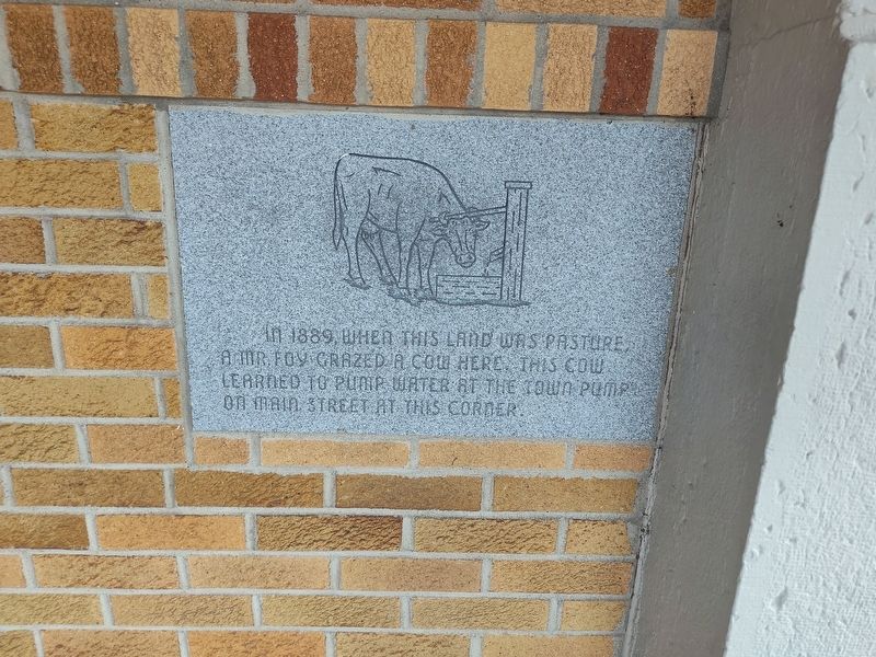
Photographed by Craig Doda, July 6, 2024
1. Mr. Foy's Cow Marker
Topics. This historical marker is listed in these topic lists: Animals • Natural Resources. A significant historical year for this entry is 1889.
Location. 40° 13.355′ N, 84° 29′ W. Marker is in Versailles, Ohio, in Darke County. It is at the intersection of East Main Street and South 2nd Street, on the right when traveling east on East Main Street. Touch for map. Marker is at or near this postal address: 104 E Main St, Versailles OH 45380, United States of America. Touch for directions.

Regionally, this marker is in the Till Plains. It is also in the American Midwest and in the Corn Belt. Globally, it is in North America, the Western Hemisphere, the Western World, and the Anglosphere. Historically, it finds itself in what was once the Haudenosaunee (Iroquois) Confederacy, the territory of the Mississippian Culture, and the Northwest Territory.
Other nearby markers. At least 8 other markers are within walking distance of this marker: The Fire of 1901 (here, next
this page online
Credits. This page was last revised on July 27, 2024. It was originally submitted on July 18, 2024, by Craig Doda of Napoleon, Ohio. This page has been viewed 179 times since then and 46 times this year. Photo 1. submitted on July 18, 2024, by Craig Doda of Napoleon, Ohio. • Devry Becker Jones was the editor who published this page.
