Irving in Dallas County, Texas — The American South (West South Central)
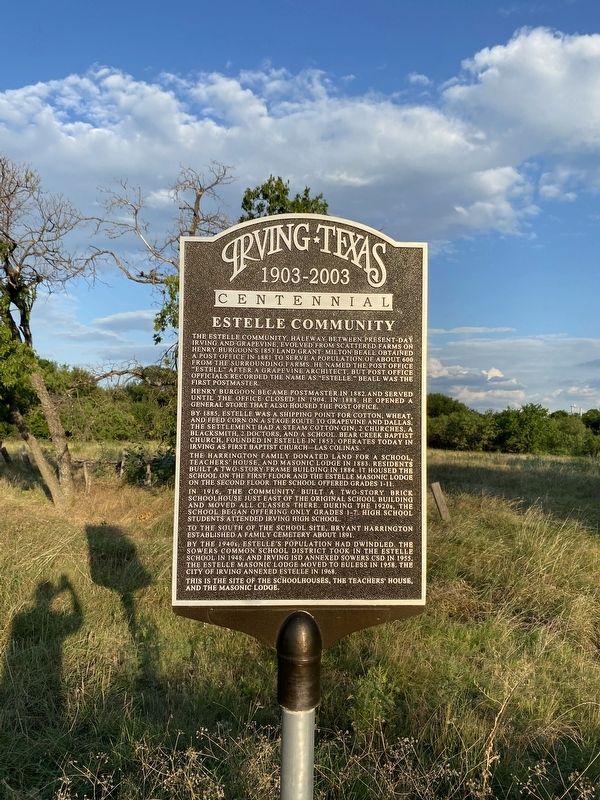
Estelle Community
1903-2003
| — | Centennial | — |
Photographed by Morgan Petermann, July 18, 2024
1. Estelle Community Marker
Henry Burgoon became postmaster in 1882, and served until the office closed in 1904. In 1888, he opened a general store that also housed the post office.
By 1885, Estelle was a shipping point for cotton, wheat, and feed corn on a stage route to Grapevine and Dallas. The settlement had a steam cotton gin, 2 churches, a blacksmith, 2 doctors, and a school. Bear Creek Baptist Church, founded in Estelle in 1853, operates today in Irving as First Baptist Church–Las Colinas.
The Harrington family donated land for a school, teachers' house, and Masonic lodge in 1883. Residents built a two-story frame building in 1884. It housed the school on the first floor and the Estelle Masonic lodge on the second floor. The school offered
this page online
In 1916, the community built a two-story brick schoolhouse just east of the original school building and moved all classes there. During the 1920s, the school began offering only grades 1-7. High school students attended Irving High School.
To the south of the school site, Bryant Harrington established a family cemetery about 1891.
By the 1940s, Estelle's population had dwindled. The Sowers Common School District took in the Estelle school in 1948, and Irving ISD annexed Sowers CSD in 1955. The Estelle Masonic lodge moved to Euless in 1958. The City of Irving annexed Estelle in 1968.
This is the site of the schoolhouses, the teachers' house, and the Masonic lodge.
Erected 2003 by Irving Heritage Society.
Topics. This historical marker is listed in these topic lists: Education • Industry & Commerce • Settlements & Settlers. A significant historical year for this entry is 1853.
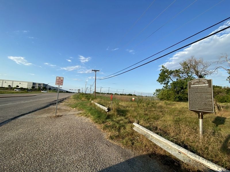
Location. 32° 51.971′ N, 97° 0.957′ W. Marker is in Irving, Texas, in Dallas County. It is on Valley View Lane south of West Walnut Hill Lane, on the right when traveling north. Touch for map. Marker is at or near this
Photographed by Morgan Petermann, July 18, 2024
2. Estelle Community Marker

Regionally, this marker is in the Prairies & Lakes Region and in the Dallas-Fort Worth Metropolitan Area. Globally, it is in North America, a Gulf of Mexico state, the Western Hemisphere, the Western World, and the Anglosphere. Historically, it finds itself in what was once New Spain, the Republic of Texas, one of the Confederate States of America, and the Antebellum South.
Other nearby markers. At least 8 other markers are within 3 miles of this marker, measured as the crow flies: Haley Memorial Cemetery (approx. 2½ miles away); Hitch Cemetery (approx. 2.6 miles away); Bear Creek Cemetery (approx. 2.8 miles away); Shelton’s Bear Creek Cemetery (approx. 2.9 miles away); Minter's Chapel Cemetery (approx. 2.9 miles away); Bird's Fort Trail (approx. 3 miles away); Alexander Dobkins Family Cemetery (approx. 3 miles away); Sowers Community (approx. 3 miles away). Touch for a list and map of all markers in Irving.
Credits. This page was last revised on July 21, 2024. It was originally submitted on July 19, 2024, by Morgan Petermann of Hurst, Texas. This page has been viewed 503 times since then and 75 times this year. Photos: 1, 2. submitted on July 19, 2024, by Morgan Petermann of Hurst, Texas. • James Hulse was the editor who published this page.
