Altadena in Los Angeles County, California — The American West (Pacific Coastal)
Altadena Founders Tree
The Deodar Cedar
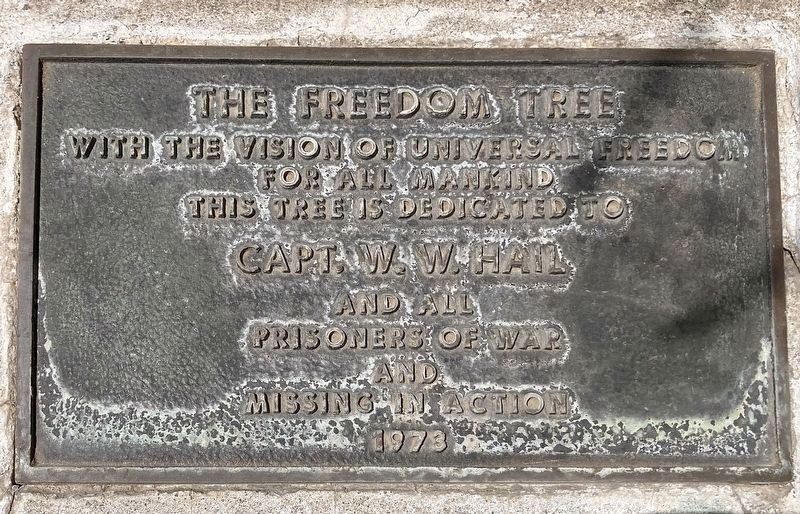
| — | The Freedom Tree | — |

Photographed by Craig Baker, July 16, 2024
1. Altadena Founders Tree Marker
John Woodbury, founder of Altadena with his brother Fred, first saw our town's iconic conifer, Cedrus deodara, touring Italy in the 1870s. After the United States Department of Agriculture assured him the Himalayan native would grow here, he sent seedlings ahead to Fred, who nurtured them. John planted 140 small trees along what is today Santa Rosa Avenue as the approach to his future estate. This was never built because in 1888 he went bankrupt - but the trees remain as his legacy and gift to Altadena. In 1920, Santa Rosa Avenue was inaugurated as 'Christmas Tree Lane' and has been lit seasonally ever since. It is the oldest large-scale Christmas lighting in the United States and listed on the National Register of Historic Places. The Deodar Cedar is Altadena's official tree.
The Freedom Tree
With the vision of Universal Freedom for all Mankind, this tree is dedicated to Capt. W.W. Hail and all Prisoners of War and Missing in Action - 1973.
Topics. This historical marker is listed in these topic lists: Horticulture & Forestry • Settlements & Settlers. A significant historical year for this entry is 1888.
Location. 34° 11.388′ N,
this page online

Regionally, this marker is in Greater Los Angeles and in the Transverse Ranges. It is also on the American Pacific Coast. Globally, it is in North America, on the Ring of Fire, on the Pacific Rim, in the Western Hemisphere, in the Western World, and in the Anglosphere. Historically, it finds itself in what was once New Spain and also Mexico’s Alta California.
Other nearby markers. At least 8 other markers are within walking distance of this marker: Owen Brown, Abolitionist (a few steps from this marker); The Old Mill (a few steps from this marker); Transit to Nature (within shouting distance of this marker); Altadena’s Beginnings (within shouting distance of this marker); Woodbury–Story House (about 500 feet away, measured in a direct line);
Photographed by Craig Baker, July 16, 2024
2. The Freedom Tree

Photographed by Craig Baker, July 16, 2024
3. Altadena Founders Tree and Marker
Credits. This page was last revised on July 19, 2024. It was originally submitted on July 19, 2024, by Craig Baker of Sylmar, California. This page has been viewed 1,970 times since then and 65 times this year. Photos: 1, 2, 3. submitted on July 19, 2024, by Craig Baker of Sylmar, California.
