Osdorp in Amsterdam, North Holland, Netherlands — Northwestern Europe
Dorpskerk van Sloten
⎯⎯⎯
Sloten Village Church
Photographed by Andrew Ruppenstein, July 6, 2024
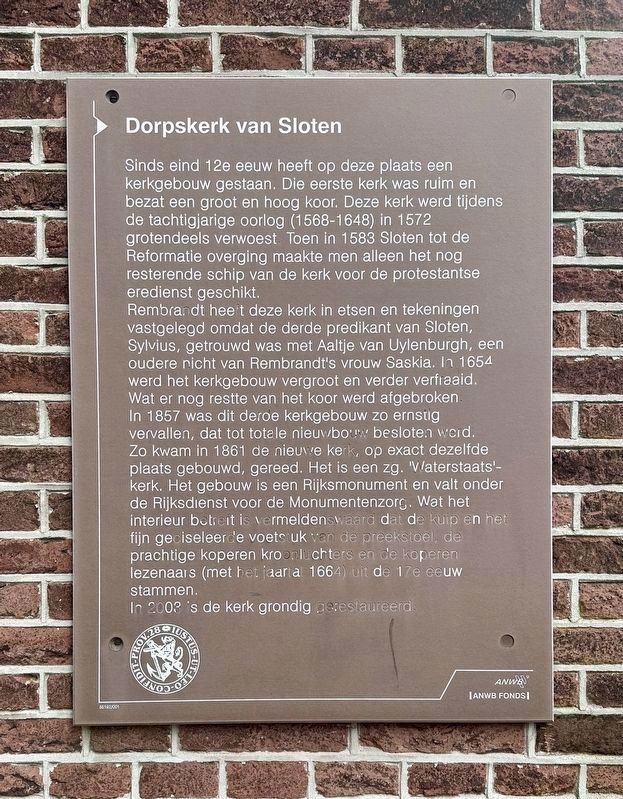
1. Dorpskerk van Sloten / Sloten Village Church Marker

Sinds eind 12e eeuw heeft op deze plaats een kerkgebouw gestaan. Die eerste kerk was ruim en bezat een groot en hoog koor. Deze kerk werd tijdens de tachtigjarige oorlog (1568-1648) in 1572 grotendeels verwoest. Toen in 1583 Sloten tot de Reformatie overging maakte men alleen het nog resterende schip van de kerk voor de protestantse eredienst geschikt.
Rembrandt heeft deze kerk in etsen en tekeningen vastgelegd omdat de derde predikant van Sloten, Sylvius, getrouwd was met Aaltje van Uylenburgh, een oudere nicht van Rembrandt's vrouw Saskia. In 1654. werd het kerkgebouw vergroot en verder verfiaaid. Wat er nog restte van het koor werd afgebroken In 1857 was dit deroe kerkgebouw zo ernstig vervallen, dat tot totale nieuwbouw besloten werd. Zo kwam in 1861 de nieuwe kerk, op exact dezelfde plaats gebouwd, gereed. Het is een zg. 'Waterstaats'- kerk. Het gebouw is een Rijksmonument en valt onder de Rijksdienst voor de Monumentenzorg. Wat het interieur betreit is vermeldenswaard dat de kuip en het fijn geciseleerde voetstuk van de preekstoel, de prachtige koperen kroonluchters
this page online
In 2003 is de kerk grondig gerestaureerd.
Sloten Village Church
A church building has stood on this site since the late 12th century. That first church was spacious and had a large and high choir. This church was largely destroyed in 1572 during the Eighty Years' War (1568-1648). When Sloten underwent the Reformation in 1583, only the remaining nave of the church was made suitable for Protestant worship.
Rembrandt recorded this church in etchings and drawings because the third minister of Sloten, Sylvius, was married to Aaltje van Uylenburgh, an older cousin of Rembrandt's wife Saskia. In 1654 the church building was enlarged and further embellished. What remained of the choir was demolished. In 1857, this church building was so seriously dilapidated that it was decided to build a complete new building. Thus, in 1861 the new church, built on exactly the same site, was completed. It is a so-called 'Waterstaats' church. The building is a national monument and falls under the National Monument Care Agency. As for the interior, it
Photographed by Andrew Ruppenstein, July 6, 2024
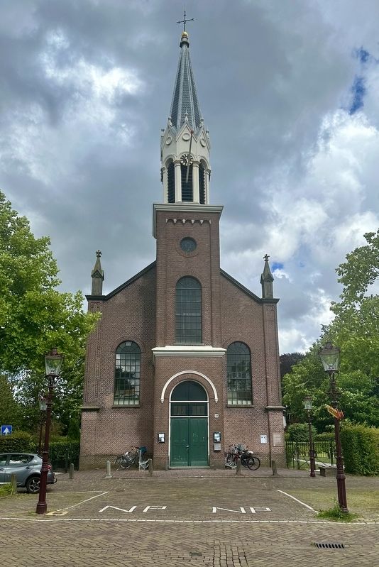
2. Dorpskerk van Sloten / Sloten Village Church and Marker
The marker is visible here on the right corner of the building.
The church was thoroughly restored in 2003.
Erected by ANWB Fonds, VVV. (Marker Number 35192/001.)
Topics. This historical marker is listed in these topic lists: Architecture • Religion & Religious Structures. A significant historical year for this entry is 1572.
Location. 52° 20.527′ N, 4° 47.859′ E. Marker is in Amsterdam, Noord-Holland (North Holland). It is in Osdorp. It is at the intersection of Osdorperweg and Nieuwe Akerweg, on the right when traveling north on Osdorperweg. Touch for map. Marker is at or near this postal address: Osdorperweg 28, Amsterdam, Noord-Holland 1066 CW, Netherlands. Touch for directions.

Regionally, it is in Europe, the European Union, Atlantic Europe, the Benelux Low Countries, the Schengen Area, Western Europe, and the Western World. Historically, it finds itself in what was once the Holy Roman Empire.
Other nearby markers. At least 8 other markers are within walking distance of this marker: Sloten Netherlands East Indies War Memorial (within shouting distance of this marker); Dorpsplein / Village Square (within shouting distance of this marker); Banpaal 1794 / Sloten’s Boundary Stake (about 90 meters away, measured in a direct line); Het Water / The Water (approx. 0.3 kilometers away); Molen van Sloten / Sloten Windmill (approx. 0.4 kilometers away); Hoeve / Farm (approx. 0.4 kilometers away); Willem Hovy (approx. 0.7 kilometers away); Iwan Kanteman (approx. 1.2 kilometers away). Touch for a list and map of all markers in Amsterdam.
Also see . . . Sloterkerk (Wikipedia, in Dutch).
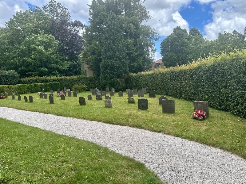
Excerpt (in translation): The first Sloterkerk is first mentioned in a charter from(Submitted on July 20, 2024.)Bishop Willem I (of Gelre) from 1063. This church probably stood at the level of the current Van Suchtelen van Haarestraat in Osdorp (between Osdorpplein and Hoekenes). The village was moved to its current location around 1200. The second Sloterkerk was built there, but it was largely destroyed by the Sea Beggars (a group of patriotic privateers) in 1573 during the Siege of Haarlem. In 1664, the remains of the nave were restored and made suitable as a Protestant church. Rembrandt recorded this third church in etchings and drawings, partly because the third pastor of Sloten, Sylvius, was married to Aaltje van Uylenburgh, a niece of Rembrandt's wife Saskia. Rembrandt's granddaughter, Titia van Rijn, married Francois Van Bijler (the younger) in this church on June 27, 1686. However, by the mid-19th century the church had fallen into such disrepair that new construction was deemed necessary.Photographed by Andrew Ruppenstein, July 6, 20243. Sloten Village Church cemetery

Abraham Rademacher (courtesy Stadsarchief Amsterdam via Wikimedia Commons), 1730
4. Sloten Village Church
Osdorperweg 28, view of the reformed church of Sloten, as it looked around 1640, with the choir in ruins.
Click for more information.
Click for more information.
Credits. This page was last revised on July 20, 2024. It was originally submitted on July 20, 2024, by Andrew Ruppenstein of Lamorinda, California. This page has been viewed 144 times since then and 20 times this year. Photos: 1, 2, 3. submitted on July 20, 2024, by Andrew Ruppenstein of Lamorinda, California. 4. submitted on July 20, 2024.
