
North Bend in Dodge County, Nebraska — The American Midwest (Upper Plains)
Thomsen's Corner
1923-2012
| — | Old Settlers Heritage Trail | — |
Photographed by Mark Parker, June 26, 2024
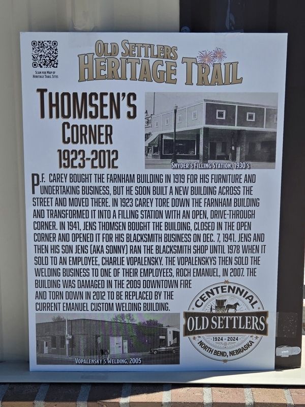
1. Thomsen's Corner Marker
P.F. Carey bought the Farnham Building in 1919 for his furniture and undertaking business, but he soon built a new building across the street and moved there. In 1923 carey tore down the Farnham Building and transformed it into a filling station with an open, drive-through corner. In 1941, Jens Thomsen bought the building, closed in the open corner and opened it for his blacksmith business. On Dec. 7, 1941. Jens and then his son Jens (AKA Sonny) ran the blacksmith shop until 1978 when it sold to an employee, Charlie Vopalensky. The Vopalenskys then sold the welding business to one of their employees, Roch Emanuel, in 2007. The building was damaged in the 2009 downtown fire and torn down in 2012 to be replaced by the current Emanuel Custom Welding building.
Captions
Snyder's Filling Station, 1930's
Vopalensky's Welding
Erected 2024.
Topics. This historical marker is listed in this topic list: Industry & Commerce. A significant historical date for this entry is December 7, 1941.
Location. 41° 27.774′ N, 96° 46.802′ W. Marker is in North Bend, Nebraska, in Dodge County. It is at the intersection of North Main Street (Nebraska
this page online

Regionally, this marker is in Eastern Nebraska and in Greater Omaha. It is also in the American Midwest, in the Corn Belt, and on the prairies. Globally, it is in North America, the Western Hemisphere, the Western World, and the Anglosphere. Historically, it finds itself in what was once the Louisiana Purchase.
Other nearby markers. At least 8 other markers are within 9 miles of this marker, measured as the crow flies: Farnham Building (here, next to this marker); Datel Building (a few steps from this marker); Hyatt / Lee Building (within shouting distance of this marker); Downtown Fire: Dec. 28, 2009 (within shouting distance of this marker); Jansen Hardware (within shouting distance of this marker); Memorial Park (about 600 feet away, measured in a direct line); Mormon Trail 1847 / Military Road 1856 (approx. 1.3 miles away); Overland Trail (approx. 8.6 miles away). Touch for a list and map
Photographed by Mark Parker, June 26, 2024
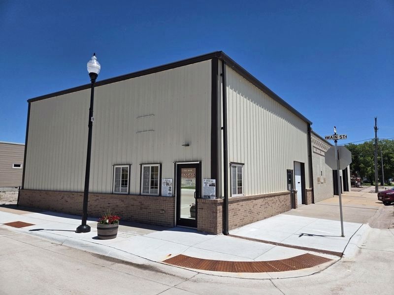
2. Thomsen's Corner Marker
This view shows the former site of the Farnham Building and Thomsen's Corner. It was rebuilt after 2012 and is currently Emanuel Custom Welding.
Credits. This page was last revised on July 22, 2024. It was originally submitted on July 20, 2024, by Mark Parker of Hickory, North Carolina. This page has been viewed 197 times since then and 15 times this year. Photos: 1, 2. submitted on July 20, 2024, by Mark Parker of Hickory, North Carolina. • J. Makali Bruton was the editor who published this page.
