Amsterdam-Noord , North Holland, Netherlands — Northwestern Europe
Ransdorp (village)
Photographed by Andrew Ruppenstein, July 14, 2024
1. Ransdorp (village) Marker

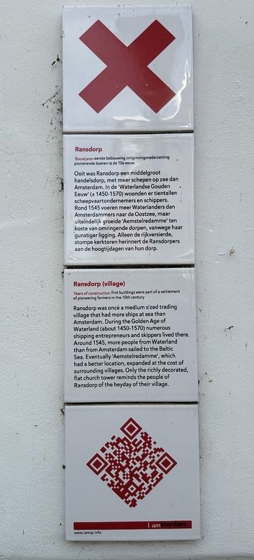
Bouwjaren eerste bebouwing ontginningsnederzetting pionierende boeren in de 10e eeuw
Ooit was Ransdorp een middelgroot handelsdorp, met meer schepen op zee dan Amsterdam. In de 'Waterlandse Gouden Eeuw' (± 1450-1570) woonden er tientallen scheepvaartondernemers en schippers. Rond 1545 voeren meer Waterlanders dan Amsterdammers naar de Oostzee, maar uiteindelijk groeide 'Aemstelredamme' ten koste van omringende dorpen, vanwege haar gunstiger ligging. Alleen de rijkversierde, stompe kerktoren herinnert de Ransdorpers aan de hoogtijdagen van hun dorp.
Ransdorp (village)
Years of construction first buildings were part of a settlement of pioneering farmers in the 10th century
Ransdorp was once a medium sized trading village that had more ships at sea than Amsterdam. During the Golden Age of Waterland (about 1450-1570) numerous shipping entrepreneurs and skippers lived there. Around 1545, more people from Waterland than from Amsterdam sailed to the Baltic Sea. Eventually 'Aemstelredamme', which had a better location, expanded at the cost of surrounding villages. Only the richly decorated, flat church tower reminds the people of Ransdorp of the heyday of their village.
Erected by IAmsterdam.
Topics and series. This historical marker is listed in this topic list: Settlements & Settlers. In addition, it is included in the IAmsterdam series list. A significant historical year for this entry is 1545.
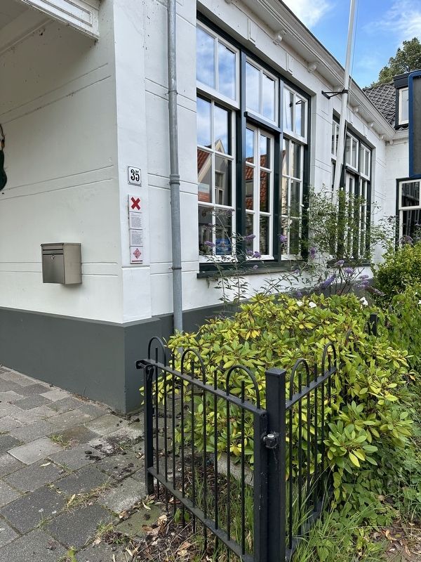
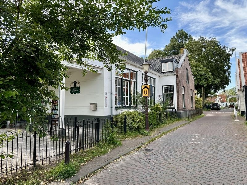
Location. 52° 23.56′ N, 4° 59.663′ E. Marker is in Amsterdam, Noord-Holland (North Holland). It is in Amsterdam-Noord. It is on Dorpsweg Ransdorp, on the left when traveling north. Touch for map. Marker is at or near this postal address: Dorpsweg Ransdorp 35, Amsterdam, Noord-Holland 1028 BP, Netherlands. Touch for directions.

Regionally, it is in Europe, the
this page online
Other nearby markers. At least 8 other markers are within 5 kilometers of this marker, measured as the crow flies: Het Zeeburgerdorp (approx. 4.4 kilometers away); Museum de Noord (museum of the north) and Vogeldorp (village) (approx. 4.7 kilometers away); Wielerbaan Zeeburg / Zeeburg Velodrome (approx. 4.7 kilometers away); Zicht op Havenrak / View of Havenrak (approx. 4.7 kilometers away); Nederlandse Hervormde Kerk / Dutch Reformed Church (approx. 4.8 kilometers away); Het Badhuis / The Bathhouse (approx. 4.9 kilometers away); Krijtmolen d’Admiraal / Chalkmill d’Admiraal (approx. 4.9 kilometers away); Krijtmolen d’Admiraal (chalk mill) (approx. 4.9 kilometers away). Touch for a list and map of all markers in Amsterdam.
Also see . . . Ransdorp (Wikipedia).
Excerpt: Ransdorp is a village in the province of North Holland, Netherlands, part of the municipality of Amsterdam. It lies about 7 km northeast of the city centre, in the(Submitted on July 21, 2024.)Landelijk Noord district. Ransdorp is a part of the borough (Dutch: stadsdeel) Amsterdam-Noord and has about 245 inhabitants.Photographed by Andrew Ruppenstein, July 14, 20242. Ransdorp (village) Marker - wide view
In 1840, the village had 292 inhabitants, living in 44 houses. Ransdorp was a separate municipality until 1921, when it merged with Amsterdam so that the Government of Amsterdam could ensure that the village's infrastructure was well-maintained…
Photographed by Andrew Ruppenstein, July 14, 2024
3. Ransdorp (village) Marker - wider view
Credits. This page was last revised on July 21, 2024. It was originally submitted on July 21, 2024, by Andrew Ruppenstein of Lamorinda, California. This page has been viewed 129 times since then and 29 times this year. Photos: 1, 2, 3. submitted on July 21, 2024, by Andrew Ruppenstein of Lamorinda, California.
