
Hurt in Pittsylvania County, Virginia — The American South (Mid-Atlantic)
Founding the Town of Hurt
Photographed by Cosmos Mariner, May 11, 2024
1. Founding the Town of Hurt Marker
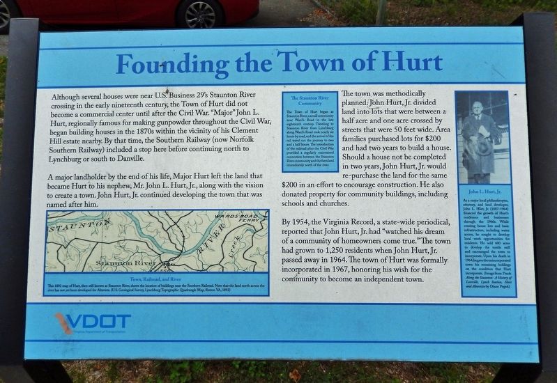
Although several houses were near U.S. Business 29's Staunton River crossing in the early nineteenth century, the Town of Hurt did not become a commercial center until after the Civil War. “Major” John L. Hurt, regionally famous for making gunpowder throughout the Civil War, began building houses in the 1870s within the vicinity of his Clement Hill estate nearby. By that time, the Southern Railway (now Norfolk Southern Railway) included a stop here before continuing north to Lynchburg or south to Danville.
A major landholder by the end of his life, Major Hurt left the land that became Hurt to his nephew, Mr. John L. Hurt, Jr., along with the vision to create a town. John Hurt, Jr. continued developing the town that was named after him.
The town was methodically planned. John Hurt, Jr. divided land into lots that were between a half acre and one acre crossed by streets that were 50 feet wide. Area families purchased lots for $200 and had two years to build a house. Should a house not be completed in two years, John Hurt, Jr. would re-purchase the land for the same $200 in an effort to encourage construction. He also donated
this page online
By 1954, the Virginia Record, a state-wide periodical, reported that John Hurt, Jr. had “watched his dream of a community of homeowners come true.” The town had grown to 1,250 residents when John Hurt, Jr. passed away in 1964. The town of Hurt was formally incorporated in 1967, honoring his wish for the community to become an independent town.
The Staunton River Community
The Town of Hurt began as Staunton River, a small community near Ward's Road in the late eighteenth century. Traveling to Staunton River from Lynchburg along Ward's Road took nearly six hours by road, and the arrival of the rail travel cut the journey to two and a half hours. The introduction of the railroad after the Civil War provided a regularly maintained connection between the Staunton River community and the farmland immediately north of the river.
Erected by Virginia Department of Transportation.
Topics. This historical marker is listed in these topic lists: Charity & Public Work • Industry & Commerce • Railroads & Streetcars • Settlements & Settlers. A significant historical year for this entry is 1954.
Location. 37° 6.217′ N,

2. Marker detail: Town, Railroad and River
This 1892 map of Hurt, then known as Staunton River, shows the location of buildings near the Southern Railroad. Note that the land north across the river his not yet been developed for Altavista. (U.S. Geological Survey, Lynchburg Topographic Quadrangle Map, Reston VA, 1892)

Regionally, this marker is in Southern Virginia, specifically in the Piedmont, and in Southside Virginia. It is also in the American South and specifically in the Upper South. Globally, it is in North America, the Western Hemisphere, the Western World, and the Anglosphere. Historically, it finds itself in what was once the territory of the Mississippian Culture, one of the original Thirteen Colonies, one of the Confederate States of America, and the Antebellum South.
Other nearby markers. At least 8 other markers are within 2 miles of this marker, measured as the crow flies: Pittsylvania County / Campbell County (here, next to this marker); Clement Hill (approx. 0.3 miles away); 1928 Bridge Between Hurt and Altavista
3. Marker detail: John L. Hurt, Jr.
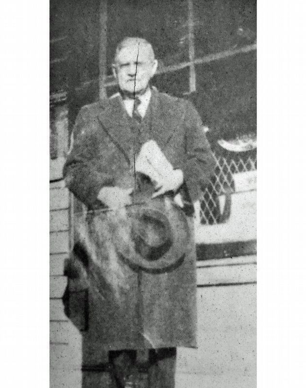
As a major local philanthropist, attorney, and land developer, John L. Hurt, Jr. (1887-1964) financed the growth of Hurt's residences and businesses through the 1960s. While creating house lots and basic infrastructure, including water access, he sought to develop local work opportunities for residents. He sold 600 acres to develop the textile mill and encouraged the town to incorporate. Upon his death in 1964, he gave the unincorporated town his remaining holdings on the condition that Hurt incorporate. (Image from Tracks Along the Staunton: A History of Leesville, Lynch Station, Hurt and Altavista by Diane Popek)
Also see . . . A Brief History of Hurt, Virginia. Excerpt:
Incorporated in 1967, Hurt derives its name from Mr. John L. Hurt, Jr. (1887 – 1964), a local attorney and landowner who bequeathed the land on which it now stands. Mr. Hurt was known for his philanthropy, determination and enterprising spirit. To this day, his life story continues to be an inspiration for those who take time to read it.(Submitted on July 22, 2024, by Cosmos Mariner of Cape Canaveral, Florida.)

Photographed by Cosmos Mariner, May 11, 2024
4. Founding the Town of Hurt Marker
Looking south along Main Street (Business U.S. 29).

Photographed by Cosmos Mariner, May 11, 2024
5. Welcome to Hurt Sign
Located about 60 meters southwest of the marker.
Credits. This page was last revised on November 3, 2024. It was originally submitted on July 21, 2024, by Cosmos Mariner of Cape Canaveral, Florida. This page has been viewed 885 times since then and 112 times this year. Photos: 1, 2, 3, 4, 5. submitted on July 21, 2024, by Cosmos Mariner of Cape Canaveral, Florida.
