Poplar Springs in Howard County, Maryland — The American Northeast (Mid-Atlantic)
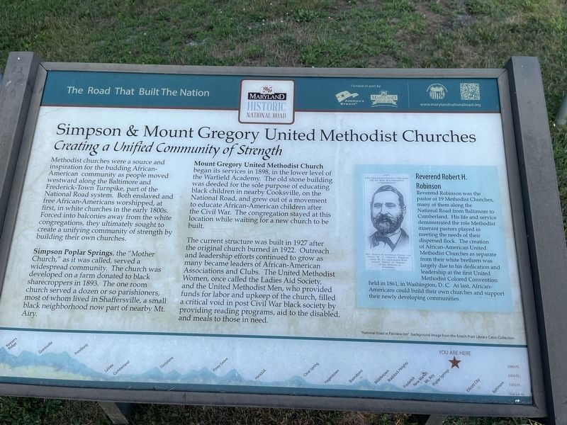
Simpson & Mount Gregory United Methodist Churches
Creating a Unified Community of Strength
| — | The Road That Built The Nation | — |
Photographed by Devry Becker Jones (CC0), July 14, 2024
1. Simpson & Mount Gregory United Methodist Churches Marker
Methodist churches were a source and inspiration for the budding African-American community as people moved westward along the Baltimore and Frederick-Town Turnpike, part of the National Road system. Both enslaved and free African-Americans worshipped, at first, in white churches in the early 1800s. Forced into balconies away from the white congregations, they ultimately sought to create a unifying community of strength by building their own churches.
Simpson Poplar Springs, the "Mother Church," as it was called, served a widespread community. The church was developed on a farm donated to black sharecroppers in 1893. The one room church served a dozen or so parishioners, most of whom lived in Shaffersville, a small black neighborhood now part of nearby Mt. Airy.
Mount Gregory United Methodist Church began its services in 1898, in the lower level of the Warfield Academy. The old stone building was deeded for the sole purpose of educating black children in nearby Cooksville, on the National Road, and grew out of a movement to educate African-American children after the Civil War. The congregation stayed at this location
this page online
The current structure was built in 1927 after the original church built in 1922. Outreach and leadership efforts continued to grow as many became leaders of African-American Associations and Clubs. The United Methodist Women, once called the Ladies Aid Society, and the United Methodist Men, who provided funds for labor and upkeep of the church, filled a critical void in post Civil War black society by providing reading programs, aid to the disabled, and meals to those in need.
[Sidebar:]
Reverend Robert H. Robinson
Reverend Robinson was the pastor of 19 Methodist Churches, many of them along the National Road from the Baltimore to Cumberland. His life and service demonstrated the role of Methodist itinerant pastors played in meeting the needs of their dispersed flock. The creation of African-American United Methodist Churches as separate from their white brethren was largely due to his dedication and leadership at the first United Methodist Colored Convention held in 1861, in Washington, D. C. At last, African-Americans could build their own churches and support their newly developing communities.
Erected by America's

Photographed by Devry Becker Jones (CC0), July 14, 2024
2. Simpson & Mount Gregory United Methodist Churches Marker
Topics and series. This historical marker is listed in these topic lists: African Americans • Education • Religion & Religious Structures. In addition, it is included in the The Historic National Road series list. A significant historical year for this entry is 1893.
Location. 39° 20.302′ N, 77° 6.102′ W. Marker is in Poplar Springs, Maryland, in Howard County. It is on Hardy Road 0.3 miles east of St. Michaels Road, on the right when traveling east. Touch for map. Marker is at or near this postal address: 16901 Hardy Rd, Mount Airy MD 21771, United States of America. Touch for directions.

Regionally, this marker is in the Baltimore Metro Region and in Central Maryland. It is also in the American Mid-Atlantic and on the Eastern Seaboard. Globally, it is in the North Atlantic Region, North America, the Western Hemisphere, the Western World, and the Anglosphere. Historically, it finds itself in what was once one of the original Thirteen Colonies and also the Antebellum South.
Other nearby markers. At least 8 other markers are within 2 miles of this marker, measured as the crow flies: St. Michael's Religious Education Wing & Multipurpose Building (approx. 0.2 miles away); St. Michael's Church (approx. ¼ mile away); St. Michael's Outdoor Grotto (approx. ¼ mile away); St. Michael's Historical Church (approx. ¼ mile away); St. Michael's Parish Cemetery (approx. 0.3 miles away); Poplar Springs (approx. 0.6 miles away); Lisbon Hotel (approx. 1.6 miles away); Lafayette's Tour (approx. 1.8 miles away). Touch for a list and map of all markers in Poplar Springs.
Other markers no longer nearby. Simpson & Mount Gregory United Methodist Churches (has been replaced with this marker); a different marker also named Poplar Springs (was approx. 0.6 miles away but has been replaced with another marker now near it).
Related marker. Click here for another marker that is related to this marker. This marker has replaced the linked marker. There are differences in subtitles and attributed erecting organizations.
Credits. This page was last revised on July 22, 2024. It was originally submitted on July 22, 2024, by Devry Becker Jones of Washington, District of Columbia. This page has been viewed 198 times since then and 31 times this year. Photos: 1, 2. submitted on July 22, 2024, by Devry Becker Jones of Washington, District of Columbia.
