Sunset Hill in Kansas City in Jackson County, Missouri — The American Midwest (Upper Plains)
Santa Fe Trail
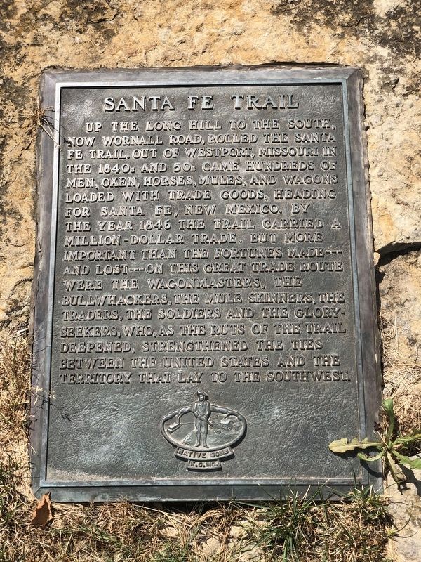
Photographed by Duane and Tracy Marsteller, June 30, 2024
1. Santa Fe Trail Marker
Erected 1975 by Native Sons of Kansas City. (Marker Number 10.)
Topics and series. This historical marker is listed in this topic list: Industry & Commerce. In addition, it is included in the Kansas City - Native Sons and Daughters of Greater Kansas City, and the Santa Fe Trail series lists. A significant historical year for this entry is 1846.
Location. 39° 2.366′ N, 94° 35.597′ W. Marker is in Kansas City, Missouri, in Jackson County. It is in Sunset Hill. It is on Ward Parkway east of Sunset
this page online

Regionally, this marker is in the American Midwest, in the Lewis & Clark Corridor, in the Corn Belt, and on the Santa Fe Trail Corridor. Globally, it is in North America, the Western Hemisphere, the Western World, and the Anglosphere. Historically, it finds itself in what was once the territory of the Mississippian Culture, the Louisiana Purchase, and the Antebellum South.
Other nearby markers. At least 8 other markers are within walking distance of this marker: Battle of Westport (a few steps from this marker); Union Position (about 500 feet away, measured in a direct line); Landing At Westport (about 800 feet away); Wild Boar of Florence (approx. ¼ mile away); Aleman Court (approx. ¼ mile away); Neptune (approx. ¼ mile away); Confederate Position (approx. 0.3 miles
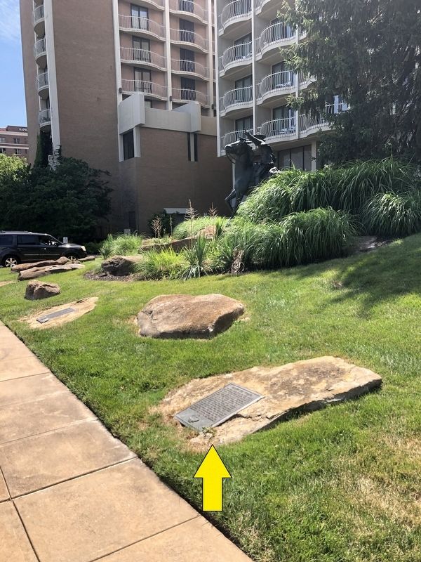
Photographed by Duane and Tracy Marsteller, June 30, 2024
2. Santa Fe Trail Marker
Featured marker is in the foreground, as indicated by arrow.
Credits. This page was last revised on July 22, 2024. It was originally submitted on July 22, 2024, by Duane and Tracy Marsteller of Murfreesboro, Tennessee. This page has been viewed 421 times since then and 21 times this year. Photos: 1, 2. submitted on July 22, 2024, by Duane and Tracy Marsteller of Murfreesboro, Tennessee.
