Near Highland in Doniphan County, Kansas — The American Midwest (Upper Plains)
The Barns of Doniphan County
An all-purpose barn for the Kansas farmer
| — | Glacial Hills Scenic Byway | — |
Photographed by Mark Hilton, July 11, 2024
1. The Barns of Doniphan County Marker
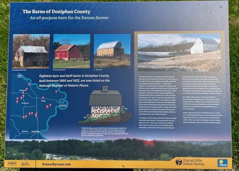
Eighteen byre and bluff barns in Doniphan County, built between 1860 and 1933, are now listed on the National Register of Historic Places.
The distinctive barns of Doniphan County help tell the story of the people who settled this scenic part of our state. The county, established in 1855, increased in population quickly after the Civil War. New settlers came from Ohio, Pennsylvania, Virginia, and Germany, and brought their techniques of raising milk cows and cattle and building barns with them. These traditions combined with the hilly topography of the glacial hills area to produce the "byre and bluff" barn design. The "byres" were full basements built into an earth bank or bluff. The foundations of these barns were often built of limestone and embedded in the earth, sheltering the basement level from the elements and providing warmth in winter and cooler temperatures in summer for livestock. The second story often accommodated draft animals and tools and implements, with a hay loft above.
J.D. Walters of the Kansas State Agricultural College called this barn style an "all-purpose barn for the Kansas farmer." Distinctive styles and materials were used at various times. For example, board and batten construction with louvered vents was typical during the 1870s and 1880s, while large structures with gambrel roofs were characteristic of the 1910s through 1930s. While these barns were sturdy and versatile, they also were expensive and required skilled craftsmanship, making them relatively uncommon. Eighteen
this page online
The Godfrey Nuzum Barn, built around 1890, 1s one of 18 byre and bluff barns of Doniphan County Constructed for a Virginia native who settled here in 1855, this one-story limestone and German lap-sided barn was built into the embankment as a mixed-use barn.
Some of the historic byre and bluff barns are still in use. The Nicolas Bohr Barn is a functioning part of the homestead and the T.L. White Barn is still used for cattle. Others are used for storage or are in various states of disrepair. Most are still on private property.
Caption:
The barns have access to both levels because they are built into a slope, or "bluff," making it possible for the farmer to drive a wagon of hay directly to the top and unload. This technology became somewhat outdated as loose hay was replaced with bales and then industrial-sized bales.
Erected by Kansas Tourism, Kansas Department of Transportation.
Topics. This historical marker is listed in this topic list: Notable Buildings. A significant historical year for this entry is 1860.
Location. 39° 55.781′ N, 95° 14.286′ W. Marker is near Highland, Kansas, in Doniphan County. It is at the intersection of Dove Creek Road and State Route 7, on the right when traveling north on Dove Creek Road. Located at Iowa Point. Touch for map. Marker is in this post office area: Highland KS 66035, United States of America. Touch for directions.

Regionally, this marker is
Photographed by Mark Hilton, July 11, 2024
2. The Barns of Doniphan County Marker (on right of three)
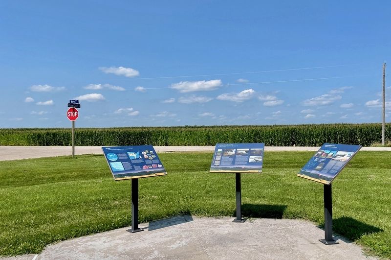
Kansas Highway 7 is in background.
Other nearby markers. At least 8 other markers are within 5 miles of this marker, measured as the crow flies: Landscape of the Glacial Hills (here, next to this marker); Glaciers (here, next to this marker); Homeland of the Kanza Indians (approx. 4½ miles away); "the water…contains a half…Glass of ooze" (approx. 4½ miles away); The Lewis and Clark Expedition (approx. 4½ miles away); Glacial Hills Scenic Byway (approx. 4½ miles away); Wilbur Chapman (approx. 4½ miles away); July 10, 1804 (approx. 4½ miles away). Touch for a list and map of all markers in Highland.
Another marker is no longer nearby. "abounds with Beaver" (was approx. 3.2 miles away but has been confirmed missing).
Also see . . . Glacial Hills Scenic Byway – Kansas. (Submitted on July 23, 2024, by Mark Hilton of Montgomery, Alabama.)
Credits. This page was last revised on July 23, 2024. It was originally submitted on July 23, 2024, by Mark Hilton of Montgomery, Alabama. This page has been viewed 277 times since then and 34 times this year. Photos: 1, 2. submitted on July 23, 2024, by Mark Hilton of Montgomery, Alabama.
