Jim Thorpe in Carbon County, Pennsylvania — The American Northeast (Mid-Atlantic)
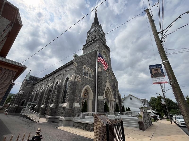
St. Joseph's Church
Founded 1871
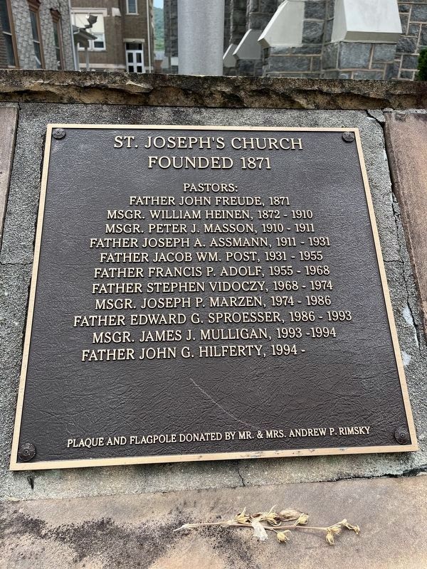
Erected by Mr. & Mrs. Andrew P. Rimsky.
Topics. This historical marker is listed in this topic list: Religion & Religious Structures. A significant historical year for this entry is 1871.
Location. 40° 52.515′ N, 75° 43.943′ W. Marker is in Jim Thorpe, Pennsylvania, in Carbon County. It is on North Street (Pennsylvania Route 903) south of West 6th Street, on the right when traveling north. Touch for map. Marker is at or near this postal address: 526 North St, Jim Thorpe PA 18229, United States of America. Touch for directions.

Regionally, this marker is in Anthracite Coal Region and in the Pocono Mountains. It is also in the American Northeast, in the Mid-Atlantic, in Appalachia, and
this page online
Other nearby markers. At least 8 other markers are within walking distance of this marker: World War II Honor Roll (approx. ¼ mile away); Waterborne Veterans Memorial (approx. 0.4 miles away); World War I Memorial (approx. 0.4 miles away); From Rails to Trails (approx. 0.6 miles away); Exploring The Corridor (approx. 0.6 miles away); Civil War Memorial (approx. 0.6 miles away); Lock No. 1, Lehigh Canal Upper Division (approx. 0.6 miles away); All Aboard (approx. 0.7 miles away). Touch for a list and map of all markers in Jim Thorpe.
Additional commentary.
1. About the plaque
This plaque serves as a historical marker because it shares every priest of the parish through at least 1994.
— Submitted July 24, 2024, by Devry Becker Jones of Washington, District of Columbia.
Credits. This page was last revised on July 24, 2024. It was originally submitted on July 24, 2024, by Devry Becker Jones of Washington, District of Columbia. This page has been viewed 276 times since then and 41 times this year. Photos: 1, 2. submitted on July 24, 2024, by Devry Becker Jones of Washington, District of Columbia.
