Tracy in San Joaquin County, California — The American West (Pacific Coastal)
Site of Carnegie
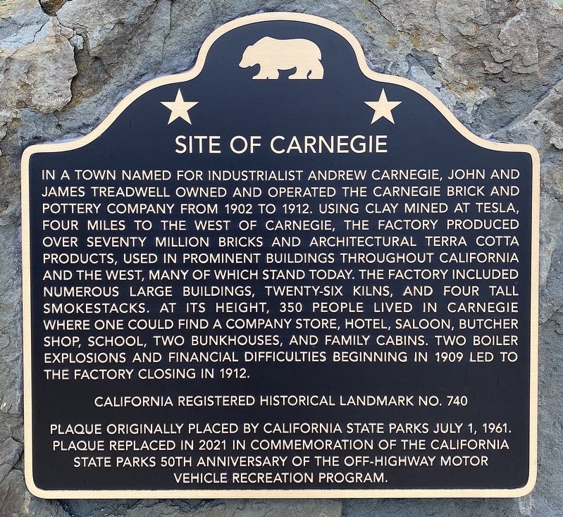
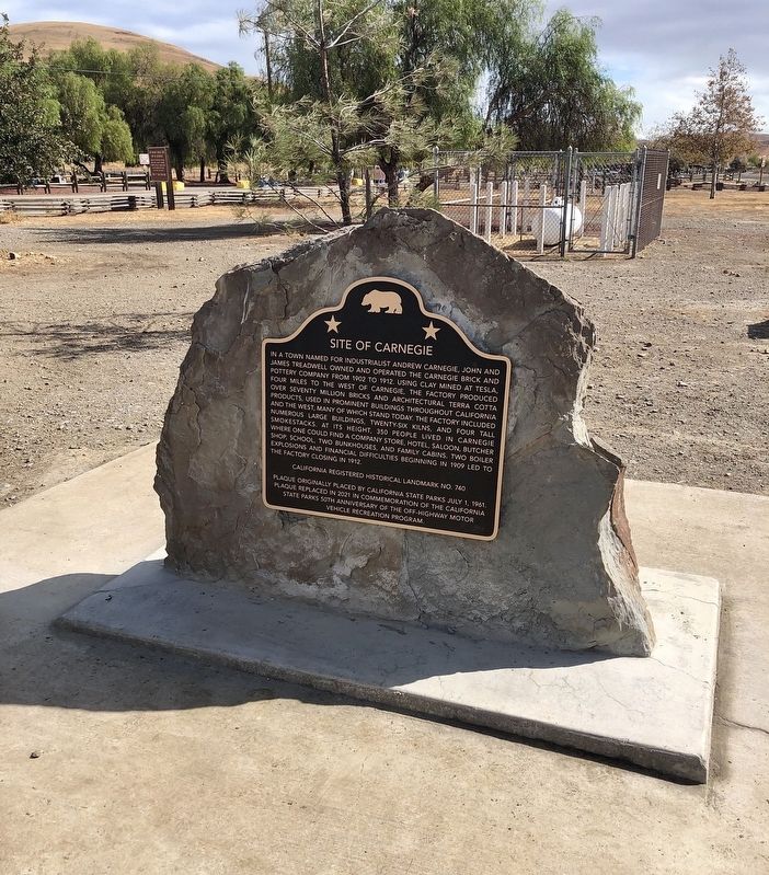
In a town named for industrialist Andrew Carnegie, John and James Treadwell owned and operated the Carnegie Brick and Pottery Company from 1902 to 1912. Using clay mined at Tesla, four miles to the west of Carnegie, the factory produced over seventy million bricks and architectural Terra Cotta products, used in prominent buildings throughout California and the west, many of which stand today. The factory included numerous large buildings, twenty-six kilns, and four tall smokestacks. At its height, 350 people lived in Carnegie where one could find a company store, hotel, saloon, butcher shop, school, two bunk houses, and family cabins. Two boiler explosions and financial difficulties beginning in 1909 led to the factory closing in 1912.
California Registered Historical Landmark No. 740.
Plaque originally placed by California State Parks July 1, 1961. Plaque replaced in 2021 in commemoration of the California State Parks 50th Anniversary of the Off-Highway Motor Vehicle Recreation Program.
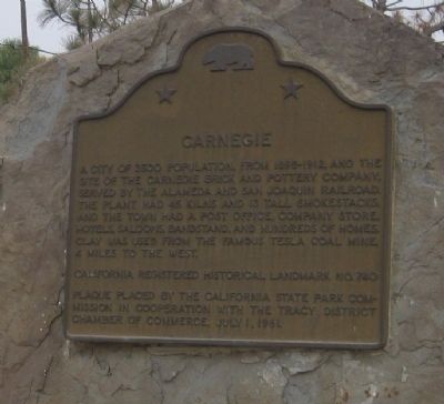
original marker:
Carnegie
A city of 3500 population, from 1895-1912, and the site of the Carnegie Brick and Pottery Company, served by the Alameda and San Joaquin Railroad. The plant had 45 kilns and 13 tall smokestacks, and the town had a post office, company store, hotels, saloons, bandstand, and hundreds of homes. Clay was used from the famous Tesla coal mine, 4 miles to the west.
California Registered Historical Landmark No. 740.
Erected 1961 by California State Park Commission, and the Tracy District Chamber of Commerce. (Marker Number 740.)
Topics and series. This historical marker is listed in these topic lists: Industry & Commerce • Settlements & Settlers. In addition, it is included in the California Historical Landmarks series list. A significant historical date for this entry is July 1, 1902.
Location. 37° 37.983′ N, 121° 32.61′ W. Marker is in Tracy, California, in San Joaquin County. Marker can be reached from Corral Hollow Road, 8 miles west of Interstate 580. Touch for map. Marker is at or near this postal address: 18600 Corral Hollow Road, Tracy CA 95376, United States of America. Touch for directions.
Other nearby markers. At least 8 other markers are within 11 miles of this marker, measured as the crow flies. City of Tracy Station 91 (approx. 9.1 miles away); Lawrence Livermore National Laboratory (approx. 9.2 miles away); Tracy World War I Memorial and Honor Roll (approx. 9.7 miles away); Tracy War Memorial (approx. 9.9 miles away); Tracy City Hall (approx. 9.9 miles away); Wente Bros. Winery (approx. 10.2 miles away); Lincoln Highway (approx. 10.4 miles away); a different marker also named Lincoln Highway (approx. 10.4 miles away). Touch for a list and map of all markers in Tracy.
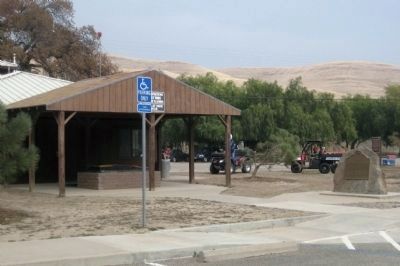
More about this marker. The marker is located in Carnegie State Vehicular Recreation Area, a state park for the enjoyment of dirt bikes and ATVs. Although there is an entrance fee to the park, the ranger may waive the fee if you tell them you are only interested in seeing the marker, provided you are not towing a dirt bike or ATV.
Regarding Site of Carnegie. Local historian Dan Mosier took issue with the accuracy of the original historical marker, stating, "...The information on the plaque is mixed up with Tesla, another larger town four miles west of Carnegie. The town of Carnegie did not exist from "1895-1912". The brick plant and town wasn't established until 1902. The plaque states "a city of 3,500". The population of Carnegie was no more than 400. The town never could have supported 3,500 people with only two bunkhouses, each capable of holding up to 100 single men, a 20-room hotel, and 18 homes for families. Not even Tesla, which had a capacity for 1,200 inhabitants, could support that many people. Carnegie did not have "45 kilns and 13 tall smokestacks", as the plaque suggests. It actually had 12 kilns and 4 tall smokestacks and 5 short stacks. The description of the town on the plaque is that for Tesla, not Carnegie. Carnegie did not have a post office, bandstand, or hundreds of homes; these were at Tesla. Instead, Carnegie had one hotel, one saloon, one company store, one bakery, one butcher shop, two schoolhouses (yes, lots of children lived in the 18 family homes), and one railroad depot. The last line about the Tesla coal mine is correct."
A new, updated plaque was installed on October 30, 2021.
Also see . . .
1. Carnegie, California. Wikipedia entry. (Submitted on October 13, 2020, by Larry Gertner of New York, New York.)
2. Carnegie SVRA. The California Department of Parks and Recreation's page for the park, including a brief history of Carnegie, "...Carnegie's unique past can be traced to the Gold Rush when miners, traveling through Corral Hollow Canyon on their way to the gold fields, discovered that the canyon contained a rich deposit of clay. Fueled by California's rapid population growth and the subsequent demand for building materials, the Carnegie Brick and Pottery Company was formed. By the turn of the 20th century a vibrant town with over 2,000 inhabitants was in place and the town's brick factory was producing upwards
of 100,000 bricks per day! However, by 1916 the brick company was facing financial ruin and was sold. The new owners, in an effort to return the area to ranch land, sold off the factory's equipment and destroyed what remained of the town's buildings...." (Submitted on December 7, 2009.)
Photographed By Andrew Ruppenstein, December 5, 2009
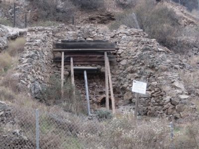
5. Kiln structure remains, located in Kiln Canyon
Althogh little remains to be seen of Carnegie, the remains of a kiln are still visible 1/4 mile up Kiln Canyon. (The sign visible to the right of the kiln indicate that this is an archeological resource area.)
Credits. This page was last revised on April 24, 2024. It was originally submitted on December 7, 2009, by Andrew Ruppenstein of Lamorinda, California. This page has been viewed 1,856 times since then and 123 times this year. Photos: 1. submitted on December 27, 2021, by Craig Baker of Sylmar, California. 2. submitted on December 28, 2021, by Craig Baker of Sylmar, California. 3, 4, 5. submitted on December 7, 2009, by Andrew Ruppenstein of Lamorinda, California. • Syd Whittle was the editor who published this page.
