Intramuros in Manila, Metro Manila, Philippines — Southeast Asia
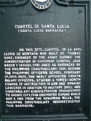
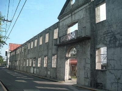
Cuartel de Santa Lucia
Santa Lucia Barracks
Erected 1990 by National Historical Institute.
Topics. This historical marker is listed in this topic list: Government & Politics. A significant historical date for this entry is February 17, 1905.
Location. 14° 35.249′ N, 120° 58.484′ E. Marker is in Manila, Metro Manila. It is in Intramuros. Marker is on Sta. Lucia Street near Sta. Potencia Street, on the right when traveling south. Touch for map. Marker is in this post office area: Manila, Metro Manila 1002, Philippines. Touch for directions.
Other nearby markers. At least 8 other markers are within walking distance of this marker. No. 1 Victoria St. (within shouting distance of this marker); Beaterio de la Compañia de Jesus (about 90 meters away, measured in a direct line); Church of San Agustin (about 210 meters away); Lourdes Church and Convent (about 240 meters away); Ateneo de Manila (approx. 0.3 kilometers away); San Ignacio Church (approx. 0.3 kilometers away); Colegio de Santa Isabel (approx. 0.3 kilometers away); The Jesuit Compound (approx. 0.3 kilometers away). Touch for a list and map of all markers in Manila.
Also see . . . Intramuros (The Walled City). Information on this historic site in addition to other historical sites in the area. (Submitted on December 11, 2009.)
Credits. This page was last revised on January 10, 2024. It was originally submitted on December 7, 2009, by I.G.V.Atajar of San Jose, California. This page has been viewed 3,150 times since then and 219 times this year. Photos: 1, 2. submitted on December 7, 2009, by I.G.V.Atajar of San Jose, California. • Syd Whittle was the editor who published this page.
Editor’s want-list for this marker. Wide area view of the marker and its surroundings. • Can you help?

