Petrogradsky District in Saint Petersburg in Petrogradsky, Sankt-Peterburg, Russia — Россия (Eastern Europe or Northern Asia)
Carthouse
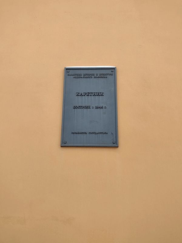
Photographed by Charles Berman, December 2, 2021
1. Carthouse Marker

Федерального значения
Каретник
Построен в 1846 г.
Охраняется государством
Carthouse
Built in 1846
Protected by the state.
Topics. This historical marker is listed in this topic list: Architecture. A significant historical year for this entry is 1846.
Location. 59° 56.932′ N, 30° 18.984′ E. Marker is in Saint Petersburg, Sankt-Peterburg, in Petrogradsky. It is in the Petrogradsky District. It can be reached from Peter and Paul Fortress. Touch for map. Marker is at or near this postal address: Neizvestnaya doroga, Saint Petersburg,
this page online

Regionally, it is on the Pacific Rim. Historically, it finds itself in what was once the Soviet Union and also the Russian Empire.
Other nearby markers. At least 8 other markers are within 3 kilometers of this marker, measured as the crow flies: Platz-Mayorsky House (within shouting distance of this marker in Leningrad Oblast); Monument to Peter I (about 150 meters away, measured in a direct line in Leningrad Oblast); 1924 and 1975 Floods (approx. 0.7 kilometers away in Leningrad Oblast); 1824 Flood (approx. 0.7 kilometers away in Leningrad Oblast); 1752, 1777 and 1788 Floods (approx. 0.7 kilometers away in Leningrad Oblast); Kulikov Vladimir Evgenievich (approx. 1.2 kilometers away in Leningrad Oblast); Shell traces (approx. 2.3 kilometers away in Leningrad Oblast); S. Shustov 19th Century Architecture (approx. 2.4 kilometers away in Leningrad Oblast). Touch for a list and map of all markers in Saint Petersburg.
Credits. This page was last revised on August 1, 2024. It was originally submitted on July 26, 2024, by Charles Berman of Binghamton, New York. This page has been viewed 107 times since then and 9 times this year. Photo 1. submitted on July 26, 2024, by Charles Berman of Binghamton, New York. • Andrew Ruppenstein was the editor who published this page.
