
Leicester, England, United Kingdom — Northwestern Europe (the British Isles)
All Saints' Church
Changing Pasts
Photographed by Ray Gurganus, April 14, 2024
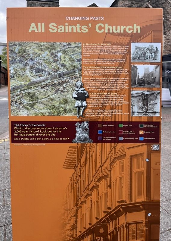
1. All Saints' Church Marker
The Church of All Saints is probably one of the six Leicester churches mentioned in the Domesday Book. It stands with its west end bordering High Cross Street, the main route from north to south through the town. This location meant that the church was at the centre of town life for many centuries.
Changes to the layout of the surrounding buildings and streets, since the Medieval period, have left the church isolated from the modern-day city centre.
View of the church from Castle Street
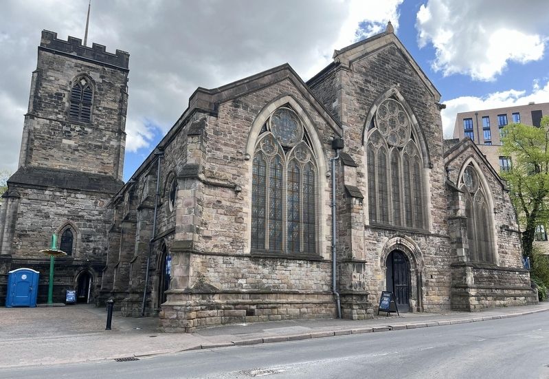
The church was originally cross-shaped and probably had a tower above the crossing. It was rebuilt at the end of the 1300s. Only the base of the tower and the west door remain from the original church.
There is a small hole in the wall to the right of the west door, giving a view of the altar to people outside. This may have been to let people see the Holy Communion. Medieval people believed that merely seeing the communion bread was just as good for you spiritually, as actually eating it. The Church also used to have quarter jacks on the clock. They would strike a bell every quarter hour.
A New Future for All Saints
In
this page online
It has been used as a base for several projects including the At Risk War Memorials Project and "Sanctuaries" with the Y-Theatre. All Saints has also been a polling station for General Elections.
Topics. This historical marker is listed in this topic list: Religion & Religious Structures.
Location. 52° 38.295′ N, 1° 8.447′ W. Marker is in Leicester, England. It is on Highcross Street. Touch for map. Marker is at or near this postal address: 109 Highcross Street, Leicester, England LE1 4PH, United Kingdom. Touch for directions.

Regionally, this marker is in England’s Midlands. Globally, it is on the Atlantic Ocean, in the North Atlantic Region, in Europe, in Atlantic Europe, on one of the British Isles, in the Western World, and in the Anglosphere. Historically,
Photographed by Ray Gurganus, April 14, 2024
2. All Saints' Church
Other nearby markers. At least 8 other markers are within walking distance of this marker: Vine Street Courtyard House (about 180 meters away, measured in a direct line); Shaftesbury Hall (approx. 0.3 kilometers away); The Dryad Collection (approx. 0.4 kilometers away); Forum and Basilica (approx. 0.4 kilometers away); Ratae Corieltavorum (approx. 0.4 kilometers away); BBC Asian Network (approx. 0.4 kilometers away); BBC Radio Leicester (approx. 0.4 kilometers away); Visit of the Queen (approx. 0.4 kilometers away). Touch for a list and map of all markers in Leicester.
Credits. This page was last revised on August 2, 2024. It was originally submitted on July 26, 2024, by Ray Gurganus of Washington, District of Columbia. This page has been viewed 155 times since then and 30 times this year. Photos: 1, 2. submitted on July 26, 2024, by Ray Gurganus of Washington, District of Columbia. • Andrew Ruppenstein was the editor who published this page.
