Kings Mountain in Cleveland County, North Carolina — The American South (South Atlantic)
Kings Mountain Battleground
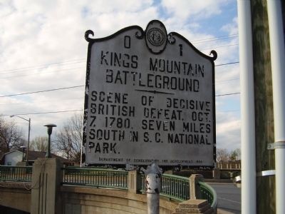
Photographed by Stanley and Terrie Howard, March 29, 2009
1. Kings Mountain Battelground Marker
Erected 1936 by Department of Conservation and Development. (Marker Number O-1.)
Topics and series. This historical marker is listed in this topic list: War, US Revolutionary. In addition, it is included in the North Carolina Division of Archives and History series list. A significant historical date for this entry is October 7, 1780.
Location. This marker has been replaced by another marker nearby. It was located near 35° 14.445′ N, 81° 20.666′ W. Marker was in Kings Mountain, North Carolina, in Cleveland County. It was on South Battleground Avenue (North Carolina Route 216) near West King Street ( Route 74). Touch for map. Marker was in this post office area: Kings Mountain NC 28086, United States of America. Touch for directions.

Regionally, this marker was in North Carolina’s Piedmont. It was also in the American South and specifically in the Upper South. Globally, it was in North America, the Western Hemisphere, the Western World, and the Anglosphere. Historically, it found itself in what was once the territory of
this page online
Other nearby markers. At least 8 other markers are within 4 miles of this location, measured as the crow flies: Battle of Kings Mountain (here, next to this marker); William Andrew Mauney House (about 300 feet away, measured in a direct line); Jimmy Wayne (about 600 feet away); Robert Barber House (approx. 0.2 miles away); Patriots Park (approx. 0.2 miles away); The Cupola (approx. 0.2 miles away); George Washington Cornwell House (approx. 0.2 miles away); Lincoln Academy (approx. 3.4 miles away). Touch for a list and map of all markers in Kings Mountain.
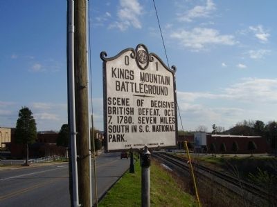
Photographed by Stanley and Terrie Howard, March 29, 2009
2. Kings Mountain Battelground Marker
Credits. This page was last revised on January 28, 2025. It was originally submitted on April 4, 2009, by Stanley and Terrie Howard of Greer, South Carolina. This page has been viewed 1,711 times since then and 32 times this year. Last updated on July 27, 2024, by Carl Gordon Moore Jr. of North East, Maryland. Photos: 1, 2. submitted on April 4, 2009, by Stanley and Terrie Howard of Greer, South Carolina. • Bernard Fisher was the editor who published this page.
