Henrietta in Rutherford County, North Carolina — The American South (South Atlantic)
The High Shoal Ironworks Village
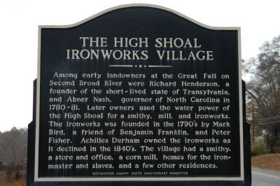
Photographed by Michael Sean Nix, December 21, 2008
1. The High Shoal Ironworks Village Marker
Erected by Rutherford County 225th Anniversary Committee.
Topics. This historical marker is listed in this topic list: Notable Places.
Location. 35° 15.87′ N, 81° 47.59′ W. Marker is in Henrietta, North Carolina, in Rutherford County. It is on Harris-Henrietta Road 0.1 miles north of Main Street, on the left when traveling south. Touch for map. Marker is in this post office area: Henrietta NC 28076, United States of America. Touch for directions.

Regionally, this marker is in North Carolina’s
this page online
Other nearby markers. At least 8 other markers are within 7 miles of this marker, measured as the crow flies: Raleigh Rutherford Haynes / Simpson Bobo Tanner (here, next to this marker); Raleigh Rutherford Haynes (approx. 2 miles away); Get Up Bell (approx. 2 miles away); North Carolina / South Carolina (approx. 5.8 miles away); Memorial Trees (approx. 6.1 miles away); Elisha Baxter (approx. 6.1 miles away); Building the Community Connector (approx. 6.2 miles away); Rutherford County Memorial (approx. 6.2 miles away).
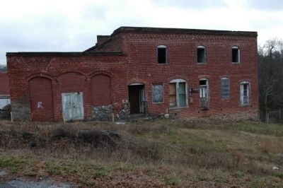
Photographed by John Nix, October 21, 2003
2. Old Henrietta Mill on Second Broad River
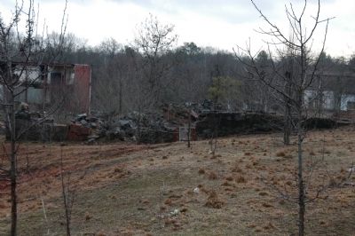
Photographed by John Nix, December 21, 2008
3. Old Henrietta Mill on Second Broad River
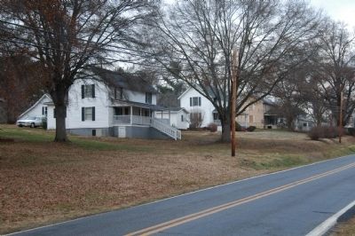
Photographed by John Nix, December 21, 2008
4. Mill houses on Main Street
Credits. This page was last revised on July 28, 2024. It was originally submitted on December 21, 2008, by Michael Sean Nix of Spartanburg, South Carolina. This page has been viewed 1,744 times since then and 67 times this year. Last updated on July 27, 2024, by Carl Gordon Moore Jr. of North East, Maryland. Photos: 1, 2, 3, 4. submitted on December 21, 2008, by Michael Sean Nix of Spartanburg, South Carolina. • Bernard Fisher was the editor who published this page.
