Saint Stephens Church in King and Queen County, Virginia — The American South (Mid-Atlantic)
Clark Home
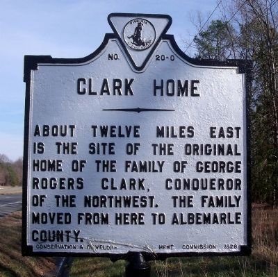
Photographed by Bernard Fisher, December 6, 2009
1. Clark Home Marker
Erected 1928 by Conservation & Development Commission. (Marker Number O-20.)
Topics and series. This historical marker is listed in these topic lists: Settlements & Settlers • War, US Revolutionary. In addition, it is included in the Virginia Department of Historic Resources (DHR) series list.
Location. 37° 48.262′ N, 77° 3.012′ W. Marker is in Saint Stephens Church, Virginia, in King and Queen County. It is on Richmond Tappahannock Highway (U.S. 360) 0.3 miles The Trail (Virginia Route 14), on the right when traveling east. Touch for map. Marker is in this post office area: Saint Stephens Church VA 23148, United States of America. Touch for directions.

Regionally, this marker is on the Middle Peninsula. It is also in the American South, specifically in the Upper South, in the Tidewater, in the Chesapeake Bay Region, and on the Eastern Seaboard. Globally, it is in the North Atlantic
this page online
Other nearby markers. At least 8 other markers are within 6 miles of this marker, measured as the crow flies: Apple Tree Church (about 400 feet away, measured in a direct line); Cavalry Raids (approx. 3.4 miles away); Bruington Church (approx. 3.7 miles away); Montville (approx. 4.1 miles away); Hillsboro (approx. 4.7 miles away); King and Queen County / Essex County (approx. 5.7 miles away); Mattaponi Indian Town (approx. 5.7 miles away); Bacon's Northern Force (approx. 5.7 miles away).
Another marker is no longer nearby. Mount Pleasant (was approx. 4.7 miles away but has been confirmed missing).
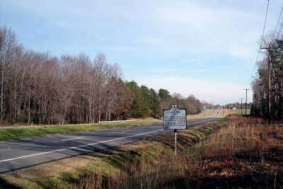
Photographed by Bernard Fisher, December 6, 2009
2. Richmond Tappahannock Highway (facing east)
Credits. This page was last revised on December 25, 2019. It was originally submitted on December 8, 2009, by Bernard Fisher of Richmond, Virginia. This page has been viewed 1,440 times since then and 55 times this year. Photos: 1, 2. submitted on December 8, 2009, by Bernard Fisher of Richmond, Virginia.
