Near Williston in Williams County, North Dakota — The American Midwest (Upper Plains)
Navigating Cut Bluff

Photographed by Barry Swackhamer, February 2, 2011
1. Navigating Cut Bluff Marker
Compass circa 1815, Hadley Quadrant, Surveyor's Compass
"Beginning at the mouth of the Missouri, you will take observations of latitude & longitude, at all remarkable points on the river & especially at the mouth of rivers, at rapids, at islands, & other places & objects distinguished by such natural marks & characters of a durable kind, as that may with certainty be recognized hereafter." ~ Thomas Jefferson, Instructions to Meriwether Lewis, June 20, 1803
I asscended to the top of the cutt bluff this morning, from whence I had a most delightfull view of the country, the whole of which except the vally formed by the Missouri is void of timber or underbrush, exposing to the first glance of the spectator immence herds of Buffaloe, Elk, deer, & Antelopes feeding in one common and boundless pasture. Capt. Lewis, April 22, 1805
to the upper point of the timbered bottom on Lard. side below a high bluff point which we called Cut bluff, at 1 mile pass White Earth river on Stard. Capt. Lewis, April 21, 1805
Among Lewis and Clark's many objectives on their expedition into the Louisiana Purchase was the claiming of territory and the making of accurate maps. To
this page online
Erected by National Park Service and Williston Star Fund.
Topics and series. This historical marker is listed in this topic list: Exploration. In addition, it is included in the Lewis & Clark Expedition series list. A significant historical date for this entry is April 21, 1805.
Location. 48° 7.515′ N, 103° 33.688′ W. Marker has been reported damaged. Marker is near Williston, North Dakota, in Williams County. It can be reached from the intersection of 133rd Avenue North West and 49th Street North West. The directions (signs) to Cut Bluff Overlook can be somewhat ambiguous. Touch for map. Marker is in this post office area: Williston ND 58801, United States of America. Touch for directions.

Regionally, this marker is in the Bakken Oil Patch. It is also in the American Lewis & Clark Corridor, on the prairies, and on the Northern Plains. Globally, it is in North America, the Western Hemisphere, the Western World, and the Anglosphere. Historically, it finds itself in what was once Rupert’s Land and also the Louisiana Purchase.
Other nearby markers. At least 5 other markers are within 8 miles of this location, measured as the crow

Photographed by Barry Swackhamer
2. Navigating Cut Bluff Marker
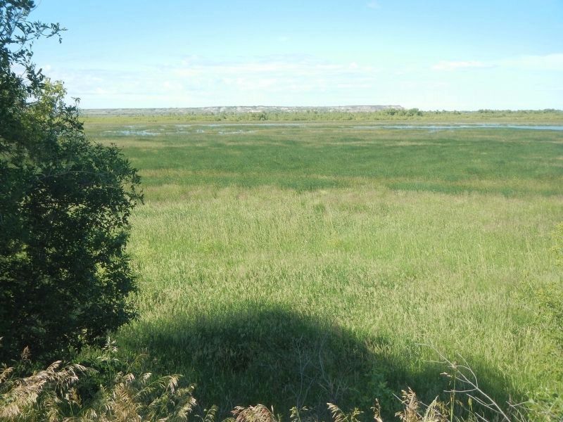
Photographed by Barry Swackhamer
3. Cut Bluff Overlook
Credits. This page was last revised on July 17, 2025. It was originally submitted on July 28, 2024, by Barry Swackhamer of Brentwood, California. This page has been viewed 549 times since then and 81 times this year. Photos: 1, 2, 3. submitted on July 28, 2024, by Barry Swackhamer of Brentwood, California.
