Prospect Park in Mount Airy in Carroll County, Maryland — The American Northeast (Mid-Atlantic)
Mayors of Mount Airy
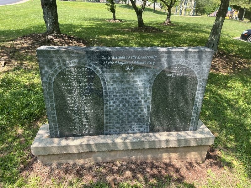
of the Mayors of Mount Airy
1894
Bryon S. Dorsey 1894 - 1898 & 1900 - 1904 • Lycurgus Clary 1891 - 1900 • R. Gassaway Molesworth 1904 - 1906 • Frank J. Lewis 1906 - 1910 • Francis J. Leatherwood 1910 - 1914 • Archley R. Molesworth 1914 - 1928 • Charles A. Ogle 1928 - 1944 • Nathan A. Dorsey 1944 - 1946 • Walter L. Spurrer 1946 - 1952 • Henry C. Krantz, Jr. 1952 - 1954 • Norman E Etzler 1954 - 1958 • Frank E. Horpel 1958 - 1964 • Dr. Carl M. Vanpoole 1964 - 1967 • Paul E. Beall 1967 - 1968 • Carl W. Smith 1968 - 1972 • Lewis C. Dixon 1972 - 1986 • Linda R. Boyer 1986 - 1990 • Gerald R. Johnson 1990 - 2002 • James S. Holt 2002 - 2006 • Frank M. Johnson 2006 - 2009
David W. Pyatt 2009 • Peter R. Helt 2009 - 2010 • Patrick T. Rockinberg 2010 -
Erected 2010.
Topics. This historical marker is listed in this topic list: Government & Politics. A significant historical year for this entry is 1894.
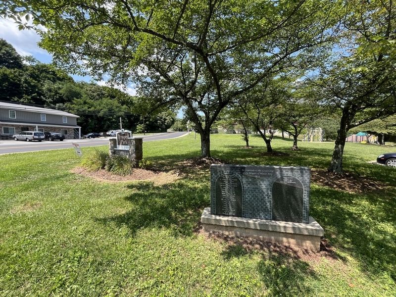
Location. 39° 22.74′ N, 77° 9.339′ W. Marker is in Mount Airy, Maryland, in Carroll County. It is in Prospect
this page online

Regionally, this marker is in the Baltimore Metro Region and in Central Maryland. It is also in the American Mid-Atlantic. Globally, it is in North America, the Western Hemisphere, the Western World, and the Anglosphere. Historically, it finds itself in what was once one of the original Thirteen Colonies and also the Antebellum South.
Other nearby markers. At least 8 other markers are within walking distance of this marker: First National Bank Building (about 700 feet away, measured in a direct line); Runkles Mill & The Mount Airy Milling Company (about 800 feet away); The Mount Airy Founding (about 800 feet away); The Mount Airy Station (approx. 0.2 miles away); William Hood Building (approx. 0.2 miles away); Sledding in Mount Airy in the Past (approx. 0.2 miles away); Railway Express Agency Baggage Wagon (approx. 0.2 miles away); The Gillis Building (approx.
Other markers no longer nearby. Runkles Mill and The Mt. Airy Milling Company (was about 800 feet away but has been replaced with another marker now near it); The Mount Airy Rail Yard (was about 800 feet away but has been replaced with another marker now near it).
Additional commentary.
1. About the marker
While most dedications for mayors and other political positions do not necessarily serve as historical markers, this one does; it names every mayor of the town from its incorporation in 1894 through 2010, when the marker was erected.
— Submitted July 28, 2024, by Devry Becker Jones of Washington, District of Columbia.
Credits. This page was last revised on August 1, 2024. It was originally submitted on July 28, 2024, by Devry Becker Jones of Washington, District of Columbia. This page has been viewed 206 times since then and 51 times this year. Photos: 1, 2. submitted on July 28, 2024, by Devry Becker Jones of Washington, District of Columbia.
Editor’s want-list for this marker. A photo of the back of the marker (featuring erection information) • Can you help?
