New Franklin in Howard County, Missouri — The American Midwest (Upper Plains)
First Baptist Church
(Originally Mount Pleasant Baptist Church)
Photographed by Duane and Tracy Marsteller, July 1, 2024
1. First Baptist Church Marker
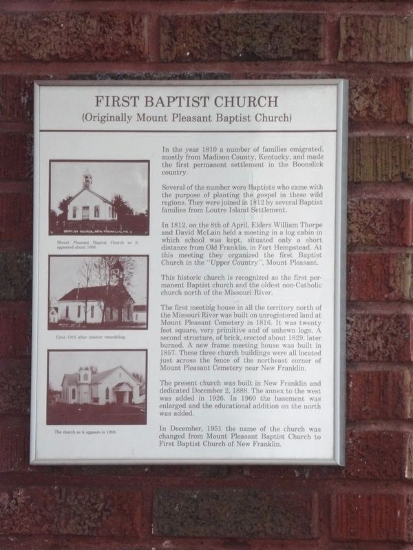
In the year 1810 a number of families emigrated, mostly from Madison County, Kentucky, and made the first permanent settlement in the Boonslick country.
Several of the number were Baptists who came with the purpose of planting the gospel in these wild regions. They were joined in 1812 by several Baptist families from Loutre Island Settlement.
In 1812, on the 8th of April, Elders William Thorpe and David McLain held a meeting in a log cabin in which school was kept, situated only a short distance from Old Franklin, in Fort Hempstead. At this meeting they organized the first Baptist Church in the “Upper Country”, Mount Pleasant.
This historic church is recognized as the first permanent Baptist church and the oldest non-Catholic church north of the Missouri River.
The first meeting house in all the territory north of the Missouri River was built on unregistered land at Mount Pleasant Cemetery in 1816. It was twenty feet square, very primitive and of unhewn logs. A second structure, of brick, erected about 1829, later burned. A new frame meeting house was built in 1857. These three church buildings
this page online
The present church was built in New Franklin and dedicated December 2, 1888. The annex to the west was added in 1926. In 1960 the basement was enlarged and the educational addition on the north was added.
In December, 1951 the name of the church was changed from Mount Pleasant Baptist Church to First Baptist Church of New Franklin.
[Captions, top to bottom]
• Mount Pleasant Baptist Church as it appeared about 1908
• Circa 1915 after interior remodeling.
• The church as it appears in 1989.
Erected by First Baptist Church of New Franklin.
Topics. This historical marker is listed in these topic lists: Religion & Religious Structures • Settlements & Settlers. A significant historical date for this entry is April 8, 1812.
Location. 39° 1.039′ N, 92° 44.099′ W. Marker is in New Franklin, Missouri, in Howard County. It can be reached from East Broadway east of North Howard Street, on the left when traveling east. Touch for map. Marker is at or near this postal address: 206 E Broadway, New Franklin MO 65274, United
Photographed by Duane and Tracy Marsteller, July 1, 2024
2. First Baptist Church Marker
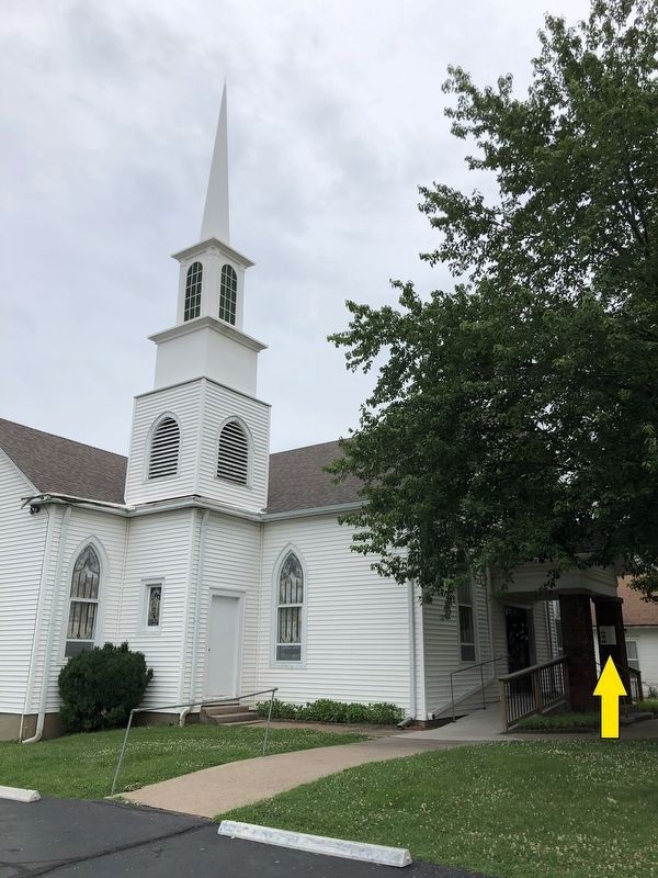
Marker is on one of the portico columns, as indicated by the arrow.

Regionally, this marker is in Little Dixie and in the Missouri River Corridor. It is also in the American Midwest, in the Lewis & Clark Corridor, in the Corn Belt, and on the Santa Fe Trail Corridor. Globally, it is in North America, the Western Hemisphere, the Western World, and the Anglosphere. Historically, it finds itself in what was once the territory of the Mississippian Culture, the Louisiana Purchase, and the Antebellum South.
Other nearby markers. At least 8 other markers are within walking distance of this marker: "Missouri Waltz" (about 400 feet away, measured in a direct line); Franklin and New Franklin (about 400 feet away); Missouri - Kansas - Texas Railroad (about 400 feet away); Franklin (about 400 feet away); End of Boone's Lick Trail (about 400 feet away); City of Trails (about 400 feet away); Santa Fe Trail Marker (about 400 feet away); New Franklin to Rocheport (approx. 0.3 miles away). Touch for a list and map of all markers in New Franklin.
Another marker is no longer nearby. KATY Caboose #127 (was about 600 feet away but has been confirmed missing).
Credits. This page was last revised on October 7, 2024. It was originally submitted on July 28, 2024, by Duane and Tracy Marsteller of Murfreesboro, Tennessee. This page has been viewed 235 times since then and 53 times this year. Photos: 1, 2. submitted on July 28, 2024, by Duane and Tracy Marsteller of Murfreesboro, Tennessee.
