Corriganville in Allegany County, Maryland — The American Northeast (Mid-Atlantic)
Veterans/First Responders Memorial

Photographed by Bradley Owen, July 28, 2024
1. Veterans/First Responders Memorial
To our community veterans and first responders.
Erected by The Corriganville Light & Improvement Association.
Topics. This memorial is listed in these topic lists: Charity & Public Work • Military.
Location. 39° 41.711′ N, 78° 47.321′ W. Memorial is in Corriganville, Maryland, in Allegany County. It is on Diamond Lane north of Kreighbaum Road, on the right when traveling west. Touch for map. Memorial is at or near this postal address: 12529 Diamond Lane, Corriganville MD 21524, United States of America. Touch for directions.

Regionally, this memorial is in Western Maryland. It is also in the American Mid-Atlantic, in Appalachia, and specifically in Northern Appalachia. Globally, it is in North America, the Western Hemisphere, the Western World, and the Anglosphere. Historically, it finds itself in what was once one of the original Thirteen Colonies.
Other nearby markers. At least 8 other markers are within 3 miles of this marker, measured as the crow flies: Corriganville Honor Roll (about 600 feet away, measured in
this page online
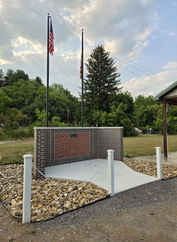
Photographed by Bradley Owen, July 28, 2024
2. Veterans/First Responders Memorial
Credits. This page was last revised on July 29, 2024. It was originally submitted on July 29, 2024, by Bradley Owen of Morgantown, West Virginia. This page has been viewed 188 times since then and 40 times this year. Photos: 1, 2. submitted on July 29, 2024, by Bradley Owen of Morgantown, West Virginia.
