Union Springs in Bullock County, Alabama — The American South (East South Central)
Depot & Coal Shute
Wes Hardin, Muralist - November 2015
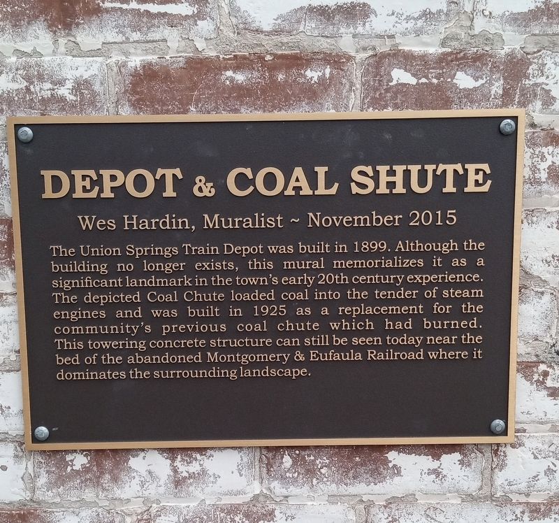
Photographed by James L.Whitman, July 27, 2024
1. Depot & Coal Shute Marker
Topics. This historical marker is listed in these topic lists: Industry & Commerce • Railroads & Streetcars. A significant historical year for this entry is 1899.
Location. 32° 8.774′ N, 85° 42.966′ W. Marker is in Union Springs, Alabama, in Bullock County. It is at the intersection of Conecuh Avenue and North Prairie Street, on the right when traveling west on Conecuh Avenue. Touch for map. Marker is at or near this postal address: 305 N Prairie St, Union Springs AL 36089, United States of America. Touch for directions.

Regionally, this marker is in the American South, specifically in the Deep South,
this page online
Other nearby markers. At least 8 other markers are within 2 miles of this marker, measured as the crow flies: Eddie Kendricks (within shouting distance of this marker); Union Springs, Alabama (about 300 feet away, measured in a direct line); Bullock County Courthouse Historic District (about 300 feet away); Hank Williams (about 600 feet away); Trinity Episcopal Church / Red Door Theater (approx. 0.2 miles away); Log Cabin Museum / Old City Cemetery (approx. 0.2 miles away); Indian Treaty Boundary Line (approx. 0.8 miles away); a different marker also named Indian Treaty Boundary Line (approx. 1.2 miles away). Touch for a list and map of all markers in Union Springs.

Photographed by James L.Whitman, July 26, 2024
2. Depot & Coal Shute Marker
Credits. This page was last revised on August 2, 2024. It was originally submitted on July 29, 2024, by James L.Whitman of Eufaula, Alabama. This page has been viewed 361 times since then and 58 times this year. Photos: 1, 2. submitted on July 29, 2024, by James L.Whitman of Eufaula, Alabama. • James Hulse was the editor who published this page.
