Versailles in Darke County, Ohio — The American Midwest (Great Lakes)
Original Plat of Jacksonville
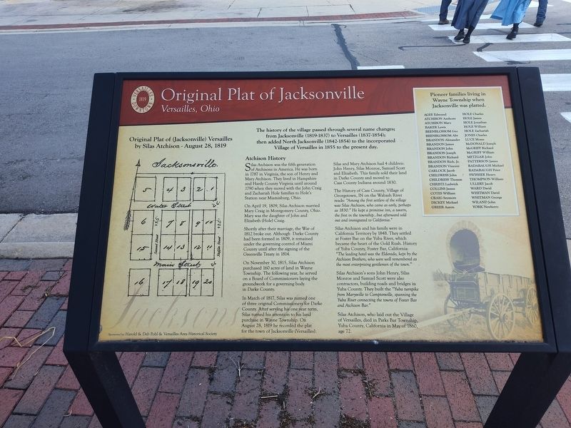
Photographed by Craig Doda, July 6, 2024
1. Original Plat of Jacksonville Marker
Original Plat of (Jacksonville) Versailles by Silas Atchison - August 28, 1819
The history of the village passed through several name changes; from Jacksonville (1819-1837) to Versailles (1837-1854); then added North Jacksonville (1842-1854) to the incorporated Village of Versailles in 1855 to the present day.
Atchison History
Silas Atchison was the fifth generation in 1787 in Virginia, the son of Henry and Mary Atchison. They lived in Hampshire and Hardy County Virginia until around 1790 when they moved with the John Craig and Zachariah Hole families to Hole's Station near Miamisburg, Ohio.
On April 19, 1809, Silas Atchison married Mary Craig in Montgomery County, Ohio. Mary was the daughter of John and Elizabeth (Hole) Craig.
Shortly after their marriage, the War of 1812 broke out. Although Darke County had been formed in 1809, it remained under the governing control of Miami County until after the signing of the Greenville Treaty in 1814.
On November 30, 1815, Silas Atchison purchased 160 acres of land in Wayne Township. The following year, he served on a Board of Commissioners laying the groundwork for a governing
this page online
In March of 1817, Silas was named one of three original Commissioners for Darke County. After serving his one year term, Silas turned his attention to his land purchase in Wayne Township. On August 28, 1819 he recorded the plat for the town of Jacksonville (Versailles).
Silas and Mary Atchison had 4 children: John Henry, Silas Monroe, Samuel Scott and Elizabeth. This family sold their land in Darke County and moved to Cass County Indiana around 1830.
The History of Cass County, Village of Georgetown, IN on the Wabash River reads: "Among the first settlers of the village was Silas Atchison, who came as early, perhaps as 1830." He kept a primitive inn, a tavern, the first in the township...but afterward sold out and immigrated to California."
Silas Atchison and his family were in California Territory by 1848. They settled at Foster Bar on the Yuba River, which became the heart of the Gold Rush. History of Yuba County, Foster Bar, California: "The leading hotel was the Eldorado, kept by the Atchison Brothers, who were well remembered as the most enterprising gentlemen of the town."
Silas Atchison's sons John
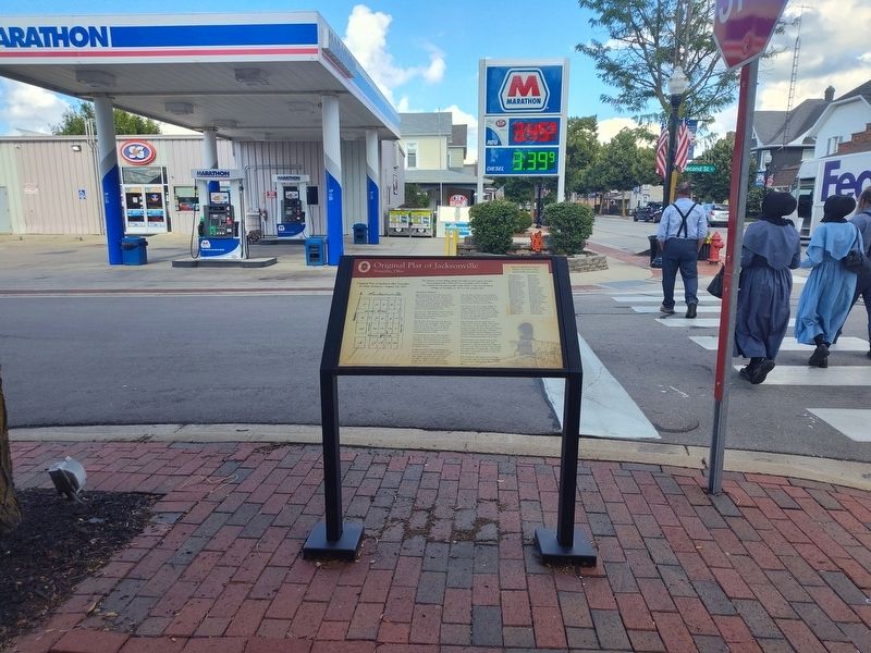
Photographed by Craig Doda, July 6, 2024
2. Original Plat of Jacksonville Marker
Silas Atchison, who laid out the Village of Versailles, died in Parks Bar Township, Yuba County, California in May of 1860, age 72.
Topics. This historical marker is listed in this topic list: Settlements & Settlers. A significant historical month for this entry is March 1817.
Location. 40° 13.367′ N, 84° 29.011′ W. Marker is in Versailles, Ohio, in Darke County. It is at the intersection of North 2nd Street and East Main Street (State Route 47), on the right when traveling south on North 2nd Street. Touch for map. Marker is at or near this postal address: 7 N 2nd St, Versailles OH 45380, United States of America. Touch for directions.

Regionally, this marker is in Ohio’s Till Plains. It is also in the American Midwest and in the Corn Belt. Globally, it is in North America, the Western Hemisphere, the Western World, and the Anglosphere. Historically, it finds itself in what was once the Haudenosaunee (Iroquois) Confederacy, the territory of the Mississippian Culture, and the Northwest Territory.
Other nearby markers. At least 8 other markers are within walking distance of this marker: The Fire of 1901 (within shouting distance of this marker); Mr. Foy's Cow (within shouting distance of this marker); The Inn (about 300 feet away, measured in a direct line); Town Hall & Wayne Township House (about 300 feet away); Veterans Memorial (about 400 feet away); Fountain Square (about 400 feet away); Veterans Memorial Building (about 500 feet away); Versailles World War Memorial (about 500 feet away). Touch for a list and map of all markers in Versailles.
Credits. This page was last revised on July 31, 2024. It was originally submitted on July 30, 2024, by Craig Doda of Napoleon, Ohio. This page has been viewed 215 times since then and 45 times this year. Photos: 1, 2. submitted on July 30, 2024, by Craig Doda of Napoleon, Ohio. • Devry Becker Jones was the editor who published this page.
