Gloucester in Gloucestershire, England, United Kingdom — Northwestern Europe (the British Isles)
Old Crypt Schoolroom
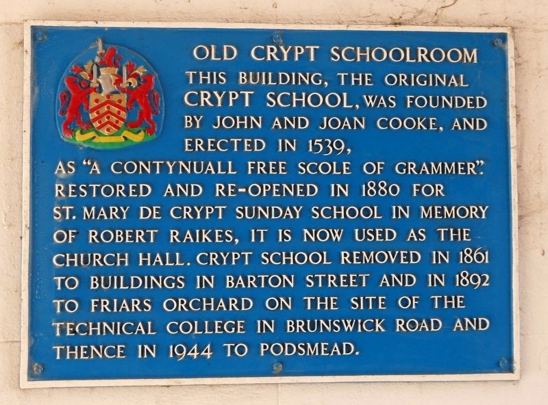
Photographed by Roger W. Sinnott, July 19, 2024
1. Old Crypt Schoolroom Marker
Topics. This historical marker is listed in these topic lists: Education • Religion & Religious Structures. A significant historical year for this entry is 1539.
Location. 51° 51.858′ N, 2° 14.833′ W. Marker is in Gloucester, England, in Gloucestershire. It is on Southgate Street, on the left when traveling south. Marker is within the open-air public right of way called Marylone, which is on the left when traveling south on Southgate Street. Marylone tunnels through the building complex referred to in the marker. This right of way stands opposite 42 Southgate Street. Touch for map. Marker is in this post office area: Gloucester, England GL1 1TP, United Kingdom. Touch for directions.

Regionally,
this page online
Other nearby markers. At least 8 other markers are within 13 kilometers of this marker, measured as the crow flies: George Whitefield (here, next to this marker); Roman Gloucester in AD 180 (within shouting distance of this marker); St. Mary’s Gate (approx. 0.4 kilometers away); Gloria Soli Deo (approx. 0.4 kilometers away); St Oswald's Anglo Saxon Minster and Medieval Priory (approx. 0.6 kilometers away); Welcome to Llanthony Secunda Priory (approx. 0.7 kilometers away); Montpellier Gardens (approx. 12 kilometers away); Gustav Holst (approx. 12.1 kilometers away). Touch for a list and map of all markers in Gloucester.

Photographed by Roger W. Sinnott, July 19, 2024
2. The Marylone Public Right of Way
The marker is just to the right of the George Whitefield marker.

Photographed by Roger W. Sinnott, July 19, 2024
3. Looking South on Southgate Street
The Marylone right of way is at left.
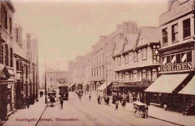
Photographed by Taylor, Gloucester, circa 1905
4. Looking South on Southgate Street, more than a century earlier
Taken from nearly the same location, perhaps 4 yards further north than the previous picture, but at a slightly different angle, the original Crypt school building is visible here on the left, with St Mary de Crypt Church slightly further down the street.
Credits. This page was last revised on July 31, 2024. It was originally submitted on July 30, 2024, by Roger W. Sinnott of Norwell, Massachusetts. This page has been viewed 153 times since then and 30 times this year. Photos: 1, 2, 3. submitted on July 30, 2024, by Roger W. Sinnott of Norwell, Massachusetts. 4. submitted on July 30, 2024. • Andrew Ruppenstein was the editor who published this page.
