Near Washburn in McLean County, North Dakota — The American Midwest (Upper Plains)
Lewis and Clark Expedition

Photographed by Barry Swackhamer
1. Masonic Lewis and Clark Expedition Marker
This memorial is erected by the Grand Lodge A.F.&A.M. of the State of North Dakota in cooperation with constituent lodges, as a lasting tribute to the courage, the heroism, the fidelity to trust, and the enduring service to country of these distinguished masons. A.D. 1935 A.L. 5935
Erected 1935 by Grand Lodge A.F.&A.M. of the State of North Dakota.
Topics and series. This historical marker is listed in these topic lists: Exploration • Forts and Castles • Fraternal or Sororal Organizations. In addition, it is included in the Lewis & Clark Expedition series list. A significant historical date for this entry is April 7, 1805.
Location. 47° 17.703′ N, 101° 17.107′ W. Marker is near Washburn, North Dakota, in McLean County. It is on 37th Avenue Southwest near 7m Street Southwest. It is about a 15 mile drive from the Lewis & Clark
this page online

Regionally, this marker is in the Standing Rock Sioux Tribe, in the Drift Prairie, and on the Missouri Plateau. It is also in the American Lewis & Clark Corridor, on the prairies, and on the Northern Plains. Globally, it is in North America, the Western Hemisphere, the Western World, and the Anglosphere. Historically, it finds itself in what was once Rupert’s Land and also the Louisiana Purchase.
Other nearby markers. At least 8 other markers are within 3 miles of this marker, measured as the crow flies: Fort Mandan Historic Site (here, next to this marker); Matootnha (approx. 2½ miles away); Sheheke-Shote's Return (approx. 2.6 miles away); Palisade Wall (approx. 2.9 miles away); Smallpox and the Central Plaza (approx. 2.9 miles away); Fort Clark Historic Site (approx. 2.9 miles away); Fort Mandan Overlook
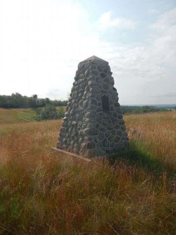
Photographed by Barry Swackhamer
2. Masonic Lewis and Clark Expedition Marker

Photographed by Barry Swackhamer
3. Masonic Lewis and Clark Expedition Marker
North Dakota Fort Mandan Site Monument in the distance.
Credits. This page was last revised on July 31, 2024. It was originally submitted on July 30, 2024, by Barry Swackhamer of Brentwood, California. This page has been viewed 182 times since then and 34 times this year. Photos: 1, 2, 3. submitted on July 30, 2024, by Barry Swackhamer of Brentwood, California.
