
National Park in Gloucester County, New Jersey — The American Northeast (Mid-Atlantic)
The Naval Engagement
Red Bank Battlefield
Photographed by Bill Coughlin, October 18, 2015
1. The Naval Engagement Marker
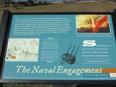
While the battle raged at Fort Mercer, American and British naval forces engaged in intense fire on the Delaware River. Earlier in the fall of 1777, American forces had sunk chevaux de frise (racks of wooden, spiked spears) in the Delaware River, which proved difficult for British ships to navigate. During the conflict, two British ships caught fire after running aground: the Augusta and the Merlin. The Augusta exploded the next day – a blast so loud it was heard as far north as Germantown in Philadelphia. The park displays multiple cannons and a portion of chevaux de frise recovered from the Delaware River.
Erected 2015 by New Jersey Historical Commission.
Topics. This historical marker is listed in this topic list: War, US Revolutionary. A significant historical date for this entry is October 22, 1777.
Location. 39° 52.244′ N, 75° 11.4′ W. Marker is in National Park, New Jersey, in Gloucester County. It can be reached from Hessian Road, on the right when traveling west. The marker
this page online

Regionally, this marker is in South Jersey and in Greater Philadelphia. It is also in the American Northeast, in the Mid-Atlantic, and on the Eastern Seaboard. Globally, it is in the North Atlantic Region, North America, the Western Hemisphere, the Western World, and the Anglosphere. Historically, it finds itself in what was once New Netherland and also one of the original Thirteen Colonies.
Other nearby markers. At least 8 other markers are within walking distance of this marker: Brigadier General Hugh Mercer (within shouting distance of this marker); Fort Mercer at Red Bank / Fort Mercer is Alerted (within shouting distance of this marker); Fort Mercer (within shouting distance of this marker); a different marker also named Fort Mercer (within shouting distance of this marker); Archaeology at Red Bank (within shouting distance of this marker); The Battle of Red Bank (within shouting distance of this marker); Flag of Fort Mercer (within shouting distance of this
Photographed by Bill Coughlin, October 18, 2015
2. The Naval Engagement Marker
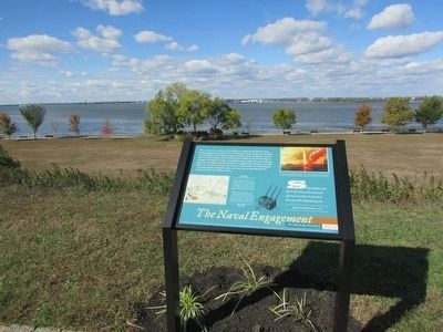
The Delaware River, where the naval battle took place, can be seen behind the marker.
More about this marker. The upper right of the marker contains an oil painting depicting the “Destruction of HMS Augusta" done by a British naval officer. The bottom left of the marker features a map of the plan of assault on Red Bank, 1777. It has a caption of “This map shows Fort Mercer and its proximity to ‘Mud Island’, better known today as Fort Mifflin. Note the heavy naval presence in the Delaware River and the chevaux de frise blocking the British fleet. Below this is a picture of a Chevaux de Frise with the caption “Chevaux de frise were used to block British access to Philadelphia. They consisted of weighted boxes, sunk in the Delaware River, with wooden, iron-tipped spears lying just below the water line, ready to pierce the hulls of British naval vessels.”
Also see . . . Red Bank Battlefield. Wikipedia entry (Submitted on November 18, 2023, by Larry Gertner of New York, New York.)
Photographed by Bill Coughlin, October 18, 2015
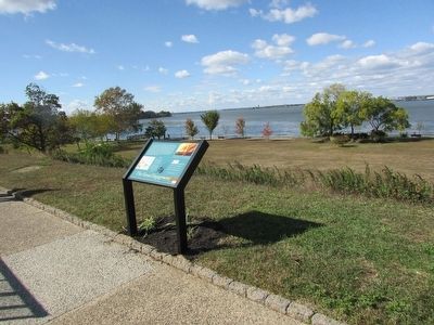
3. Marker on the Red Bank Battlefield
Photographed by Bill Coughlin, October 18, 2015
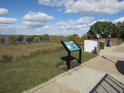
4. The Naval Engagement Marker
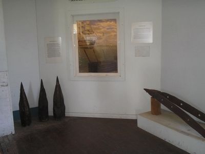
Photographed by Bill Coughlin, October 11, 2008
5. Chevaux-de-frise
This display at Fort Mifflin shows an example of the chevaux-de-frise that the Americans placed in the Delaware River to obstruct British ships. To the left are the actual tops of the chevaux-de-frise spikes.
Credits. This page was last revised on July 31, 2024. It was originally submitted on October 19, 2015, by Bill Coughlin of Woodland Park, New Jersey. This page has been viewed 698 times since then and 38 times this year. Last updated on July 30, 2024, by Carl Gordon Moore Jr. of North East, Maryland. Photos: 1, 2, 3, 4, 5. submitted on October 19, 2015, by Bill Coughlin of Woodland Park, New Jersey. • Devry Becker Jones was the editor who published this page.
