White Sands in Doña Ana County, New Mexico — The American Mountains (Southwest)
QH-50 DASH
Photographed by James Hulse, July 23, 2024
1. QH-50 DASH Marker
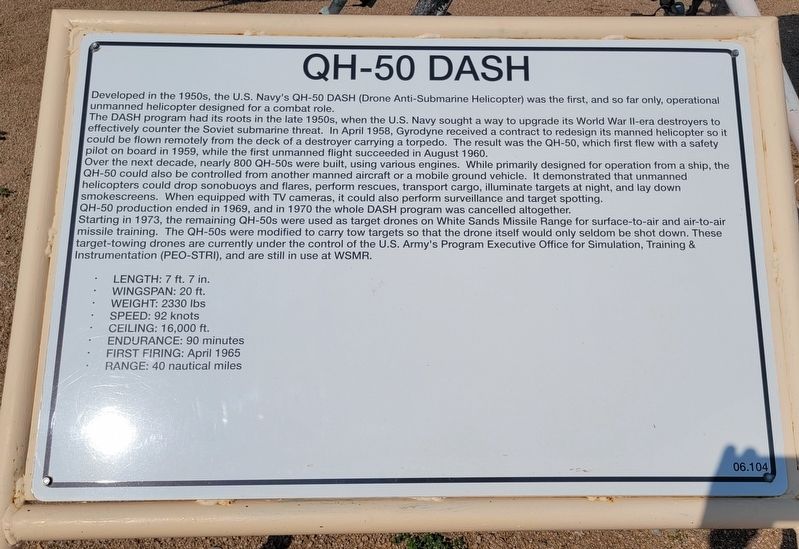
The DASH program had its roots in the late 1950s, when the U.S. Navy sought a way to upgrade its World War II-era destroyers to effectively counter the Soviet submarine threat. In April 1958, Gyrodyne received a contract to redesign its manned helicopter so it could be flown remotely from the deck of a destroyer carrying a torpedo. The result was the QH-50, which first flew with a safety pilot on board in 1959, while the first unmanned flight succeeded in August 1960.
Over the next decade, nearly 800 QH-50s were built, using various engines. While primarily designed for operation from a ship, the QH-50 could also be controlled from another manned aircraft or a mobile ground vehicle. It demonstrated that unmanned helicopters could drop sonobuoys and flares, perform rescues, transport cargo, illuminate targets at night, and lay down smokescreens. When equipped with TV cameras, it could also perform surveillance and target spotting. QH-50 production
this page online
Starting in 1973, the remaining QH-50s were used as target drones on White Sands Missile Range for surface-to-air and air-to-air missile training. The QH-50s were modified to carry tow targets so that the drone itself would only seldom be shot down. These target-towing drones are currently under the control of the U.S. Army's Program Executive Office for Simulation, Training & Instrumentation (PEO-STRI), and are still in use at WSMR.
Length: 7 ft. 7 in.
Wingspan: 20 ft.
Weight: 2330 lbs
Speed: 92 knots
Ceiling: 16,000 ft.
Endurance: 90 minutes
First Firing: April 1965
Range: 40 nautical miles
Erected by White Sands Missile Range Museum. (Marker Number 06.104.)
Topics. This historical marker is listed in this topic list: Air & Space. A significant historical month for this entry is February 1964.
Location. 32° 23.157′ N, 106° 28.739′ W. Marker is in White Sands, New Mexico, in Doña Ana County. It is on Wsmr P Rt 1 (New Mexico Route 213) 4 miles south of U.S. 70. The marker and various missiles are located on the grounds of the White Sands Missile Range
Photographed by James Hulse, July 23, 2024
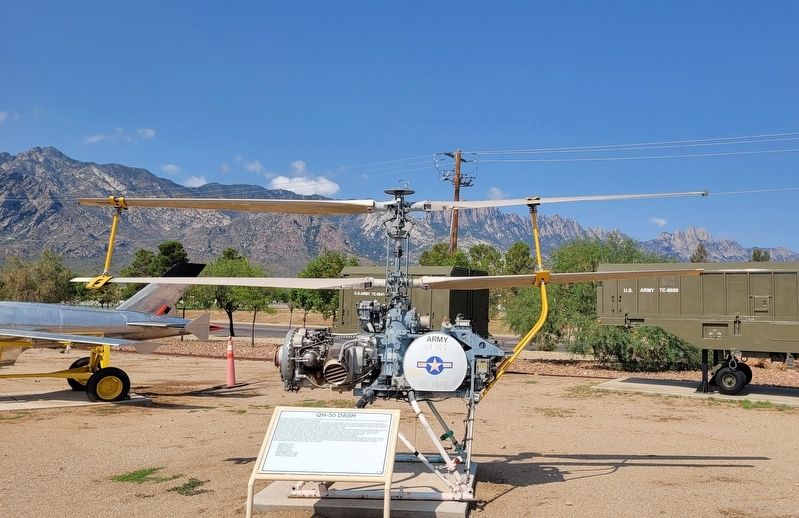
2. The QH-50 DASH and Marker

Regionally, this marker is in the Rio Grande Valley. It is also in the American Borderlands and in the Southwest. Globally, it is in North America, the Western Hemisphere, the Western World, and the Anglosphere. Historically, it finds itself in what was once New Spain, the Gadsden Purchase, and the Republic of Texas.
Other nearby markers. At least 8 other markers are within walking distance of this marker: XM-21 (here, next to this marker); Crossbow (here, next to this marker); MQM-42 Redhead/Roadrunner Target Drone (a few steps from this marker); Hawk (a few steps from this marker); Improved Hawk Rocket Test Sled (a few steps from this marker); PGM-11 Redstone Tactical Version (a few steps from this marker); Firebee (a few steps from this marker); a different marker also named PGM-11 Redstone Tactical Version (a few steps from this marker). Touch for a list and map of all markers in White Sands.
More about this marker. The marker and museum are located on the White Sands
Public Domain - US Navy - Eric Bollin, USN, circa 1967
3. QH-50 DASH
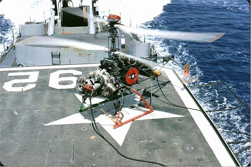
A Gyrodyne QH-50 DASH anti-submarine drone on board the destroyer USS Allen M. Sumner (DD-692) during the Vietnam War.
Also see . . .
1. Welcome to the White Sands Missile Range Museum. White Sands Missile Range Museum (Submitted on July 31, 2024, by James Hulse of Medina, Texas.)
2. Gyrodyne QH-50 DASH. Wikipedia
The Gyrodyne QH-50 DASH (Drone Anti-Submarine Helicopter) is a small drone helicopter built by Gyrodyne Company of America for use as a long-range anti-submarine weapon on ships that would otherwise be too small to operate a full-sized helicopter. It remained in production until 1969. Several are still used today for various land-based roles.(Submitted on August 1, 2024, by James Hulse of Medina, Texas.)
Credits. This page was last revised on August 1, 2024. It was originally submitted on July 31, 2024, by James Hulse of Medina, Texas. This page has been viewed 233 times since then and 53 times this year. Photos: 1, 2, 3. submitted on August 1, 2024, by James Hulse of Medina, Texas.
