Toluca in Marshall County, Illinois — The American Midwest (Great Lakes)
The Jumbo
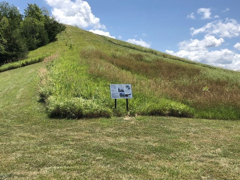
Standing at 138 feet
| — | The Historic Symbol of Toluca and Illinois' Longwall Mining Era | — |

Photographed by Duane and Tracy Marsteller, July 6, 2024
1. The Jumbo Marker
The Jumbo, a Toluca Landmark, an Illinois State Historical Site, is more than a pile of shale to Toluca residents. It is a history which would not have been preserved if not for the dedication and work of several individuals in this community. As work began on nearby Interstate 39 many of the surrounding slag piles in local communities were fattened and used as fill on the highway. Though the slag pile had become grown over by brush, was littered by used tires, refrigerators, car parts, and other trash, it was still a landmark for Toluca residents.
In 1996, when a backhoe tore into the jumbo for fill, Elton Pearson
this page online
In 1997, after many planning meetings, the Toluca Coal Mine Preservation and Development Inc. (aka Toluca Coal Mine Association) became an official organization with Bernard DeRubels Jr. serving as president, a position he held for 20 years. With immense help of Kimberly St. John, coordinator of Prairie Rivers Resource Conservation and Development, the history of Toluca Coal Mines would become a reality. Others serving on the board of the directors, in the beginning, included Elton E. Pearson, Judy Paulsen, Robin Overturf, Evelyn Pearson, Yvonne Massino, Fran Nacchi, Don Christ, June Farrar, Gregory Haugens, Anthony Bernardi, Cynthia Bernardi, and Bret Henry. These citizens dedicated many hours to research, planning, and cleaning up to form this historical site enjoyed by so many today. Many others from the community also supplied and supply
Photographed by Duane and Tracy Marsteller, July 6, 2024
2. The Jumbo Marker
[Captions]
• Center: Even the miners used the Jumbo for a backdrop.
• Bottom right: The Toluca Jumbo is not only a part of history but a part of family memories today. In the summer visitors climb the Jumbo for views of the landscape. They may enjoy a picnic lunch at the top, on the most used picnic table in the community. In the winter, adults and children flock to the Jumbo to sled down the slope. Photographers use the Jumbo for the perfect backdrop for Senior pictures, weddings and family pictures while young fisherman can be found by the pond trying to catch (and release) the big one.
Topics. This historical marker is listed in this topic list: Landmarks. A significant historical date for this entry is October 14, 1997.
Location. 40° 59.964′ N, 89° 8.058′ W. Marker is in Toluca, Illinois, in Marshall County. It can be reached from East Bennington Street 0.3 miles west of East Railroad Avenue, on the left when traveling west. Marker is in Toluca Coal Mine Park. Touch for map. Marker is at or near this postal address: 222 E Bennington St, Toluca IL 61369, United States of America. Touch for directions.

Regionally, this marker is in the Illinois River Valley and in Greater Peoria. It is also in the American Midwest and in the Corn Belt. Globally, it is in North America, the Western Hemisphere, the Western World, and the Anglosphere. Historically, it finds itself in what was once the territory of the Mississippian Culture and also the Northwest Territory.
Other nearby markers. At least 7 other markers are within 12 miles of this marker, measured as the crow flies: Toluca Coal Mine (a few steps from this marker); Devlin / Toluca Coal Mine Shaft Number 1 (within shouting distance of this marker); Santa Fe Railroad (within shouting distance of this marker); Devlin/Toluca Coal Mine Fan Housing (within shouting distance of this marker); The Pool – A Community Gathering Point (about 300 feet away, measured in a direct line); Site of the first Clear Creek Friends Meeting House (approx. 11½ miles away); John Swaney School (approx. 11½ miles away).
Credits. This page was last revised on August 1, 2024. It was originally submitted on August 1, 2024, by Duane and Tracy Marsteller of Murfreesboro, Tennessee. This page has been viewed 859 times since then and 150 times this year. Photos: 1, 2. submitted on August 1, 2024, by Duane and Tracy Marsteller of Murfreesboro, Tennessee.
