Havilah in Kern County, California — The American West (Pacific Coastal)
Havilah
California Historical Landmark
Photographed by Denise Boose, March 27, 2010
1. Havilah Marker
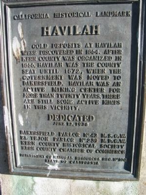
Gold deposits at Havilah were discovered in 1864. Havilah was the county seat between 1866, when Kern County was organized, and 1872, when the government was moved to Bakersfield. Havilah was an active mining center for more than 20 years, and there are still some operating mines in this vicinity.
Erected 1938 by Bakersfield Parlor No 42 N.S.G.W., El Tejon Parlor No 239 N.D.G.W, Kern County Historical Society, Kern County Chamber of Commerce. (Marker Number 100.)
Topics and series. This historical marker is listed in these topic lists: Notable Places • Settlements & Settlers. In addition, it is included in the California Historical Landmarks, and the Native Sons/Daughters of the Golden West series lists. A significant historical year for this entry is 1864.
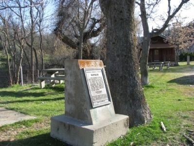
Location. 35° 31.092′ N, 118° 30.978′ W. Marker is in Havilah, California, in Kern County. It is on Caliente-Bodfish Road (County Route 483), on the right when traveling north. The marker is located between historical 1867 Havilah School House and 1866 Kern County Court House/Museum. Touch for map. Marker is at or near this postal address: 6800 County Road 483,
this page online

Regionally, this marker is in the San Joaquin Valley, specifically in the Central Valley, and in the Sierra Nevada. It is also on the American Pacific Coast. Globally, it is in North America, on the Ring of Fire, on the Pacific Rim, in the Western Hemisphere, in the Western World, and in the Anglosphere. Historically, it finds itself in what was once New Spain and also Mexico’s Alta California.
Other nearby markers. At least 8 other markers are within 8 miles of this marker, measured as the crow flies: Historic Havilah (here, next to this marker); Stage Robbery! (a few steps from this marker); a different marker also named Havilah (approx. ¼ mile away); First Catholic Church and Cemetery in Kern County (approx. ¼ mile away); a different marker also named Havilah (approx. 5.1 miles away); Silver City Ghost Town (approx. 5.7 miles away); USS Arizona (approx. 6½ miles away); Keyesville (approx. 7½ miles away). Touch for a list and map of all markers in Havilah.
Also see . . . Historic Havilah. Sierra Nevada Geotourism website entry:
July 1864
Photographed by Denise Boose, March 27, 2010
2. Havilah Marker
Additional commentary.
1. Havilah School House Survived
The school house survived the 2024 Borel Fire thanks to the wonderful firefighters. They noticed embers burning under the steps and put them out. Note To Editor only visible by Contributor and editor
— Submitted August 1, 2024, by Denise Boose of Tehachapi, California.
Photographed by Denise Boose, March 27, 2010
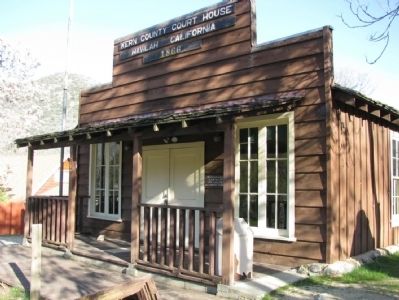
3. 1866 Kern County Court House Museum
Destroyed by the 2024 Borel Fire.
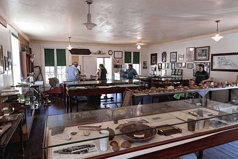
courtesy ECV #1866
4. Kern County Court House Museum
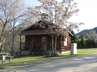
Photographed by Denise Boose, March 27, 2010
5. 1867 Havilah School House
The marker seen in this view is the nearby "Stage Robbery" marker.
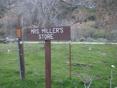
Photographed by Denise Boose, March 27, 2010
6. Mrs. Miller Store
There are wood markers that show where the pioneers lived during Havilah's heyday.
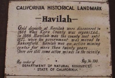
Photographed by Lester J Letson, September 23, 2006
7. Havilah Marker
This marker was inside the Kern County Court House Museum nearby. The wording is the same except for the bottom portion. It appears to date from the 1930's, the same time period the outside marker was erected.
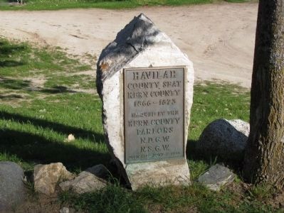
Photographed by Denise Boose, March 27, 2010
8. Havilah Marker
Havilah - County Seat - Kern County, 1866 - 1873.
Marked by the Kern County Parlors, N.D.G.W., N.S.G.W.
Dedicated June 2, 1935.
(Located at the Old Havilah Cemetery just down the road.)

Photographed by Ryan Babroff/SoCal Fire Photo
9. Havilah
Most of the town was destroyed by the Borel Fire 7/26/24.
Credits. This page was last revised on May 29, 2025. It was originally submitted on January 21, 2012, by Denise Boose of Tehachapi, California. This page has been viewed 1,377 times since then and 71 times this year. Last updated on August 1, 2024, by Denise Boose of Tehachapi, California. Photos: 1, 2, 3. submitted on January 21, 2012, by Denise Boose of Tehachapi, California. 4. submitted on May 27, 2025, by Craig Baker of Sylmar, California. 5, 6. submitted on January 21, 2012, by Denise Boose of Tehachapi, California. 7. submitted on February 20, 2012, by Lester J Letson of Fresno, California. 8. submitted on May 22, 2015, by Denise Boose of Tehachapi, California. 9. submitted on July 28, 2024, by Craig Baker of Sylmar, California. • J. Makali Bruton was the editor who published this page.
