New Woodstock in Madison County, New York — The American Northeast (Mid-Atlantic)
New Woodstock Heritage Park
Photographed by Kevin W., August 1, 2024
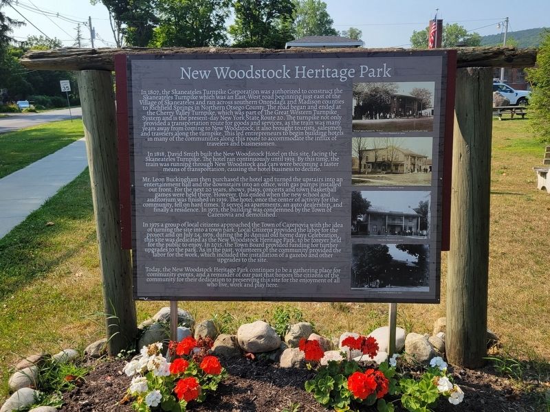
1. New Woodstock Heritage Park Marker
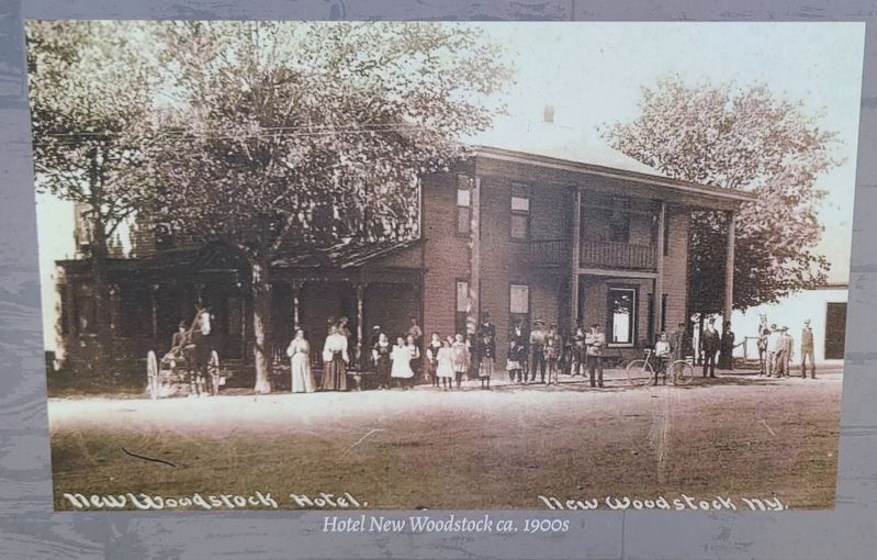
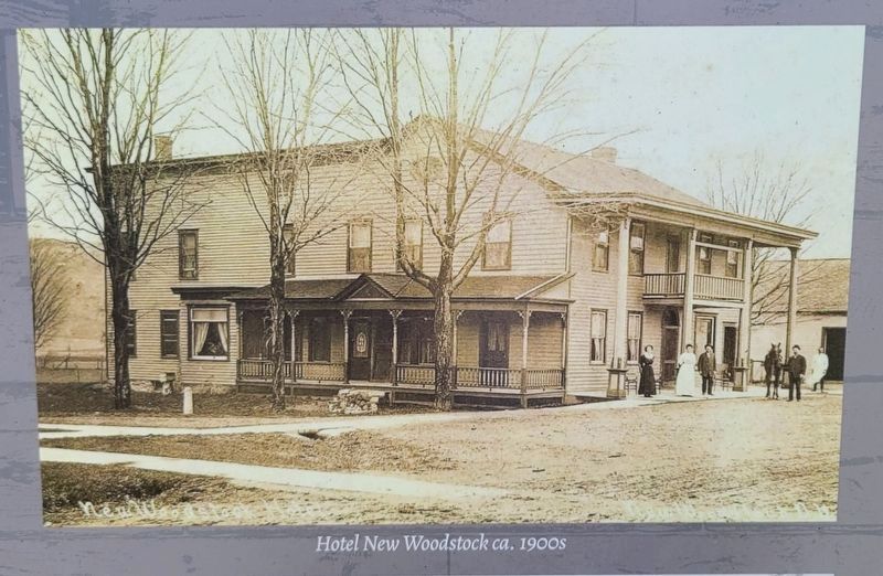
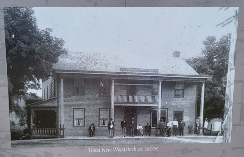
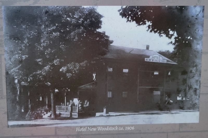
In 1818, David Smith built the New Woodstock Hotel on this site, facing the Skaneateles Turnpike. The hotel ran continuously until 1919. By this time, the train was running through New Woodstock and cars were becoming a faster means of transportation, causing the hotel business to decline.
Mr. Leon Buckingham then purchased the hotel
this page online
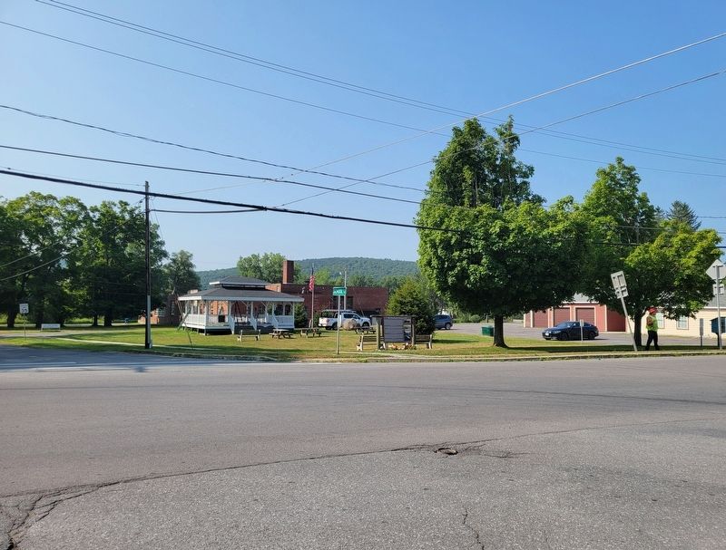
In 1975 a group of local citizens approached the Town of Cazenovia with the idea of turning the site into a town park. Local Citizens provided the labor for the project and on July 24, 1976, during the Bi-Annual old home days Celebration, this site was dedicated as the New Woodstock Heritage Park, to be forever held for the public to enjoy. In 2015, the Town Board provided funding for further upgrades to the park. As in the past, volunteers of the community provided the labor for the work, which included the installation of a gazebo and other upgrades to the site.
Today, the New Woodstock Heritage Park continues to be a
Photographed by Kevin W., August 1, 2024
2. Hotel New Woodstock ca. 1900s
Closeup of photo on the marker.
Erected by New Woodstock Regional Historical Society.
Topics. This historical marker is listed in this topic list: Settlements & Settlers. A significant historical date for this entry is July 24, 1807.
Location. 42° 50.888′ N, 75° 51.261′ W. Marker is in New Woodstock, New York, in Madison County. It is at the intersection of Main Street (New York State Route 80) and School Street, on the right when traveling east on Main Street. Touch for map. Marker is in this post office area: New Woodstock NY 13122, United States of America. Touch for directions.

Regionally, this marker is in Upstate New York, specifically in Central New York, and in the Syracuse Metropolitan Area. It is also in the American Northeast and in the Mid-Atlantic. Globally, it is in North America, the Western Hemisphere, the Western World, and the Anglosphere. Historically, it finds itself in what was once the Haudenosaunee (Iroquois) Confederacy, New Netherland,
Photographed by Kevin W., August 1, 2024
3. Hotel New Woodstock ca. 1900s
Closeup of photo on the marker.
Other nearby markers. At least 8 other markers are within 3 miles of this marker, measured as the crow flies: A different marker also named New Woodstock Heritage Park (within shouting distance of this marker); Church Building (about 400 feet away, measured in a direct line); New Woodstock Regional Historical Society (approx. 0.2 miles away); Baptist Church (approx. 0.2 miles away); New Woodstock War Memorial (approx. ¼ mile away); Smith Tavern (approx. 0.3 miles away); Belmont School (approx. 2 miles away); Site of Belmont Powder Mill (approx. 2.2 miles away). Touch for a list and map of all markers in New Woodstock.
Another marker is no longer nearby. Lehigh Valley Railroad (was approx. 0.2 miles away but has been confirmed missing).
Photographed by Kevin W., August 1, 2024
4. Hotel New Woodstock ca. 1900s
Closeup of photo on the marker.
Photographed by Kevin W., August 1, 2024
5. Hotel New Woodstock ca. 1906
Closeup of photo on the marker.
Photographed by Kevin W., August 1, 2024
6. New Woodstock Heritage Park Marker
Credits. This page was last revised on August 2, 2024. It was originally submitted on August 2, 2024, by Kevin W. of Stafford, Virginia. This page has been viewed 646 times since then and 77 times this year. Photos: 1, 2, 3, 4, 5, 6. submitted on August 2, 2024, by Kevin W. of Stafford, Virginia.
