Bury St Edmunds in Suffolk, England, United Kingdom — Northwestern Europe (the British Isles)
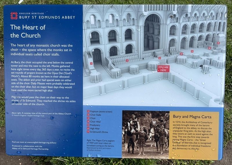
The Heart of the Church
Photographed by Ray Gurganus, March 27, 2024
1. The Heart of the Church Marker
At Bury, the choir occupied the area below the central tower and into the nave to the left. Monks gathered here eight times every day, 365 days a year, to recite the set rounds of prayers known as the Opus Dei ('God's Work'). About 80 monks sat here in their allocated seats. The abbot and prior had special seats on either side of the choir. Daily Masses were probably celebrated on the choir altar, but on major feast days they would have used the more sacred high altar.
Pilgrims would pass the choir on their way to the shrine of St Edmund. They reached the shrine via aisles on either side of the church.
1. Pulpitum (stone screen)
2. Choir Stalls
3. Choir
4. Choir Altar
5. Presbytery
6. High Altar
7. St Edmund's Shrine
Bury and Magna Carta
In 1214, the Archbishop of Canterbury secretly brought many of the barons of England to the abbey, to discuss the unpopular King John. At the high altar, they swore an oath to stand against the king. This was the first step towards signing Magna Carta
this page online
Erected by English Heritage.
Topics. This historical marker is listed in this topic list: Religion & Religious Structures.
Location. 52° 14.64′ N, 0° 43.157′ E. Marker is in Bury St Edmunds, England, in Suffolk. It can be reached from Abbeygate Street. Touch for map. Marker is in this post office area: Bury St Edmunds, England IP33 1RS, United Kingdom. Touch for directions.

Regionally, this marker is in East Anglia. Globally, it is on the Atlantic Ocean, in the North Atlantic Region, in Europe, in Atlantic Europe, on one of the British Isles, in the Western World, and in the Anglosphere. Historically, it finds itself in what was once the Roman Empire.
Other nearby markers. At least 8 other markers are within walking distance of this marker: The Chapter House (within shouting distance of this marker); Cnut's Church and its Successor (within shouting distance of this marker); The Eastern End (within shouting distance of this marker); The Magna Carta
Photographed by Ray Gurganus, March 27, 2024
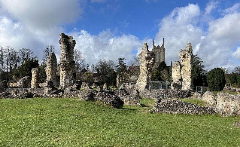
2. Bury St Edmunds Abbey Ruins
Credits. This page was last revised on August 3, 2024. It was originally submitted on July 12, 2024, by Ray Gurganus of Washington, District of Columbia. This page has been viewed 130 times since then and 14 times this year. Last updated on August 2, 2024, by Ray Gurganus of Washington, District of Columbia. Photos: 1, 2. submitted on July 12, 2024, by Ray Gurganus of Washington, District of Columbia. • J. Makali Bruton was the editor who published this page.
Editor’s want-list for this marker. photo of the marker within its surroundings; confirmation or improvement of geolocation? • Can you help?
