Derby in Sedgwick County, Kansas — The American Midwest (Upper Plains)
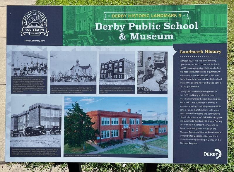
Derby Public School & Museum
Derby Historic Landmark
Photographed by Mark Hilton, July 1, 2024
1. Derby Public School & Museum Marker
During the rapid residential growth of the 1950s in Derby, multiple schools were built in Unified School District 260. Since 1953, this building has served in various capacities, including some middle school (junior high) functions until about 2000 and then became the community’s historical museum. In 2012, USD 260 gave the building to the Derby Historical Society to continue to operate the museum. In 2014, the building was placed on the National Register of Historic Places by the United States Department of Interior. It remains the only building in Derby on the National Register.
Erected 2019 by the City of Derby. (Marker Number 4.)
Topics and series. This historical marker is listed in this topic list: Education. In addition, it is included in the National Register of Historic Places (NRHP) series
this page online
Location. 37° 32.671′ N, 97° 15.795′ W. Marker is in Derby, Kansas, in Sedgwick County. It is on East Market Street east of North Westview Street, on the left when traveling east. Touch for map. Marker is at or near this postal address: 710 E Market St, Derby KS 67037, United States of America. Touch for directions.

Regionally, this marker is in Greater Wichita. It is also in the American Midwest, in the Corn Belt, on the prairies, and on the Southern Plains. Globally, it is in North America, the Western Hemisphere, the Western World, and the Anglosphere. Historically, it finds itself in what was once the Louisiana Purchase.
Other nearby markers. At least 8 other markers are within 10 miles of this marker, measured as the crow flies: The Santa Fe & St. Mary Bell (here, next to this marker); El Paso Cemetery (approx. ¼ mile away); El Paso Business District (approx. 0.4 miles away); Lauber Farm & Silo (approx. half a mile away); Arkansas River Crossing (approx. 0.6 miles away); Garrett Homestead (approx. one mile away); John Mack Bridge (approx. 8 miles away); Engine House #6

Photographed by Mark Hilton, July 1, 2024
2. Derby Public School & Museum & Marker
Also see . . . National Register of Historic Places Registration. (Submitted on August 2, 2024, by Mark Hilton of Montgomery, Alabama.)
Credits. This page was last revised on August 2, 2024. It was originally submitted on August 2, 2024, by Mark Hilton of Montgomery, Alabama. This page has been viewed 153 times since then and 23 times this year. Photos: 1, 2. submitted on August 2, 2024, by Mark Hilton of Montgomery, Alabama.
