Chester in Cheshire West and Chester, England, United Kingdom — Northwestern Europe (the British Isles)
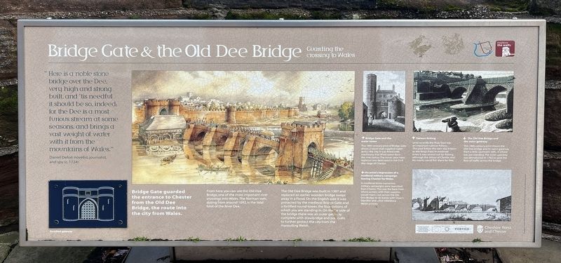
Bridge Gate & the Old Dee Bridge
Guarding the crossing to Wales
Photographed by Ray Gurganus, April 9, 2024
1. Bridge Gate & the Old Dee Bridge Marker
-- Daniel Defoe, novelist, journalist, and spy (c. 1724)
Bridge Gate guarded the entrance to Chester from the Old Dee Bridge, the route into the city from Wales.
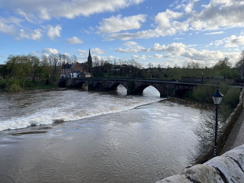
From here you can see the Old Dee Bridge, one of the most important river crossings into Wales. The Norman weir, dating from around 1092, is the tidal limit of the River Dee.
The Old Dee Bridge was built in 1387 and replaced an earlier wooden bridge swept away in a flood. On the English side it was protected by the medieval Bridge Gate and a fortified round-tower, the foundations of which you are standing in. On the far side of the bridge there was an outer gatetway complete with drawbridge and portcullis to further protect the city from the marauding Welsh.
Bridge Gate and the water tower
This 18th-century print of Badge Gate shows a tower that supplied water across the city. It was fitted with machinery that lifted
this page online
An artist's impression of a medieval military campaign leaving Chester for Wales
In medieval times numerous military campaigns were launched from Chester. This was the base from where armies, with their supplies, would march out across the Old Dee Bridge to do battle with Owan Glyndwr and other rebellious Welsh princes.
Salmon fishing
Until recently the River Dee was an important salmon fishery. The pool below the weir was known as the King's Pool. In medieval times it was rented out for fishing, although the Abbot of Chester and his monks could fish there for free.
The Old Dee Bridge and the outer gateway
This 18th-century print shows the Old Dee Bridge and its outer gateway from a little upstream (left) of where you are standing. The outer gateway was demolished in 1782 to ease the flow of traffic across the bridge.
Topics. This historical marker is listed in this topic list: Bridges & Viaducts. A significant historical year for this entry is 1387.
Location. 53° 11.184′ N, 2° 53.322′ W. Marker is in Chester, England, in
Photographed by Ray Gurganus, April 9, 2024
2. Old Dee Bridge

Regionally, this marker is in North West England. Globally, it is on the Atlantic Ocean, in the North Atlantic Region, in Europe, in Atlantic Europe, on one of the British Isles, in the Western World, and in the Anglosphere. Historically, it finds itself in what was once the Roman Empire.
Other nearby markers. At least 8 other markers are within walking distance of this marker: Old King's Head (about 150 meters away, measured in a direct line); The Roman Goddess Minerva (about 180 meters away); Welcome to the Roman Gardens (about 210 meters away); The Roman Way of Death (about 240 meters away); All-round Luxury (approx. 0.2 kilometers away); Bathing in Style (approx. 0.2 kilometers away); A Tale of Three Gateways (approx. 0.3 kilometers away); Celebrating Nature's Glory in Art (approx. 0.3 kilometers away). Touch for a list and map of all markers in Chester.
Photographed by Hugo Lang & Co., Liverpool, circa 1906
3. Bridge Gate and Bear Inn
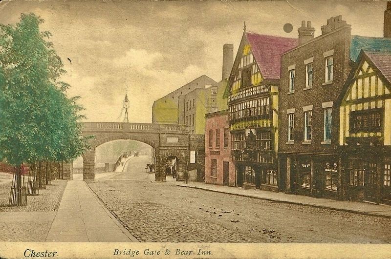
The Dee Bridge is visible here through the gate.
Credits. This page was last revised on August 4, 2024. It was originally submitted on August 3, 2024, by Ray Gurganus of Washington, District of Columbia. This page has been viewed 354 times since then and 81 times this year. Photos: 1, 2. submitted on August 3, 2024, by Ray Gurganus of Washington, District of Columbia. 3. submitted on August 4, 2024, by Andrew Ruppenstein of Lamorinda, California. • Andrew Ruppenstein was the editor who published this page.
Editor’s want-list for this marker. photo of the marker within its surroundings • Can you help?
