Chester in Cheshire West and Chester, England, United Kingdom — Northwestern Europe (the British Isles)
Chester Castle
Seat of power in the North-West
Photographed by Ray Gurganus, April 9, 2024
1. Chester Castle Marker
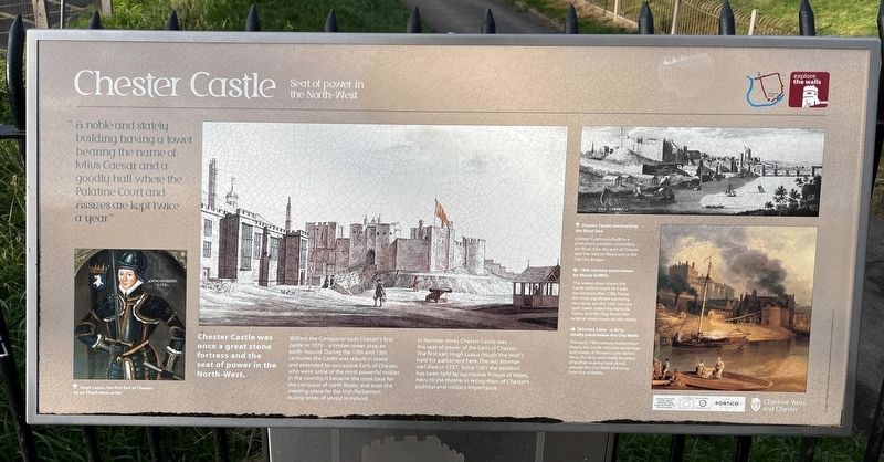
Chester Castle was once a great stone fortress and the seat of power in the North-West.
William the Conqueror built Chester's first castle in 1070 - a timber tower atop an earth mound. During the 12th and 13th centuries the Castle was rebuilt in stone and extended by successive Earls of Chester, who were some of the most powerful nobles in the country. It became the royal base for the conquest of north Wales, and even the meeting place for the Irish Parliament during times of unrest in Ireland.
In Norman times Chester Castle was the seat of power of the Earls of Chester. The first earl, Hugh Lupus (Hugh 'the Wolf') held his parliament here. The last Norman earl died in 1237. Since 1301 the earldom has been held by successive Princes of Wales, heirs to the throne, in recognition of Chester's political and military importance.
Chester Castle overlooking the River Dee
Chester Castle was built in a prominent position controlling the River Dee, the port of Chester
this page online
18th-century watercolour by Moses Griffith
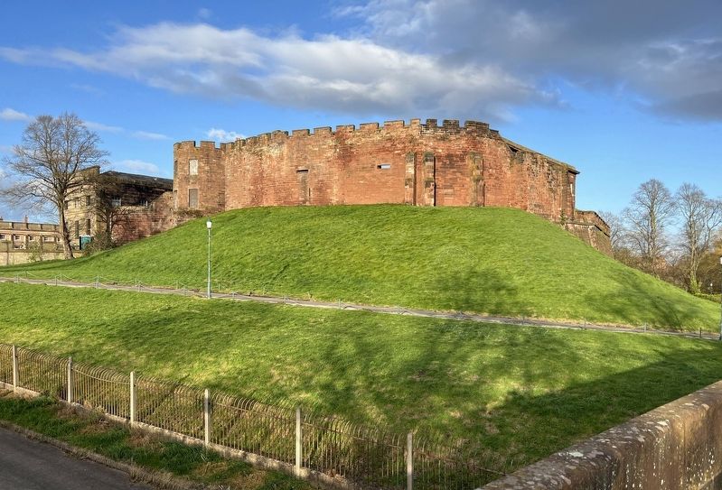
This watercolour shows the Castle before much of it was demolished after 1788. Today the most significant surviving structures are the 12th-century gate tower called the Agricola Tower, and the Flag Tower, the original stone tower on the motte.
Skinners Lane - a dirty, smelly place below the City Walls
This early 19th-century watercolour shows the Castle with the workshops and sheds of Skinners Lane below. Here, the dirty and smelly business of leather-making took place, outside the City Walls and away from the residents.
Topics. This historical marker is listed in this topic list: Forts and Castles. A significant historical year for this entry is 1070 CE.
Location. 53° 11.108′ N, 2° 53.63′ W. Marker is in Chester, England, in Cheshire West and Chester. It can be reached from City Walls Walkway. Touch for map. Marker is at or near this postal address: City Walls Walkway, Chester, England CH1 2DN, United Kingdom. Touch for directions.

Regionally, this marker is in North West England. Globally, it is on the Atlantic Ocean, in the North Atlantic
Photographed by Ray Gurganus, April 9, 2024
2. Chester Castle
Other nearby markers. At least 8 other markers are within walking distance of this marker: Old King's Head (approx. 0.3 kilometers away); The Roman Goddess Minerva (approx. 0.3 kilometers away); Bridge Gate & the Old Dee Bridge (approx. 0.4 kilometers away); Welcome to the Roman Gardens (approx. half a kilometer away); The Roman Way of Death (approx. 0.6 kilometers away); All-round Luxury (approx. 0.6 kilometers away); Bathing in Style (approx. 0.6 kilometers away); A Tale of Three Gateways (approx. 0.6 kilometers away). Touch for a list and map of all markers in Chester.
Credits. This page was last revised on August 4, 2024. It was originally submitted on August 3, 2024, by Ray Gurganus of Washington, District of Columbia. This page has been viewed 243 times since then and 49 times this year. Photos: 1, 2. submitted on August 3, 2024, by Ray Gurganus of Washington, District of Columbia. • Andrew Ruppenstein was the editor who published this page.
Editor’s want-list for this marker. photo of the marker within its surroundings • Can you help?
