
La Plume Township in Lackawanna County, Pennsylvania — The American Northeast (Mid-Atlantic)
The Northern Electric Interurban Trolley
Photographed by William Fischer, Jr., July 26, 2024
1. The Northern Electric Interurban Trolley Marker
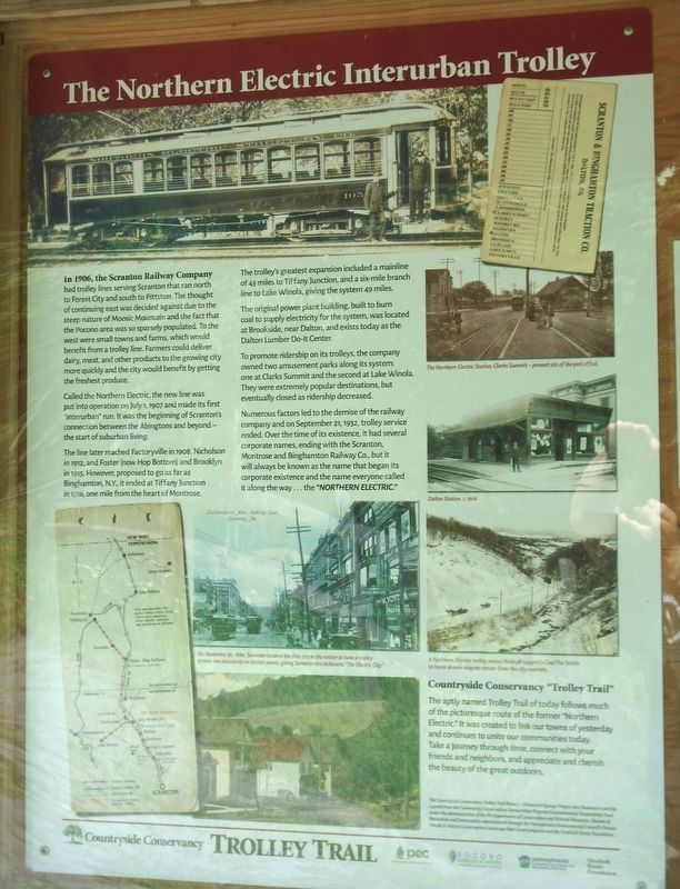
In 1906, the Scranton Railway Company had trolley lines serving Scranton that ran north to Forest City and south to Pittston. The thought of continuing east was decided against due to the steep nature of Moosic Mountain and the fact that the Pocono area was so sparsely populated. To the west were small towns and farms, which would benefit from a trolley line. Farmers could deliver dairy, meat, and other products to the growing city more quickly and the city would benefit by getting the freshest produce.
Called the Northern Electric, the new line was put into operation on July 1, 1907 and made its first "interurban" run. It was the beginning of Scranton's connection between the Abingtons and beyond—the start of suburban living.
The line later reached Factoryville in 1908, Nicholson in 1912, and Foster (now Hop Bottom) and Brooklyn in 1915. However, proposed to go as far as Binghamton, N.Y., it ended at Tiffany Junction in 1916, one mile from the heart of Montrose.
The trolley's greatest expansion included a mainline of 43 miles to Tiffany Junction, and a six-mile branch line to Lake Winola, giving the system 49 miles.
The
this page online
To promote ridership on its trolleys, the company owned two amusement parks along its system: one at Clarks Summit and the second at Lake Winola. They were extremely popular destinations, but eventually closed as ridership decreased.
Numerous factors led to the demise of the railway company and on September 21, 1932, trolley service ended. Over the time of its existence, it had several corporate names, ending with the Scranton, Montrose and Binghamton Railway Co., but it will always be known as the name that began its corporate existence and the name everyone called it along the way... the "NORTHERN ELECTRIC."
Countryside Conservancy "Trolley Trail"
The aptly named Trolley Trail of today follows much of the picturesque route of the former "Northern Electric.” It was created to link our towns of yesterday and continues to unite our communities today. Take a journey through time, connect with your friends and neighbors, and appreciate and cherish the beauty
Photographed by William Fischer, Jr., July 26, 2024
2. The Northern Electric Interurban Trolley Marker
[Photo captions, clockwise from top left, read]
• Northern Electric Street Ry. Co. Car 105
• Scranton & Binghamton Traction Co. [ticket]
• The Northern Electric Station, Clarks Summit-present site of the post office
• Dalton Station, c.1916
• A Northern Electric trolley passes through Leggett's Gap/The Notch as horse drawn wagons return from the city markets.
• On November 20, 1886, Scranton became the first city in the nation to have a trolley system run exclusively on electric power, giving Scranton the nickname "The Electric City."
• [Map of the trolley/interurban line]
Erected by Countryside Conservancy, PA DCNR, PA Environmental Council, Pocono Forests & Waters, and Overlook Estate Foundation.
Topics. This historical marker is listed in these topic lists: Industry & Commerce • Railroads & Streetcars. A significant historical date for this entry is July 1, 1907.
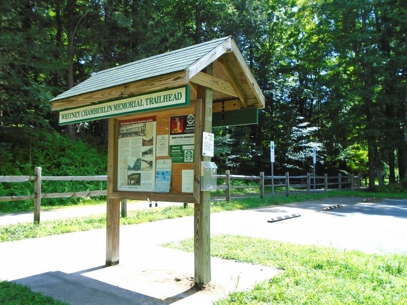
Location. 41° 33.408′ N, 75° 46.201′ W. Marker is near La Plume, Pennsylvania, in Lackawanna County. It is in La Plume Township. It can be reached from Nokomis Forest Stewardship Trail. Marker is at the Whitney Chamberlin Memorial Trailhead along the Countryside Trolley Trail, about 400 feet south of the Keystone College athletic stadium. Touch for map. Marker is in this post office area: La Plume PA 18440, United States of America. Touch for directions.

Regionally, this marker is in the Wyoming Valley and in Greater Scranton and Wilkes-Barre. It is also in the American Northeast, in the Mid-Atlantic, in Appalachia, and specifically in Northern Appalachia. Globally, it is in North America, the Western Hemisphere, the Western World, and the Anglosphere. Historically, it finds itself in what was once the Haudenosaunee (Iroquois) Confederacy and also one of the original Thirteen Colonies.
Other nearby markers. At least 8 other markers are within walking distance of this marker: Slowing the Flow (about 600 feet away, measured in a direct line); Keystone College Sugar Shack (approx. 0.2 miles away); Fun Maple Syrup Facts (approx. 0.2 miles away); History of Maple Syrup (approx. 0.2 miles away); From Sap to Syrup: The Making of Maple Sugar (approx. 0.2 miles away); Professor Howard D. Jennings (approx. 0.2 miles away); Station 17: Maple Sugaring (approx. 0.2 miles away); a different marker also named Professor Howard D. Jennings (approx. 0.2 miles away). Touch for a list and map of all markers in La Plume.
Also see . . . Lackawanna Past Times: A Tour of the Northern Electric Trolley Route on YouTube. (Submitted on August 4, 2024, by William Fischer, Jr. of Reynoldsburg, Ohio.)
Credits. This page was last revised on October 26, 2024. It was originally submitted on August 4, 2024, by William Fischer, Jr. of Reynoldsburg, Ohio. This page has been viewed 1,137 times since then and 125 times this year. Photos: 1, 2. submitted on August 4, 2024, by William Fischer, Jr. of Reynoldsburg, Ohio.
