Reading in Berkshire, England, United Kingdom — Northwestern Europe (the British Isles)
You've Found the Abbey Ruins
Abbey Quarter
Photographed by Ray Gurganus, April 1, 2024
1. You've Found the Abbey Ruins Marker
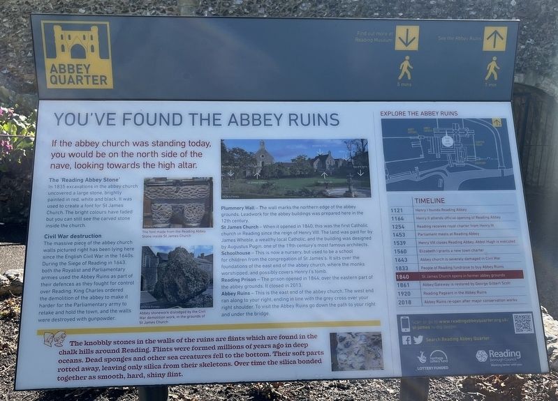
The 'Reading Abbey Stone'
In 1835 excavations in the abbey church uncovered a large stone, brightly painted in red, white and black. It was used to create a font for St James Church. The bright colours have faded but you can still see the carved stone inside the church.
Civil War destruction
The massive piece of the abbey church walls pictured right has been lying here since the English Civil War in the 1640s. During the Siege of Reading in 1643, both the Royalist and Parliamentary armies used the Abbey Ruins as part of their defences as they fought for control over Reading. King Charles ordered the demolition of the abbey to make it harder for the Parliamentary army to retake and hold the town, and the walls were destroyed with gunpowder.
Plummery Wall - The wall marks the northern edge of the abbey grounds Leadwork for the abbey buildings was prepared here in the 12th century.
St James Church - When it opened in 1840, this was the first Catholic church in Reading since the reign of Henry V. The
this page online
Schoolhouse - This is now a nursery, but used to be a school for children from the congregation of St James's. It sits over the foundations of the east end of the abbey church, where the monks worshipped, and possibly covers Henry's tomb.
Reading Prison - The prison opened in 1866 over the eastern part of the abbey grounds. It closed in 2013.
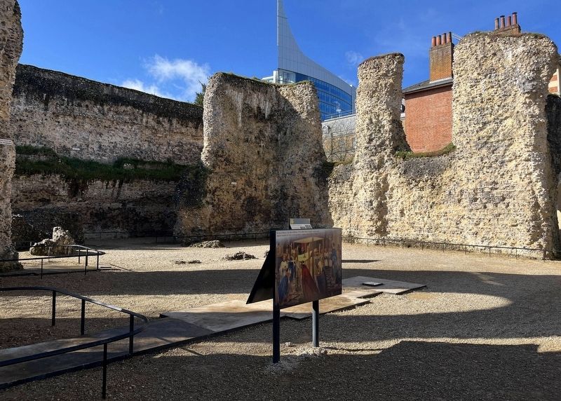
Abbey Ruins - This is the east end of the abbey church. The west end ran along to your right, ending in line with the grey cross over your right shoulder. To visit the Abbey Ruins go down the path to your right and under the bridge.
The knobbly stones in the walls of the ruins are flints which are found in the chalk hills around Reading. Flints were formed millions of years ago in deep oceans. Dead sponges and other sea creatures fell to the bottom. Their soft parts rotted away, leaving only silica from their skeletons. Over time the silica bonded together as smooth, hard, shiny flint.
Timeline
1121 - Henry I founds Reading Abbey
1164
Photographed by Ray Gurganus, April 1, 2024
2. Abbey Ruins
1254 - Reading receives royal charter from Henry III
1453 - Parliament meets at Reading Abbey
1539 - Henry VIII closes Reading Abbey. Abbot Hugh is executed
1560 - Elizabeth grants a new town charter
1643 - Abbey church is severely damaged in Civil War
1833 - People of Reading fundraise to buy Abbey Ruins
1840 - St James Church opens in former abbey grounds
1861 - Abbey Gateway is restored by George Gilbert Scott
1920 - Reading Pageant in Abbey Ruins
2018 - Abbey Ruins re-open after major conservation works
Erected by Reading Borough Council.
Topics. This historical marker is listed in this topic list: Religion & Religious Structures. A significant historical year for this entry is 1121.
Location. 51° 27.402′ N, 0° 57.942′ W. Marker is in Reading, England, in Berkshire. It can be reached from no nearby street. Touch for map. Marker is in this post office area: Reading, England RG1 3HW, United Kingdom. Touch for directions.

Regionally, this marker is in the Greater South East. Globally, it is on the Atlantic Ocean, in the North Atlantic Region, in Europe, in Atlantic Europe, on one of the British Isles, in the Western World, and in the Anglosphere. Historically, it finds itself in what was once the Roman Empire.
Other nearby markers. At least 8 other markers are within walking distance of this marker: Abbey Quarter (within shouting distance of this marker); A Church on a Huge Scale (within shouting distance of this marker); Choir and Altar (within shouting distance of this marker); Chapter and Verse (within shouting distance of this marker); At the Heart of the Abbey (within shouting distance of this marker); In the Warm (within shouting distance of this marker); a different marker also named Abbey Quarter (about 90 meters away, measured in a direct line); a different marker also named Abbey Quarter (about 120 meters away). Touch for a list and map of all markers in Reading.
Credits. This page was last revised on June 18, 2026. It was originally submitted on August 4, 2024, by Ray Gurganus of Washington, District of Columbia. This page has been viewed 226 times since then and 28 times this year. Photos: 1, 2. submitted on August 4, 2024, by Ray Gurganus of Washington, District of Columbia. • Andrew Ruppenstein was the editor who published this page.
