Reading in Berkshire, England, United Kingdom — Northwestern Europe (the British Isles)
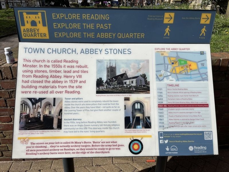
Town Church, Abbey Stones
Abbey Quarter
Photographed by Ray Gurganus, April 1, 2024
1. Town Church, Abbey Stones Marker
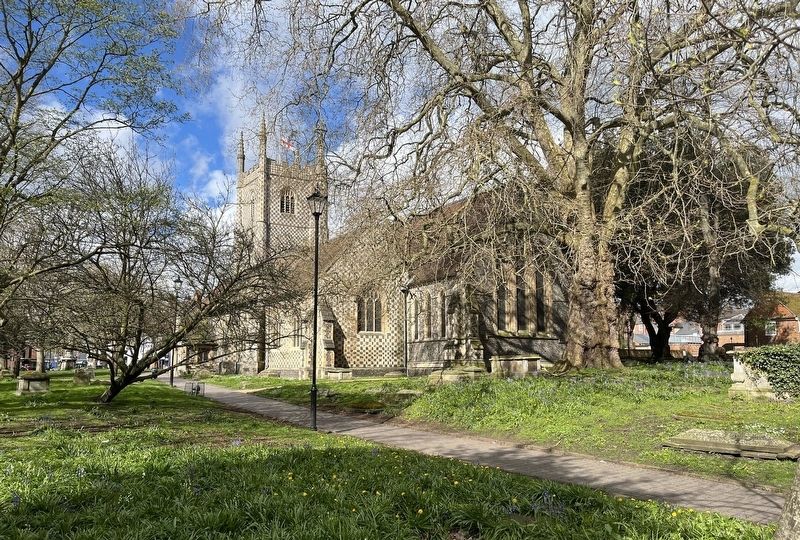
This church is called Reading Minster. In the 1550s it was rebuilt, using stones, timber, lead and tiles from Reading Abbey. Henry VIII had closed the abbey in 1539 and building materials from the site were re-used all over Reading.
Tower and pillars
Abbey stones were used to completely rebuild the tower. Inside the church are stone pillars that could be from the abbey. Over the years they have tilted-not quite as far as the Leaning Tower of Pisa, but give them another couple of hundred years...
Ancient doorway
In the 900s, long before Reading Abbey was founded. there was an Anglo-Saxon nunnery (all-female religious community) on this site. This doorway inside the church may have been may have led to the nuns living quarters.
-------
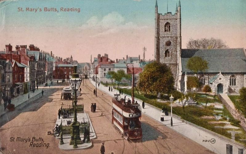
The street on your left is called St Mary's Butts. 'Butts' are not what you're thinking... they're actually archery targets. Before the army had guns, all men practised archery on Sundays, so they would be ready to go to war. Reading's archery butts were here, on the edge of the churchyard.
Timeline
1121 Henry funds Reading Abbey
1164 Henry and official opening of Reading
this page online
1254 Reading receives royal charter from Henry III
1453 Parliament meets at Reading Abbey
1539 Henry VIII closes Reading Abbey, Abbot Hugh is executed
1551-55 Reading Minster rebuilt with materials from Reading Abbey
1560 Elizabeth I grants a new town charter
1643 Abbey church is severely damaged in Civil War
1833 People of Reading fundraise to buy Abbey Ruins
1861 Abbey Gateway restored by George Gilbert Scott
1920 Reading Pageant in the Abbey Ruins
2018 Abbey Ruins re-open after major conservation works
Erected by Reading Borough Council.
Topics. This historical marker is listed in this topic list: Religion & Religious Structures. A significant historical year for this entry is 1551.
Location. 51° 27.269′ N, 0° 58.368′ W. Marker is in Reading, England, in Berkshire. It is on Chain Street, on the left when traveling north. Touch for map. Marker is in this post office area: Reading, England RG1 2HX, United Kingdom. Touch for directions.

Regionally, this marker is in the Greater South East. Globally, it is on the Atlantic Ocean, in the North Atlantic Region, in Europe, in Atlantic Europe, on one of the
Photographed by Ray Gurganus, April 1, 2024
2. Reading Minster
Other nearby markers. At least 8 other markers are within walking distance of this marker: Laurenthes Braag (within shouting distance of this marker); Old Reading (about 180 meters away, measured in a direct line); Simeon Monument (approx. 0.3 kilometers away); You've Found Reading Abbey's Market Place (approx. 0.3 kilometers away); WWII Bombing of Reading (approx. 0.3 kilometers away); Phoebe Cusden MBE (approx. 0.3 kilometers away); In Memory Of Henry West (approx. 0.4 kilometers away); The Hospitium (approx. 0.4 kilometers away). Touch for a list and map of all markers in Reading.
Photographed by John Valentine and Son, Ltd., circa 1910
3. St. Mary’s Butts
Credits. This page was last revised on August 6, 2024. It was originally submitted on July 4, 2024, by Ray Gurganus of Washington, District of Columbia. This page has been viewed 174 times since then and 20 times this year. Last updated on August 4, 2024, by Ray Gurganus of Washington, District of Columbia. Photos: 1, 2. submitted on July 4, 2024, by Ray Gurganus of Washington, District of Columbia. 3. submitted on July 9, 2024, by Andrew Ruppenstein of Lamorinda, California. • Devry Becker Jones was the editor who published this page.
Editor’s want-list for this marker. photo of the marker within its surroundings • Can you help?
