
Neuville-Saint-Vaast in Pas-de-Calais, Upper France, France — Western Europe
Be Prepared
Photographed by J. Makali Bruton, June 11, 2024
1. Be Prepared Marker

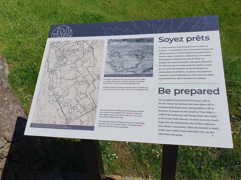
Le Corps canadien a tiré de dures leçons au début de la guerre : de nombreuses vies ont été perdues lorsque des officiers tombaient ou que les lignes de communication étaient coupées, laissant les soldats livrés à eux-mêmes. Pour préparer l'attaque sur la crête de Vimy, une maquette du champ de bataille et des lignes allemandes fut créée pour que les troupes puissent répéter. Jusqu'à 40 000 cartes de tranchées ont été distribuées aux commandants de l'artillerie, du génie et de l'infanterie. Lorsque le moment d'attaquer est enfin venu, les soldats connaissaient leur rôle et savaient où ils allaient.
Les troupes canadiennes à la crête de Vimy auraient utilisé un modèle comme celui-ci illustrant les lignes allemandes près de Lens, en France, au mois de septembre 1918.
Cette carte montre les défenses allemandes dans la région de la crête de Vimy, assignée à la 4° Division canadienne. Cette région comprend la côte 145 (Hill 145), où se trouve aujourd'hui le Mémorial de Vimy.
Be prepared
The Canadian Corps learned hard lessons early in the war. Many lives had been lost when officers
this page online
Canadian troops at Vimy Ridge may have used a model like this one showing German lines near Lens, France in September 1918. ANGR
This map shows German defenses in the area of Vimy Ridge assigned to the 4th Canadian Division. It includes Hill 145 where the Vimy Memorial stands today.
Topics. This historical marker is listed in this topic list: War, World I. A significant historical month for this entry is September 1918.
Location. 50° 22.276′ N, 2° 46.297′ E. Marker is in Neuville-Saint-Vaast, Hauts-de-France (Upper France), in Pas-de-Calais. It can be reached from Route D55 east of Route A26/E15, on the right when traveling north. Touch for map. Marker is in this post office area: Neuville-Saint-Vaast, Hauts-de-France 62580, France. Touch for directions.

Regionally,
Photographed by J. Makali Bruton, June 11, 2024
2. Be Prepared Marker
Other nearby markers. At least 8 other markers are within 5 kilometers of this marker, measured as the crow flies: Staying Healthy (within shouting distance of this marker); German Observation Post (within shouting distance of this marker); The Canadians at Vimy Ridge (within shouting distance of this marker); Jardin de la Paix Canadien (about 150 meters away, measured in a direct line); Vimy Ridge and Canadians During the First World War (approx. 0.9 kilometers away); Moroccan Division Memorial (approx. 0.9 kilometers away); Canadian National Vimy Memorial (approx. one kilometer away); General Maistre et du 21e Corps d’Armee (approx. 4.7 kilometers away). Touch for a list and map of all markers in Neuville-Saint-Vaast.
Credits. This page was last revised on August 5, 2024. It was originally submitted on August 5, 2024, by J. Makali Bruton of Washington, District of Columbia. This page has been viewed 139 times since then and 12 times this year. Photos: 1, 2. submitted on August 5, 2024, by J. Makali Bruton of Washington, District of Columbia.
