Chester in Cheshire West and Chester, England, United Kingdom — Northwestern Europe (the British Isles)
North West Tower
The Church of St John the Baptist
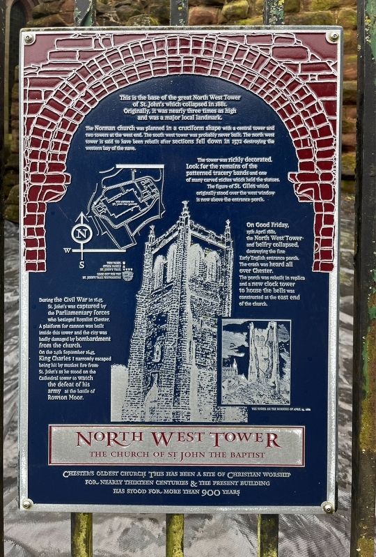
Photographed by Ray Gurganus, April 10, 2024
1. North West Tower Marker
The Norman church was planned in a cruciform shape with a central tower and two towers at the west end. The south west tower was probably never built. The north west tower is said to have been rebuilt after sections fell down in 1572 destroying the western bay of the nave.
The tower was richly decorated. Look for the remains of the patterned tracery bands and one of many carved niches which held the states The figure of St. Giles which originally stood over the west window is now above the entrance porch.
During the Civil War in St. John's was captured by the Parliamentary forces who besieged Royalist Chester. A platform for cannon was built inside this tower and the city was badly damaged by bombardment from the church. On the 24th September 1645. King Charles I narrowly escaped being hit by musket fire from St. John's as he stood on the Cathedral tower to watch the defeat of his army at the battle of Rowton Moor.
On Good Friday, 15th April 1881, The North West Tower and belfry collapsed, destroying the fine Early English entrance porch. The crash was heard all over Chester. The porch was rebuilt in replica and a new clock tower to house the bells was constructed at the east end of the church.
Topics. This historical marker is listed in this topic list: Religion & Religious Structures. A significant historical year for this entry is 1572.
Location. 53° 11.343′ N, 2° 53.174′ W. Marker is in Chester, England, in Cheshire West and Chester. It is on Little Saint John Street, on the left when traveling south. The marker is mounted to the railing to the right of the church entrance. Touch for map. Marker is at or near this postal address: 6
this page online

Regionally, this marker is in North West England. Globally, it is on the Atlantic Ocean, in the North Atlantic Region, in Europe, in Atlantic Europe, on one of the British Isles, in the Western World, and in the Anglosphere. Historically, it finds itself in what was once the Roman Empire.
Other nearby markers. At least 8 other markers are within walking distance of this marker: The Church of St John the Baptist (a few steps from this marker); Roman Amphitheatre (within shouting distance of this marker); Eastern Ruins (within shouting distance of this marker); Georgian Elegance (within shouting distance of this marker); Ruins of the Church of St John the Baptist (within shouting distance of this marker); The Chapter House (within shouting distance of this marker); a different marker also named The Church of St John the Baptist (within shouting distance of this marker); South Eastern Chapel (within shouting distance of this marker). Touch for a list and map of all markers in Chester.

Photographed by Ray Gurganus, April 9, 2024
2. St John the Baptist Church
Credits. This page was last revised on August 6, 2024. It was originally submitted on August 5, 2024, by Ray Gurganus of Washington, District of Columbia. This page has been viewed 262 times since then and 50 times this year. Photos: 1, 2. submitted on August 5, 2024, by Ray Gurganus of Washington, District of Columbia. • Andrew Ruppenstein was the editor who published this page.
Editor’s want-list for this marker. photo of the marker within its surroundings • Can you help?
