Camden in Kershaw County, South Carolina — The American South (South Atlantic)
Artillery Duel at Dawn
Battle of Camden
| — | The Liberty Trail | — |
Photographed by Mark Parker, April 5, 2024
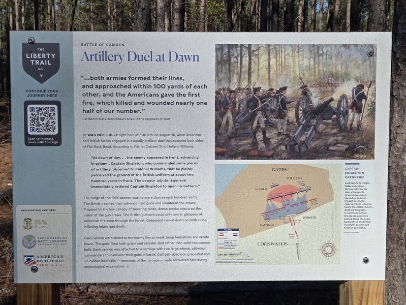
1. Artillery Duel at Dawn Marker
"…both armies formed their lines, and approached within 100 yards of each other, and the Americans gave the first fire, which killed and wounded nearly one half of our number."
- British Private John Robert Shaw, 33rd Regiment of Foot
It was not fully light here at 5:30 a.m. on August 16, when American and British forces engaged in a deadly artillery duel that spanned both sides of Flat Rock Road. According to Patriot Colonel Otho Holland Williams:
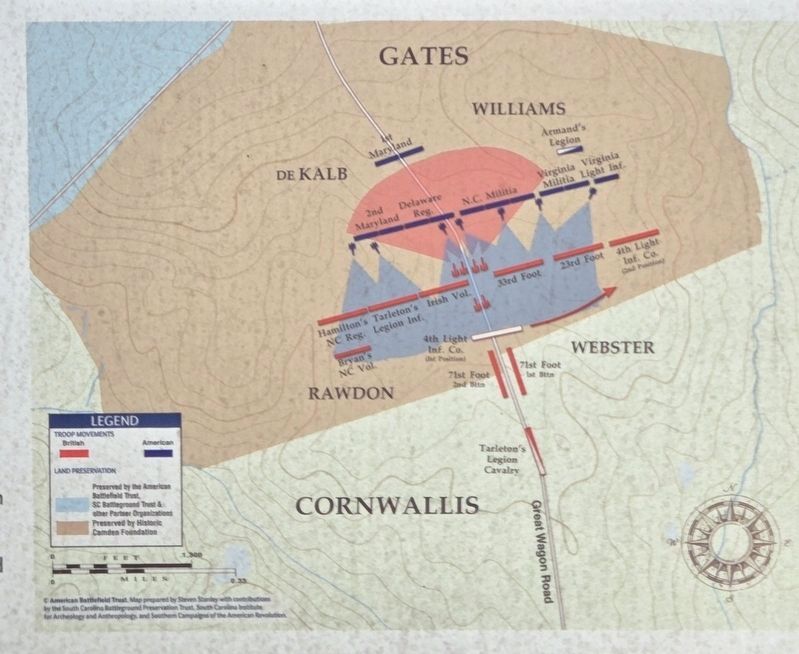
"At dawn of day... the enemy appeared in front, advancing in column. Captain Singleton, who commanded some pieces of artillery, observed to Colonel Williams, that he plainly perceived the ground of the British uniform at about two hundred yards in front. The deputy adjutant general immediately ordered Captain Singleton to open his battery."The range of the field cannon was no more than several hundred yards. The British readied their advance field guns and countered the attack. Trapped by the low canopy of towering pines, dense smoke obscured the vision of the gun crews. The British gunners could only aim at glimpses of American fire seen through the forest. Grapeshot
this page online
Field cannon were aimed at the enemy line to break troop formations and create havoc. The guns fired both grape and canister shot rather than solid iron cannon balls. Each cannon was attached to a carriage with two large wheels, allowing commanders to maneuver their guns in battle. Golf ball-sized iron grapeshot and .75 caliber lead balls—remnants of the carnage—were recovered here during archeological excavations.
(caption)
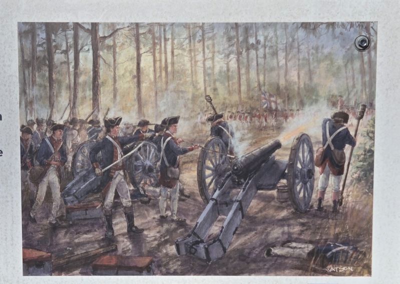
Captain Singleton Opens Fire
Just before first light, Gates rode down his line, offering his men a few words of encouragement. He had just posted himself behind his reserve troops when he heard his artillery boom. Anthony Singleton, in command of four bronze six-pounders posted along the road, had spotted the British moving in column and fired on command.
Erected by The Liberty Trail, Historic Camden Foundation, South Carolina Battleground Preservation Fund, American Battlefield Trust.
Topics. This historical marker is listed in this topic list: War, US Revolutionary. A significant historical date for this entry is August 16, 1780.
Location. 34° 21.339′ N, 80° 36.47′ W.
Photographed by Mark Parker, April 5, 2024
2. Closeup of Captain Singleton Opens Fire
Illustration by Dale Watson

Regionally, this marker is in the Midlands and in the Olde English District. It is also in the American South and specifically in the Deep South. Globally, it is in North America, the Western Hemisphere, the Western World, and the Anglosphere. Historically, it finds itself in what was once the territory of the Mississippian Culture, one of the original Thirteen Colonies, one of the Confederate States of America, and the Antebellum South.
Other nearby markers. At least 8 other markers are within walking distance of this marker: Meet the American Army of 1780 (within shouting distance of this marker); Collapse of the Patriot Militia (about 500 feet away, measured
Photographed by Mark Parker, April 5, 2024
3. Closeup on engagement between Cornwallis and Gates and Battle of Camden
Credits. This page was last revised on August 6, 2024. It was originally submitted on August 5, 2024, by Mark Parker of Hickory, North Carolina. This page has been viewed 236 times since then and 31 times this year. Photos: 1, 2, 3. submitted on August 5, 2024, by Mark Parker of Hickory, North Carolina. • Bernard Fisher was the editor who published this page.
