Near Camden in Kershaw County, South Carolina — The American South (South Atlantic)
A Night Skirmish
Battle of Camden
| — | The Liberty Trail | — |
Photographed by Mark Parker, April 5, 2024
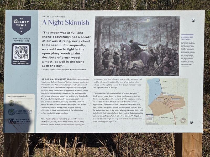
1. A Night Skirmish Marker
- Private Guilford Dudley, Dragoon, North Carolina Militia
At 2:30 a.m. on August 16, British dragoons under Lieutenant Colonel Banastre Tarleton charged Lieutenant Colonel Charles Armand's American cavalry. Lieutenant Colonel Charles Porterfield's Virginia Continental light infantry, riding behind and in support of Armand's troops, converged on the British, firing from the opposite side of the road where you stand now and forcing them back. Next, the British light infantry advanced, deployed, and laid down solid fire, throwing back the American center. Horses and men became entangled. The British then attacked the 1st Maryland Brigade, leaving Porterfield's force and some North Carolina militia to face the British advance alone.
While Patriot officers worked to get their troops into a battle line, nearby militia fired rounds before being forced to retreat as the British advanced.
this page online
The landscape did not give either side an advantage. Both armies could deploy in linear battle order with their flanks semi-protected. Low marsh on the west and swamps on the east made it difficult for units to outmaneuver opponents. Gates learned that Cornwallis's full army was before him. Cornwallis, though outnumbered, realized that he had Gates's men in the open, where they would be forced to fight. At their council of war that evening, Gates asked his commanding officers, "what is best to be done?" Brigadier General Edward Stephens responded, "Is it not too late now to do anything but fight?"
Erected by The Liberty Trail, Historic Camden Foundation, South Carolina Battleground Preservation Fund, American Battlefield Trust.
Topics. This historical marker is listed in this topic list: War, US Revolutionary. A significant historical date for this entry is August 16, 1780.
Location. 34° 21.146′ N, 80° 36.403′ W. Marker is
Photographed by Mark Parker, April 5, 2024
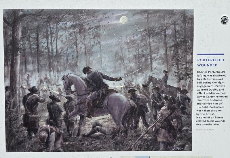
2. Closeup of Porterfield Wounded, upper right corner of marker
Charles Porterfield's left leg was shattered by a British musket ball during the night engagement. Private Guilford Dudley and a Black soldier named James Carter removed him from his horse and carried him off the field. Porterfield was taken prisoner by the British. He died of an illness related to his wounds five months later.
Illustration by Dale Watson
Illustration by Dale Watson

Regionally, this marker is in the Midlands and in the Olde English District. It is also in the American South and specifically in the Deep South. Globally, it is in North America, the Western Hemisphere, the Western World, and the Anglosphere. Historically, it finds itself in what was once the territory of the Mississippian Culture, one of the original Thirteen Colonies, one of the Confederate States of America, and the Antebellum South.
Other nearby markers. At least 8 other markers are within walking distance of this marker: Shots in the Dark (within shouting distance of this marker); All the King's Men (about 600 feet away, measured in a direct line); Attack at Dawn (about 800 feet away);

Photographed by Mark Parker, April 5, 2024
3. Closeup of the overnight engagement during the Battle of Camden
© American Battlefleld Trust. Map prepared by Steven Stanley with contibutions by the South Carolina Battleground Preservation Trust, South Carolina Institute for Archeology and Anthropology, and Southern Campaigns of the American Revolution.
Credits. This page was last revised on August 8, 2024. It was originally submitted on August 5, 2024, by Mark Parker of Hickory, North Carolina. This page has been viewed 272 times since then and 40 times this year. Photos: 1, 2, 3. submitted on August 5, 2024, by Mark Parker of Hickory, North Carolina. • Bernard Fisher was the editor who published this page.
