
Near Wallacetown in Elgin County, Ontario — Central Canada (North America)
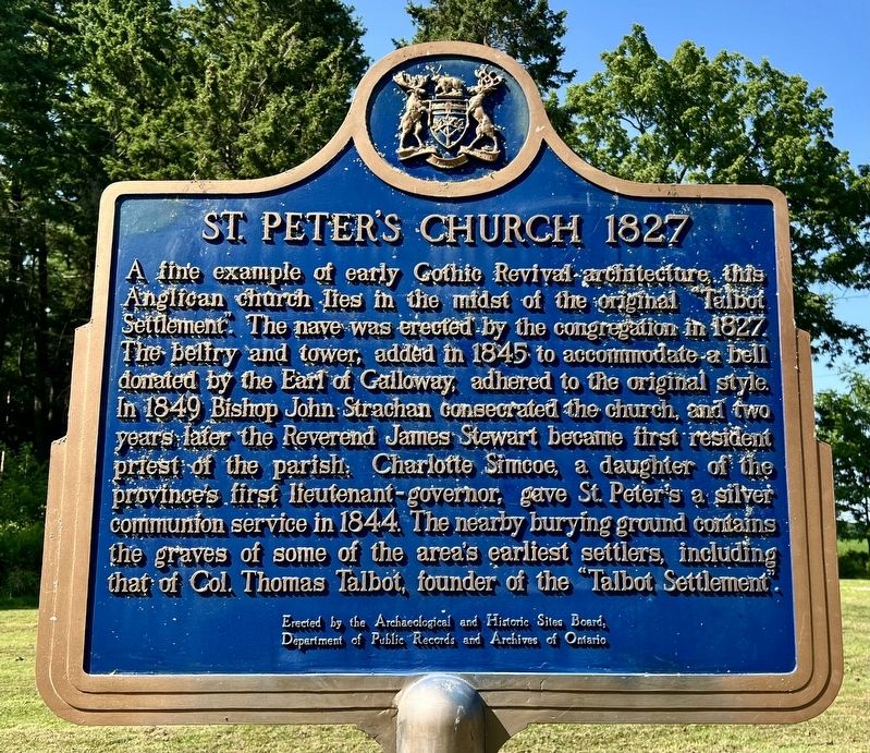
St. Peter’s Church 1827
Photographed by Tim Boyd, July 27, 2024
1. St. Peter’s Church 1827 Marker
Erected by the Archaeological and Historic Sites Board,
Department of Public Records and Archives of Ontario
Erected by Archaeological and Historic Sites Board of Ontario.
Topics and series. This historical marker is listed in these topic lists: Religion & Religious Structures • Settlements & Settlers. In addition, it is included in the Canada, Ontario Heritage Trust series list. A significant historical year for this entry is 1827.
Location. 42° 36.415′ N, 81° 26.445′ W. Marker is near Wallacetown, Ontario, in Elgin County. It is on Lakeview Line (County Road 8)
this page online

Regionally, this marker is in the Southwest Ontario Area and in Southwestern Ontario. It is also in Central Canada. Globally, it is in North America, on the Great Lakes, in the Western Hemisphere, in the Western World, and in the Anglosphere. Historically, it finds itself in what was once a British colony, the Viceroyalty of New France, the Haudenosaunee (Iroquois) Confederacy, and Rupert’s Land.
Other nearby markers. At least 8 other markers are within 10 kilometers of this marker, measured as the crow flies: Ellis Wellwood Sifton, V.C. (within shouting distance of this marker); Raids on the Talbot Settlement, 1814 (approx. 0.4 kilometers away); Tyrconnell (approx. 2 kilometers away); Col. Thomas Talbot (approx. 7.1 kilometers away); The Talbot Settlement / La Colonie de Talbot (approx. 7.1 kilometers away); John Kenneth Galbraith (approx. 7.9 kilometers away); Burwell’s Corners (approx. 9.4 kilometers away); Col. Mahlon Burwell (approx. 9.4 kilometers away). Touch for a list and map of all markers in Wallacetown.
Also see . . . St. Peter’s Church, Tyrconnell - History.
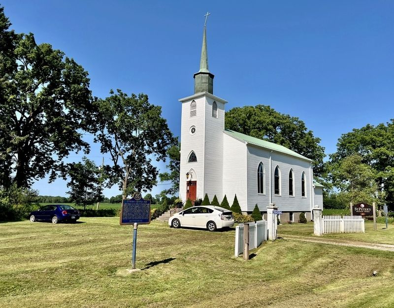
St. Peter’s(Submitted on August 6, 2024, by Tim Boyd of Hamilton, Ontario.)was built in the Autumn of 1827. There was no scarcity of timber in those days. Only the best of white or blue oak was used in the frame and used lavishly. One can almost step from cross-beam to cross-beam in the attic of the church. The outside of the church was finished in rough cast. The shingles and lath were made from pine and split by hand. Col. Patterson went by boat to Buffalo to purchase the glass for the windows also the lead and oil for the paint and the putty. Tradition has said the first pulpit was a carpender’s work bench and the seats were planks on blocks of wood.Photographed by Tim Boyd, July 27, 20242. St. Peter’s Church 1827 Marker
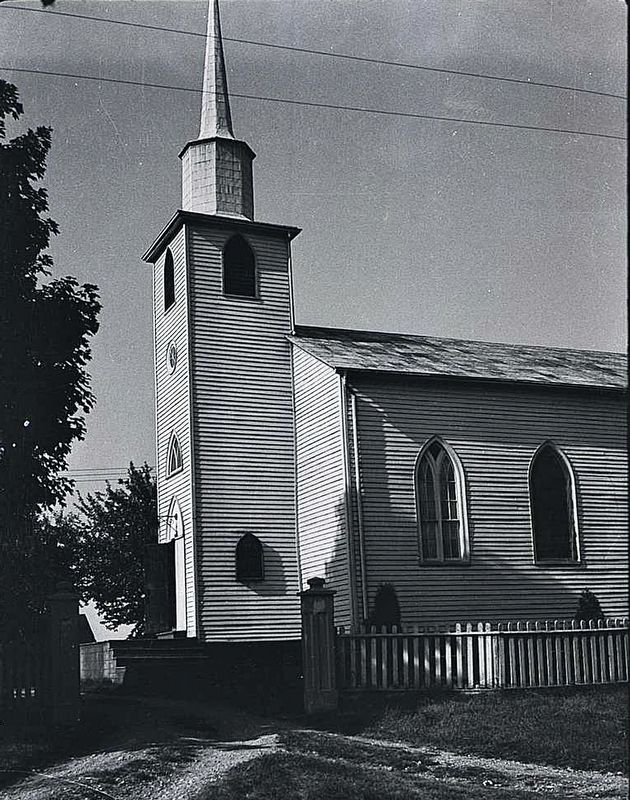
1933
3. St. Peter’s Church, 1933
Source: Archives of Ontario (public domain)
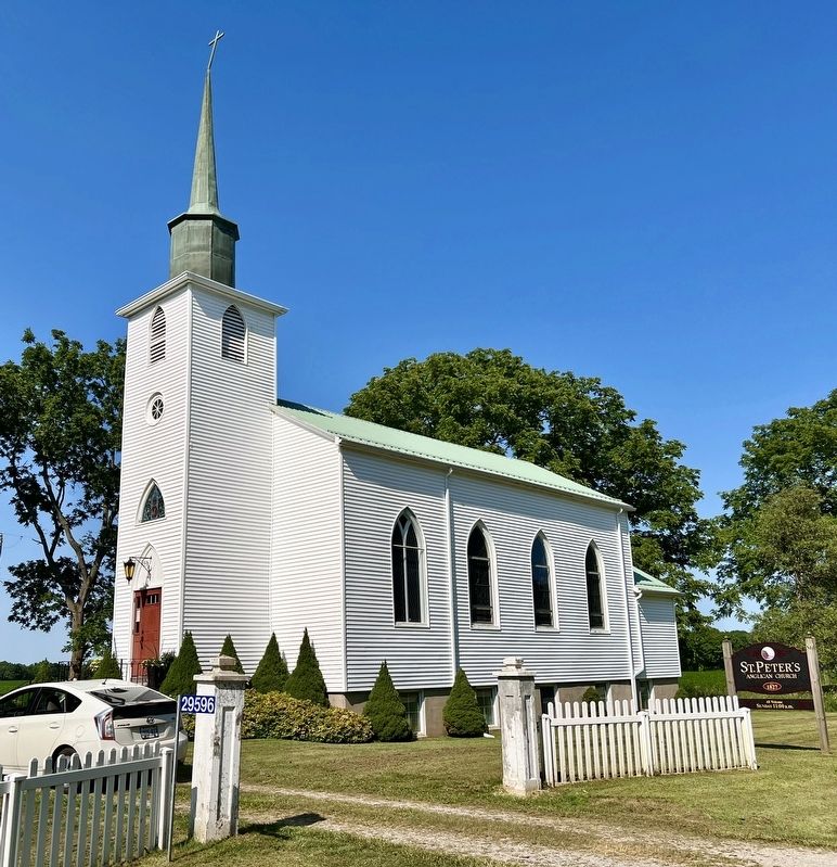
Photographed by Tim Boyd, July 27, 2024
4. St. Peter’s Church, 2024
Credits. This page was last revised on August 6, 2024. It was originally submitted on August 6, 2024, by Tim Boyd of Hamilton, Ontario. This page has been viewed 198 times since then and 35 times this year. Photos: 1, 2, 3, 4. submitted on August 6, 2024, by Tim Boyd of Hamilton, Ontario. • Andrew Ruppenstein was the editor who published this page.
