Lehi in Utah County, Utah — The American Mountains (Southwest)
Sulphur Springs History
Photographed by Jeremy Snow, August 5, 2024
1. Sulphur Springs History Marker
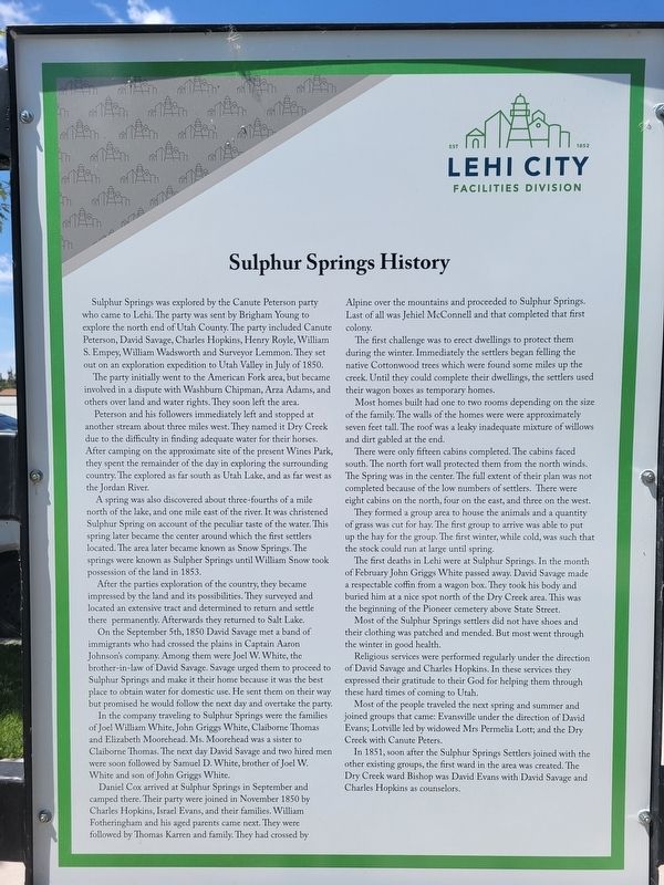
Sulphur Springs was explored by the Canute Peterson party who came to Lehi. The party was sent by Brigham Young to explore the north end of Utah County. The party included Canute Peterson, David Savage, Charles Hopkins, Henry Royle, William S. Empey, William Wadsworth and Surveyor Lemmon. They set out on an exploration expedition to Utah Valley in July of 1850.
The party initially went to the American Fork area, but became involved in a dispute with Washburn Chipman, Arza Adams, and others over land and water rights. They soon left the area.
Peterson and his followers immediately left and stopped at another stream about three miles west. They named it Dry Creek due to the difficulty in finding adequate water for their horses. After camping on the approximate site of the present Wines Park, they spent the remainder of the day in exploring the surrounding country. The explored as far south as Utah Lake, and as far west as the Jordan River.
A spring was also discovered about three-fourths of a mile north of the lake, and one mile east of the river. It was christened Sulphur Spring on account of the peculiar taste
this page online
After the parties exploration of the country, they became impressed by the land and its possibilities. They surveyed and located an extensive tract and determined to return and settle there permanently. Afterwards they returned to Salt Lake.
On the September 5th, 1850 David Savage met a band of immigrants who had crossed the plains in Captain Aaron Johnson's company. Among them were Joel W. White, the brother-in-law of David Savage. Savage urged them to proceed to Sulphur Springs and make it their home because it was the best place to obtain water for domestic use. He sent them on their way but promised he would follow the next day and overtake the party.
In the company traveling to Sulphur Springs were the families of Joel William White, John Griggs White, Claiborne Thomas and Elizabeth Moorehead. Ms. Moorehead was a sister to Claiborne Thomas. The next day David Savage and two hired men were
Photographed by Jeremy Snow, August 5, 2024
2. Sulphur Springs History Marker
Daniel Cox arrived at Sulphur Springs in September and camped there. Their party were joined in November 1850 by Charles Hopkins, Israel Evans, and their families. William Fotheringham and his aged parents came next. They were followed by Thomas Karren and family. They had crossed by Alpine over the mountains and proceeded to Sulphur Springs. Last of all was Jehiel McConnell and that completed that first colony.
The first challenge was to erect dwellings to protect them during the winter. Immediately the settlers began felling the native Cottonwood trees which were found some miles up the creek. Until they could complete their dwellings, the settlers used their wagon boxes as temporary homes.
Most homes built had one to two rooms depending on the size of the family. The walls of the homes were were approximately seven feet tall. The roof was a leaky inadequate mixture of willows and dirt gabled at the end.
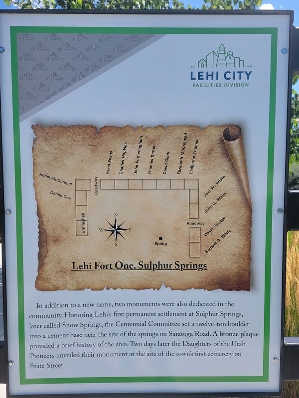
There were only fifteen cabins completed. The cabins faced south. The north fort wall protected them from the north winds. The Spring
Photographed by Jeremy Snow, August 5, 2024
3. Sulphur Springs History Marker
The first deaths in Lehi were at Sulphur Springs. In the month of February John Griggs White passed away. David Savage made a respectable coffin from a wagon box. They took his body and buried him at a nice spot north of the Dry Creek area. This was the beginning of the Pioneer cemetery above State Street.
Most of the Sulphur Springs settlers did not have shoes and their clothing was patched and mended. But most went through the winter in good health.
Religious services were performed regularly under the direction of David Savage and Charles Hopkins. In these services they expressed their gratitude to their God for helping them through these hard times of coming to Utah.
Most of the people traveled the next spring and summer and joined groups that came: Evansville under the direction of David Evans; Lotville led by widowed Mrs Permelia Lott; and the Dry Creek with Canute Peters.
In 1851, soon after the Sulphur Springs Settlers joined with the other existing groups, the first ward in the area was created. The Dry Creek ward Bishop was David Evans with David Savage and Charles Hopkins as counselors.
Lehi Fort One. Sulphur Springs
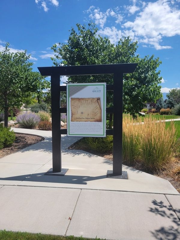
In addition to a new name, two monuments were also dedicated in the community. Honoring Lehi's first permanent settlement at Sulphur Springs, later called Snow Springs, the Centennial Committee set a twelve-ton boulder into a cement base near the site of the springs on Saratoga Road. A bronze plaque provided a brief history of the area. Two days later the Daughters of the Utah Pioneers unveiled their monument at the site of the town's first cemetery on State Street.
Erected by Lehi City.
Topics. This historical marker is listed in this topic list: Settlements & Settlers. A significant historical month for this entry is July 1850.
Location. 40° 22.334′ N, 111° 53.075′ W. Marker is in Lehi, Utah, in Utah County. It is at the intersection of 2185 West and 7750 N, on the left when traveling south on 2185 West. The marker is located on the west side of Snow Springs Park. Touch for map. Marker is in this post office area: Lehi UT 84043, United States of America. Touch for directions.

Regionally, this marker is in the Wasatch Front and in Greater Provo. It is also in the American Mountain West and on the Colorado Plateau. Globally, it is in North America, the Rocky Mountains, the Western Hemisphere, the Western World, and the Anglosphere. Historically, it finds itself in what was once New Spain and also Mexico’s Alta California.
Other nearby markers. At least 8 other markers are within 3 miles of this marker, measured as the crow flies: Pioneers of Lehi (a few steps from this marker); Lehi Hotel (approx. 1.9 miles away); Lehi Meeting House (approx. 2 miles away); Lehi Relief Society Hall (approx. 2 miles away); Relief Society Hall (1881-1909) (approx. 2 miles away); Merrihew/Dalley Building (approx. 2.1 miles away); Lehi Memorial Building (approx. 2.2 miles away); Bishop David Evans (approx. 2.2 miles away). Touch for a list and map of all markers in Lehi.
Credits. This page was last revised on August 6, 2024. It was originally submitted on August 6, 2024, by Jeremy Snow of Cedar City, Utah. This page has been viewed 303 times since then and 49 times this year. Photos: 1, 2, 3. submitted on August 6, 2024, by Jeremy Snow of Cedar City, Utah. • Andrew Ruppenstein was the editor who published this page.
