Cheltenham in Gloucestershire, England, United Kingdom — Northwestern Europe (the British Isles)
Cheltenham Minster
Photographed by Ray Gurganus, April 5, 2024
1. Cheltenham Minster Marker
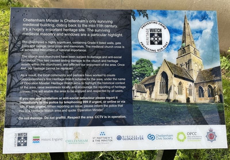
The churchyard is highly significant, containing Grade II listed walls, gate piers and railings, lamp posts and memorials. The medieval church cross is a scheduled monument of national importance.
The church and churchyard have been subject to damage and anti-social behaviour. This has caused lasting damage to the church and heritage assets within the churchyard, and affected our enjoyment of the area. Once lost, our heritage cannot be replaced.
As a result, the local community and partners have worked to create Gloucestershire's first Heritage Watch scheme for the area, under the name of Operation Minster. Heritage Watch aims to highlight the historical context of the area, raise awareness locally and encourage the reporting of heritage crimes. This will enable the area to be enjoyed and respected by all users.
Erected by Cheltenham Borough Council, St. Matthew’s and the Minster.
Topics.
this page online
Location. 51° 54.072′ N, 2° 4.628′ W. Marker is in Cheltenham, England, in Gloucestershire. It is on Well Walk. Touch for map. Marker is at or near this postal address: 7 Well Walk, Cheltenham, England GL50 3JS, United Kingdom. Touch for directions.

Regionally, this marker is in South West England. Globally, it is on the Atlantic Ocean, in the North Atlantic Region, in Europe, in Atlantic Europe, on one of the British Isles, in the Western World, and in the Anglosphere. Historically, it finds itself in what was once the Roman Empire.
Other nearby markers. At least 8 other markers are within 13 kilometers of this marker, measured as the crow flies: South African War Memorial 1899-1902 (about 180 meters away, measured in a direct line); Cheltenham War Memorial (approx. 0.2 kilometers away); a different marker also named Cheltenham War Memorial (approx. 0.2 kilometers away); Dr. Edward Adrian Wilson (approx. 0.3 kilometers away); Gustav Holst (approx. half a kilometer away); Montpellier Gardens

Photographed by Ray Gurganus, April 5, 2024
2. Cheltenham Minster
Also see . . .
1. The Heart of Cheltenham (St. Matthew’s and the Minster).
Excerpt: The Minster has been a place for worship in Cheltenham since 773.(Submitted on August 9, 2024.)
2. Cheltenham Minster, St Mary's (Wikipedia).
Overview and Background: Cheltenham Minster is the minster and parish church of Cheltenham in Gloucestershire, England.(Submitted on August 9, 2024.)
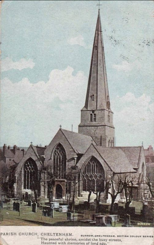
The Minster is the only surviving medieval building in Cheltenham. It has been in continuous use for 850 years, though between 1859 and 1877 it was closed intermittently for repairs.
It is believed to have replaced a Saxon church erected on this site in the 8th century. In the Domesday Book the church and its land (the rectory) were recorded as belonging to William the Conqueror's chancellor, Regenbald also known as Reinbald, who then bequeathed it to Cirencester Abbey. After the Dissolution of the Monasteries by Henry VIII it became crown property during the English Reformation. The crownproperty was sold by James I & VI and went through a succession of different owners (lay rectors) until 1863 when Edward Walker took possession of the chancel and the title of rector.Photographed by Burrow, circa 19223. Parish Church, Cheltenham
Credits. This page was last revised on August 9, 2024. It was originally submitted on August 7, 2024, by Ray Gurganus of Washington, District of Columbia. This page has been viewed 246 times since then and 27 times this year. Photos: 1, 2. submitted on August 7, 2024, by Ray Gurganus of Washington, District of Columbia. 3. submitted on August 9, 2024. • Andrew Ruppenstein was the editor who published this page.
