Chester in Cheshire West and Chester, England, United Kingdom — Northwestern Europe (the British Isles)
The Church of St John the Baptist

Photographed by Ray Gurganus, April 10, 2024
1. The Church of St John the Baptist Marker
This view of St Johns shows the full extent of the church in the early 19th century. Many changes have taken place since then and the church looks very different today.
The church was dominated by the great North West tower which collapsed in 1881. Only the ruined stump survives. It was replaced by the clock tower at the eastern end, designed by the noted Chester architect, John Douglas.
The ruined eastern chapels, cut off from the main body of the church in 1581 were enclosed behind a high wall. This was removed in 1871 when the present retaining wall and railings were built.
Between the entrance porch and the remains of the north transept was a small house, built by a Mr Orange In 1756. It was demolished in 1855. There was another house inside ruins. In the 18th century this was own by the mother of author Thomas de Quincey. Only the call chimney stack can be seen in this view.
The northern graveyard was closed and levelled in 1876 in the interests of
this page online
Topics. This historical marker is listed in this topic list: Religion & Religious Structures. A significant historical year for this entry is 1581.
Location. 53° 11.368′ N, 2° 53.126′ W. Marker is in Chester, England, in Cheshire West and Chester. It is on Vicar's Lane, on the left when traveling west. Touch for map. Marker is at or near this postal address: 1 Vicar's Lane, Chester, England CH1 1QX, United Kingdom. Touch for directions.

Regionally, this marker is in North West England. Globally, it is on the Atlantic Ocean, in the North Atlantic Region, in Europe, in Atlantic Europe, on one of the British Isles, in the Western World, and in the Anglosphere. Historically, it finds itself in what was once the Roman Empire.
Other nearby markers. At least 8 other markers are within walking distance of this marker: Eastern Ruins (a few steps from this marker); North Eastern Chapel (within shouting distance of this marker); South Eastern Chapel (within shouting distance of this marker); Ruins of the Church of St John the Baptist (within shouting distance of this marker); The Chapter House
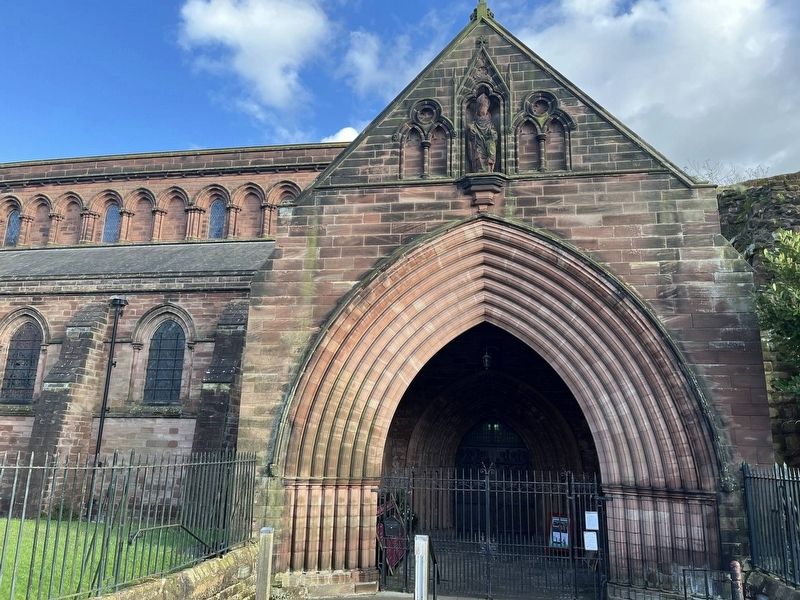
Photographed by Ray Gurganus, April 9, 2024
2. The Church of St John the Baptist
Also see . . . A History of St. John the Baptist, Chester (St John’s Church).
Excerpt: The date of foundation in 689AD by Æthelred King of Mercia is likely to be set aside and the date taken further back, possibly to the third or fourth centuries AD as recent scholarship is revealing much about St John’s that was hitherto unknown; and it is possible that we may find that this beautiful Church is one of the oldest in Europe still used for the worship of Almighty God.(Submitted on August 9, 2024.)
That said it is fairly clear that Æthelred did build, but on a site already in use as a Christian Centre, quite possibly by the remnants of the Celtic Church so derided by the Venerable Bede in his Ecclesiastical History of the English People (Historia ecclesiastica gentis Anglorum).
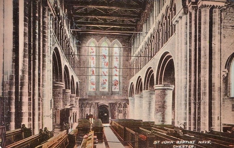
Photographed by John Valentine and Son, Co., circa 1908
3. St. John Baptist Nave, Chester
Credits. This page was last revised on August 9, 2024. It was originally submitted on August 9, 2024, by Ray Gurganus of Washington, District of Columbia. This page has been viewed 270 times since then and 43 times this year. Photos: 1, 2. submitted on August 9, 2024, by Ray Gurganus of Washington, District of Columbia. 3. submitted on August 9, 2024. • Andrew Ruppenstein was the editor who published this page.
Editor’s want-list for this marker. photo of the marker within its surroundings • Can you help?
