
Montjuïc in Barcelona, Catalonia, Spain — Southwestern Europe (Iberian Peninsula)
Barris de Barraques de Montjuïc
⎯⎯⎯
Barraques de Montjuïc Neighborhoods
Photographed by Andrew Ruppenstein, April 28, 2022
1. Barris de Barraques de Montjuïc / Barraques de Montjuïc Neighborhoods Marker (left panel)

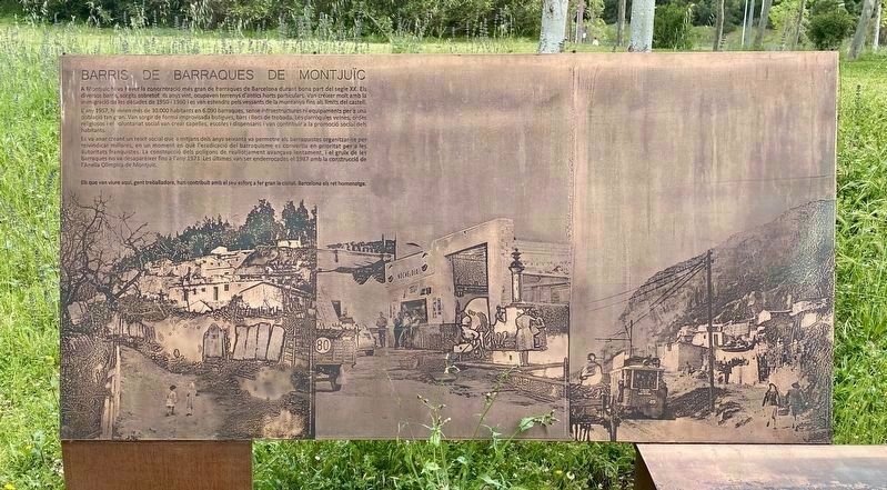
A Montjuic hi va haver la concentració més gran de barraques de Barcelona durant bona part del segle XX. Els diversos barris, sorgits sobretot als anys vint, ocupaven terrenys d'antics horts particulars. Van créixer molt amb la immigració de les dècades de 1950 i 1960 i es van estendre pels vessants de la muntanya fins als límits del castell. L'any 1957, hi vivien més de 30.000 habitants en 6.090 barraques, sense infraestructures ni equipaments per a una població tan gran. Van sorgir de forma improvisada botigues, bars i llocs de trobada. Les parròquies veïnes, ordes religiosos i el voluntariat social van crear capelles, escoles i dispensaris i van contribuir a la promoció social dels habitants.
Es va anar creant un teixit social que a mitjans dels anys seixanta va permetre als barraquistes organitzar-se per reivindicar millores, en un moment en què l'eradicació del barraquisme es convertia en prioritat per a les autoritats franquistes. La construcció dels polígons de reallotjament avançava lentament, i el gruix de les barraques no va desaparèixer fins a l'any 1973. Les últimes van ser enderrocades el 1987 amb la construcció de l'Anella Olímpica de Montjuïc.
Els que van viure aquí, gent treballadora, han contribuït amb el seu esforç a fer gran la ciutat. Barcelona els ret homenatge.
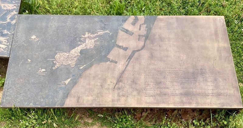
Els barris de barraques es van distribuir per tota la muntanya de Montjuic.
En el vessant nord-est, els diversos nuclis del Poble-sec s'estenien des de Miramar fins al Teatre Grec.
A la part central de Montjuïc, hi havia la concentració més gran de barraques. Els diversos barris, com Maricel, Tres Pins, Can Valero les Banderes, formaven gairebé un continu, entre l'estadi, el castell i el cementiri, una àrea que ara ocupen el Jardí Botànic, parcs com els de Petra Kelly i del Migdia, i equipaments esportius. Van anar desapareixent entre 1964 i 1973 amb motiu dels diferents projectes urbans que van afectar Montjuic, com la construcció del Parc d'Atraccions que va eliminar el barri de Maricel.
Cap al sud, entre pedreres, hi havia els nuclis de Damunt la Fossa i l'Esparver, més vinculats al barri de la Mare de Déu de Port.
Un petit grup de barraques prop del passeig de la Zona Franca constituïa el barri de la Vinya, enderrocat el 1964 per edificar blocs d'habitatges.
A ponent, en el límit de Montjuïc i baixant fins a la Gran Via, s'estenia el barri de la Magòria, eradicat el 1929 amb motiu de l'Exposició Internacional.
A la banda de mar hi havia les coves i barraques del Morrot, al llarg de l'antiga carretera al peu del penya-segat. I el barri de Can Tunis o Jesús i Maria, entre el cementiri el port, que es va enderrocar per construir el Cinturó del Litoral.
Montjuic had the largest concentration of shacks in Barcelona for much of the 20th century. The various neighborhoods, which emerged mainly in the twenties, occupied land from former private orchards. They grew a lot with the immigration of the 1950s and 1960s and spread along the slopes of the mountain to the limits of the castle. In 1957, more than 30,000 inhabitants lived there in 6,090 shacks, with no infrastructure or equipment for such a large population. Shops, bars and meeting places sprang up impromptu. Neighboring parishes, religious orders and social volunteers created chapels, schools and dispensaries and contributed to the social promotion of the inhabitants.
A social fabric was created that in the mid-sixties allowed the barracistas to organize themselves to claim improvements, at a time when the eradication of shacks became a priority for the Franco authorities. The construction of the resettlement estates progressed slowly, and the bulk of the shacks did not disappear until 1973. The last ones were demolished in 1987 with the construction of the Montjuïc Olympic Ring.
Those who lived here, working people, have contributed with their efforts to make the city great. Barcelona pays tribute to them.
The neighborhoods of shacks were distributed all over the mountain of Montjuic.
On the north-east side, the various centers of Poble-sec extended from Miramar to the Teatre Grec.
In the central part of Montjuïc, there was the largest concentration of shacks. The various neighborhoods, such as Maricel, Tres Pins, Can Valero les Banderes, formed almost a continuum, between the stadium, the castle and the cemetery, an area that is now occupied by the Botanical Garden, parks such as Petra Kelly and Migdia, and sports equipment. They disappeared between 1964 and 1973 due to the various urban projects that affected Montjuic, such as the construction of the Amusement Park that eliminated the Maricel neighborhood.
Towards the south, between quarries, there were the villages of Damunt la Fossa and l'Esparver, more closely linked to the neighborhood of La Mare de Déu de Port.
A small group of shacks near the Paseo de la Zona Franca constituted the neighborhood of La Vinya, demolished in 1964 to build blocks of flats.
To the west, on the edge of Montjuïc and down to the Gran Via, lay the neighborhood of Magòria, eradicated in 1929 on the occasion of the International Exhibition.
On the sea side were the Morrot caves and huts, along the old road at the foot of the cliff. And the neighborhood of Can Tunis or Jesús i Maria, between the cemetery and the port, which was demolished to build the Coastal Belt.
Erected 2015
this page online
Topics. This historical marker is listed in this topic list: Settlements & Settlers. A significant historical year for this entry is 1950.
Location. 41° 21.795′ N, 2° 9.441′ E. Marker is in Barcelona, Cataluña (Catalonia). It is in Montjuïc. It is on Passeig Olímpic, on the right when traveling north. Touch for map. Marker is at or near this postal address: Passeig Olímpic 14.V, Barcelona, Cataluña 08038, Spain. Touch for directions.

Regionally, it is in the North Atlantic Region, in Europe, in the European Union, in Atlantic Europe, on the Iberian Peninsula, in the Schengen Area, in a coastal Mediterranean country, and in the Western World. Historically, it finds itself in what was once the Byzantine Empire, a Spanish colony, and the Roman Empire.
Other nearby markers. At least 8 other markers are within walking distance of this marker: Estadio de Montjuïc / Estadi de Montjuïc / Montjuïc Stadium (approx. 0.3 kilometers away); Los II Juegos del Mediterraneo / The Second Mediterranean Games (approx.
Photographed by Andrew Ruppenstein, April 28, 2022
2. Barris de Barraques de Montjuïc / Barraques de Montjuïc Neighborhoods Marker (right panel)
Also see . . . Barraquisme a Montjuïc (Wikipedia, in Catalan).
Overview (in translation): Montjuïc was for centuries a place where the poorest classes of the city lived, who had no other alternative than to build a shack. For a good part of the 20th century, there was the most important cluster of shacks in the city, with nearly 6,000 shacks and 20,000 inhabitants in the 1950s.(Submitted on August 10, 2024.)
Photographed by Andrew Ruppenstein, April 28, 2022
3. Barris de Barraques de Montjuïc / Barraques de Montjuïc Neighborhoods Marker (middle panel)
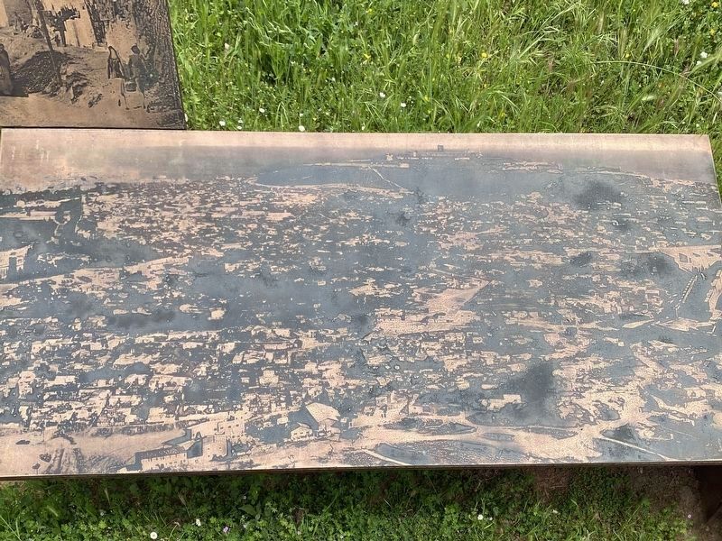
This panel has no text. It depicts an aerial view of the disappeared neighborhoods, with Montjuïc Castle being visible at the top of the picture (i.e., to the south).
Photographed by Andrew Ruppenstein, April 28, 2022
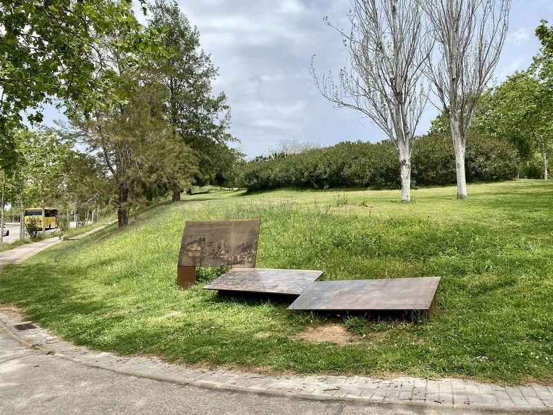
4. Barris de Barraques de Montjuïc / Barraques de Montjuïc Neighborhoods Marker - wide view
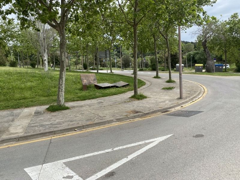
Photographed by Andrew Ruppenstein, April 28, 2022
5. Barraques de Montjuïc Neighborhoods Marker - wider view
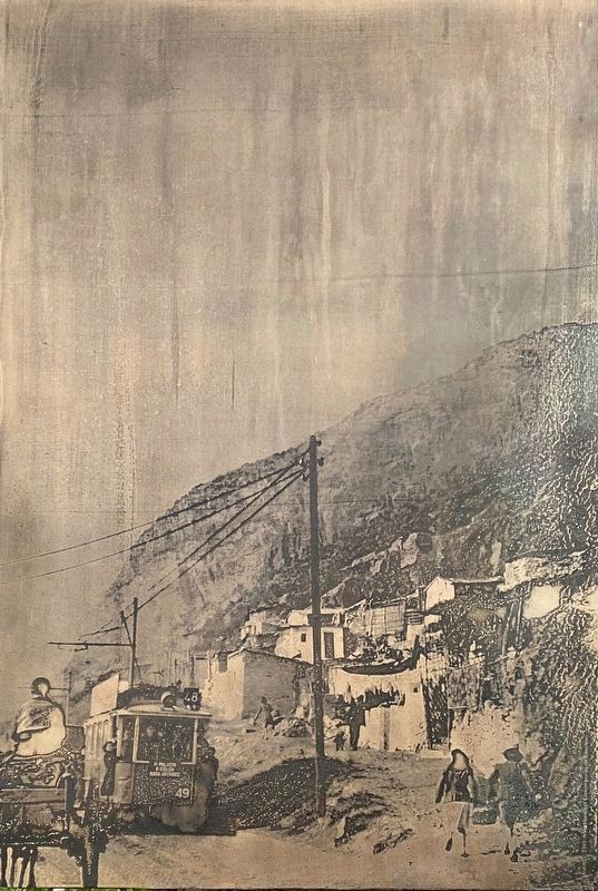
6. Marker detail - image on left panel
Credits. This page was last revised on November 1, 2025. It was originally submitted on August 10, 2024, by Andrew Ruppenstein of Lamorinda, California. This page has been viewed 151 times since then and 23 times this year. Photos: 1, 2, 3, 4, 5, 6. submitted on August 10, 2024, by Andrew Ruppenstein of Lamorinda, California.
