
La Trinidad in Benguet, Cordillera Administrative Region, Philippines — Southeast Asia
Benguet State University
Pamantasang Pang-Estado ng Benguet
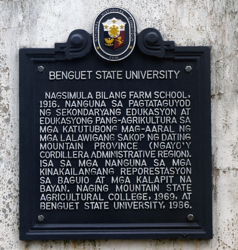
Photographed by John Marion M. Capunitan, August 8, 2023
1. Benguet State University Marker
Nagsimula bilang Farm School, 1916. Nanguna sa pagtataguyod ng mga sekondaryang edukasyon at edukasyong pang-agrikultura sa mga katutubong mag-aaral ng mga lalawigang sakop ng dating Mountain Province (ngayo’y Cordillera Administrative Region). Isa sa mga nanguna sa mga kinakailangang reporestasyon sa Baguio at mga kalapit na bayan. Naging Mountain State Agricultural College, 1969, at Benguet State University, 1986.
English translation
Started as a Farm School. 1916. Lead the establishment of secondary education and agricultural education for the indigenous students in the territories once part of the former Mountain Province (now called the Cordillera Administrative Region). One of the first to call for the reforestation of Baguio and some nearby towns. Became the Mountain State Agricultural College.1969. And as Benguet State University, in 1986.
Erected 2016 by Philippine Historical Commission.
Topics. This historical marker is listed in this topic list: Education. A significant historical year for this entry is 1916.
Location. 16° 27.067′ N, 120° 35.417′ E. Marker is in La Trinidad, Cordillera Administrative Region,
this page online

Regionally, it is in Asia, specifically in Southeast Asia, in the Malay Archipelago, in the Pacific Ocean, in North Pacific, on the Ring of Fire, in the Pacific Rim, and in the Anglosphere. Historically, it finds itself in what was once a Spanish colony.
Other nearby markers. At least one other marker is within 5 kilometers of this marker, measured as the crow flies: Malcolm Square (approx. 4.2 kilometers away in Benguet).
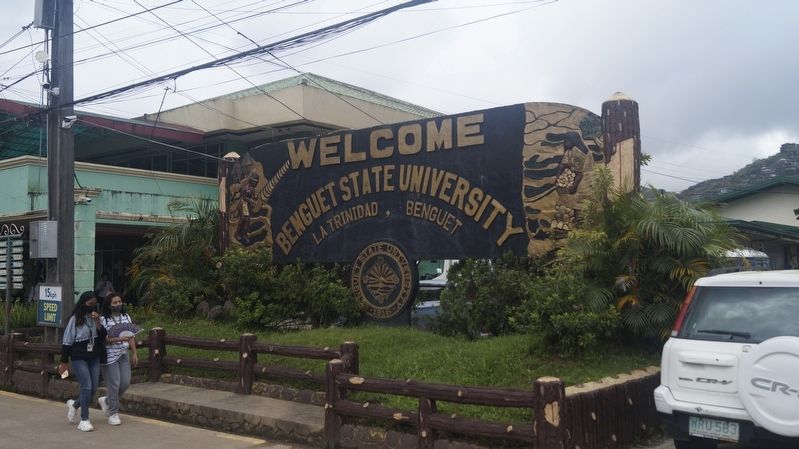
Photographed by John Marion M. Capunitan, 2023
2. Benguet State University Welcome Sign
The Historical Marker is in the front of the sign at the BSU Centennial Park.
Credits. This page was last revised on August 13, 2024. It was originally submitted on August 10, 2024, by John Marion M. Capunitan of Calamba City, Laguna, Region IV A, Philippines. This page has been viewed 196 times since then and 27 times this year. Photos: 1, 2. submitted on August 10, 2024, by John Marion M. Capunitan of Calamba City, Laguna, Region IV A, Philippines. • Andrew Ruppenstein was the editor who published this page.
