Reading in Berkshire, England, United Kingdom — Northwestern Europe (the British Isles)
Ground Level
Abbey Quarter
Photographed by Ray Gurganus, April 1, 2024
1. Ground Level Marker
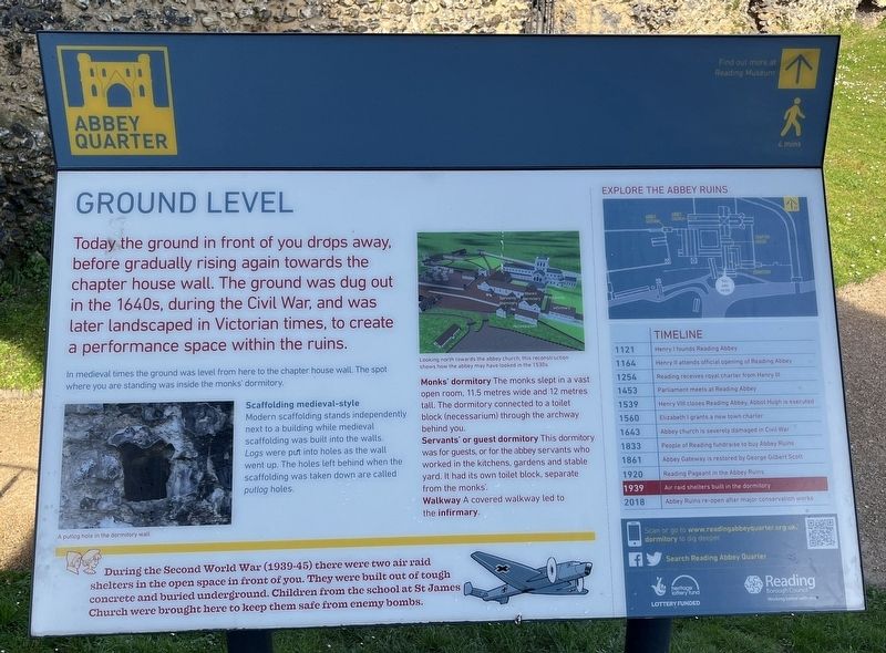
In medieval times the ground was level from here to the chapter house wall. The spot where you are standing was inside the monks' dormitory.
Scaffolding medieval-style
Modern scaffolding stands independently next to a building while medieval scaffolding was built into the walls. Logs were put into holes as the wall went up. The holes left behind when the scaffolding was taken down are called putlog holes.
Monks' dormitory: The monks slept in a vast open room. 11.5 metres wide and 12 metres tall. The dormitory connected to a toilet block (necessarium) through the archway behind you.
Servants' or guest dormitory: This dormitory was for guests, or for the abbey servants who worked in the kitchens, gardens and stable yard. It had its own toilet block, separate from the monks.
Walkway: A covered walkway led to the infirmary.
During the Second World War
this page online
Topics and series. This historical marker is listed in these topic lists: Architecture • Religion & Religious Structures. In addition, it is included in the If You've Got to Go... series list. A significant historical year for this entry is 1640.
Location. 51° 27.35′ N, 0° 57.899′ W. Marker is in Reading, England, in Berkshire. It can be reached from Abbey Street. Touch for map. Marker is at or near this postal address: 4 Abbey Street, Reading, England RG1, United Kingdom. Touch for directions.

Regionally, this marker is in the Greater South East. Globally, it is on the Atlantic Ocean, in the North Atlantic Region, in Europe, in Atlantic Europe, on one of the British Isles, in the Western World, and in the Anglosphere. Historically, it finds itself in what was once the Roman Empire.
Other nearby markers. At least 8 other markers are within walking distance of this marker: You've Found the Abbey Wharf (a few steps from this marker); You've Found the Refectory (a few steps from this marker); In the Warm (within shouting distance of this marker); At the Heart of the Abbey (within shouting distance of this marker); Chapter and Verse (within shouting distance of this marker); A Church on a Huge Scale (about 90 meters away, measured in a direct line); Abbey Quarter (about 90 meters away); a different marker also named Abbey Quarter (about 90 meters away). Touch for a list and map of all markers in Reading.
Credits. This page was last revised on August 14, 2024. It was originally submitted on August 10, 2024, by Ray Gurganus of Washington, District of Columbia. This page has been viewed 113 times since then and 12 times this year. Photo 1. submitted on August 10, 2024, by Ray Gurganus of Washington, District of Columbia. • Andrew Ruppenstein was the editor who published this page.
Editor’s want-list for this marker. photo of the marker within its surroundings • Can you help?
