Intramuros in Manila in Metropolitan Manila First District, Metro Manila, Philippines — Southeast Asia
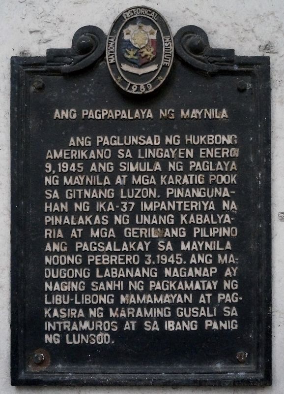
Ang Pagpapalaya ng Maynila
⎯⎯⎯
The Liberation of Manila
Photographed by John Marion M. Capunitan, October 18, 2022
1. Ang Pagpapalaya ng Maynila Marker

English translation
Erected 1989 by National Historical Institute (now National Historical Commission of the Philippines).
Topics. This historical marker is listed in this topic list: War, World II. A significant historical date for this entry is February 3, 1945.
Location. 14° 35.461′ N,
this page online

Regionally, it is in Asia, specifically in Southeast Asia, in the Malay Archipelago, in the Pacific Ocean, in North Pacific, on the Ring of Fire, in the Pacific Rim, and in the Anglosphere. Historically, it finds itself in what was once a Spanish colony.
Other nearby markers. At least 8 other markers are within walking distance of this marker: Former Palace of the Governors General (about 90 meters away, measured in a direct line); Jose Felipe del Pan (about 90 meters away); Palacio Arzobispal (about 90 meters away); The Cathedral of Manila (about 120 meters away); Pope John Paul II (about 120 meters away); Manila Cathedral (about 120 meters away); The Saint Paul Hospital and Free Public Dispensary (about 120 meters
Photographed by John Marion M. Capunitan, October 18, 2022
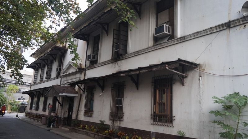
2. Ang Pagpapalaya ng Maynila Marker
More about this marker. The marker is located on the Facade of Araullo Building (Comelec Annex), a survivor of the Battle of Manila.
Additional keywords. Battle of Manila
Credits. This page was last revised on August 11, 2024. It was originally submitted on February 5, 2023, by John Marion M. Capunitan of Calamba City, Laguna, Region IV A, Philippines. This page has been viewed 1,040 times since then and 93 times this year. Last updated on August 10, 2024, by John Marion M. Capunitan of Calamba City, Laguna, Region IV A, Philippines. Photos: 1, 2. submitted on February 5, 2023, by John Marion M. Capunitan of Calamba City, Laguna, Region IV A, Philippines. • J. Makali Bruton was the editor who published this page.
